Tuesday:
Partly sunny for Tuesday with highs in the 30s on the mountains and 40s for the lower elevations near the base. A few scattered showers are possible later in the day.
Wednesday – Thursday Storm:
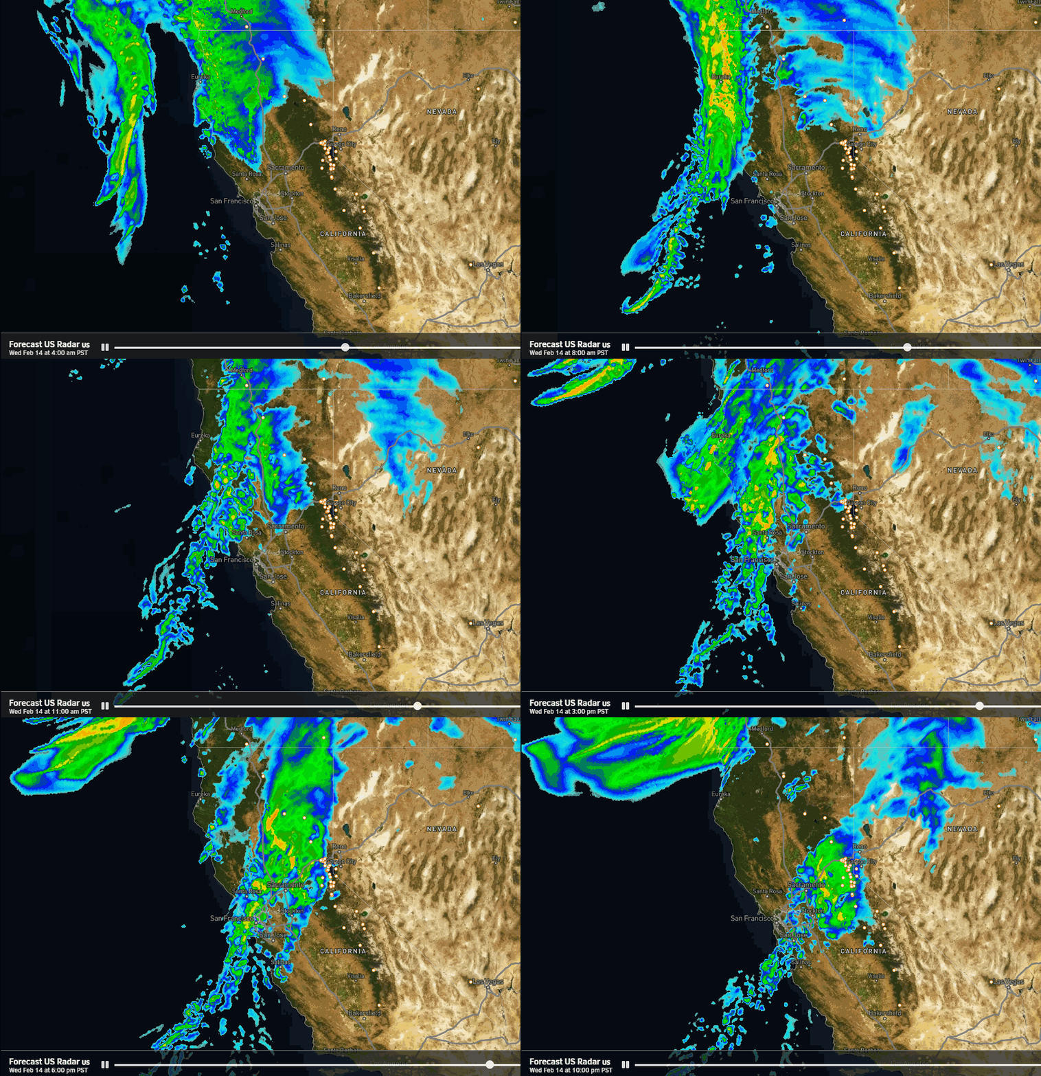
One of the changes this morning is that a few scattered showers are possible Wednesday, especially in the afternoon as the steady precipitation is expected to move in by evening. Increasing clouds and winds for Wednesday with highs in the 30s to near 40 degrees at the base. Ridgetop winds from the west gusting up to 60-70+ mph, likely closing some upper mountain lifts.
Wednesday night is the main event as the storm moves in, and a tiny little AR of moisture aims at the northern Sierra and Tahoe basin. The latest model runs show some lighter showers Thursday morning and the storm clearing the region Thursday afternoon. The winds will be a little gusty Thursday morning and then fall through the afternoon. Highs in the 30s.
Snow levels will start a little high, up around 6300-6800 ft. Wednesday afternoon/evening, which means we could start with a little rain down near the base. But snow levels are forecast to drop pretty quickly as the heavier precip moves in Wednesday night. Snow ratios could average around 13-14:1 on the upper mountain.
That means a decent shot of snow down to the base by Thursday morning and somewhat lighter density snow possibly by the end up above 8000 ft. We could see storm totals by Thursday afternoon of around 6-11 inches at the base, 9-14 inches near mid-mountain, and 12-17 inches on the upper mountain.
Friday:
Friday we will have a break between storms. We could see partly sunny skies with some clouds. Highs into the 40s for the lower elevations and 30s for the upper elevations.
Saturday Storm:
The next storm will be fast-moving and splitting apart as it moves through the Sierra later Saturday into Saturday night. We will see increasing clouds and winds Saturday with a few showers possible during the afternoon. Highs in the 30s to near 40 degrees at the base. Southerly winds gusting up to 40-50+ mph over the ridges.
Most of the precipitation is expected to fall Saturday night as the front sweeps through and could end by Sunday morning. Snow levels will be starting out high, up around 6500 – 7000 ft. Saturday afternoon/evening, with some rain near the base. Then falling Saturday night down to the base by midnight into Sunday morning.
We are expecting higher density and less snow from this storm by Sunday morning. We could see 1-4 inches near the base, 2-6 inches near mid-mountain, and 3-7 inches on the upper mountain.
Sunday:
We are still expecting a break for Sunday with the winds coming down and partly sunny skies. Highs in the 30s on the mountains and near 40 degrees down at the base. The next storm has slowed a bit and isn’t expected to move in until later Sunday night – Monday morning.
Monday – Wednesday Storm:
The next storm is expected to be slower moving as low pressure near the CA coast Monday and slowly moves through to our south through Tuesday, with showers possibly lingering into Wednesday before clearing out completely.
This storm will be tapping into subtropical moisture well to the south with some heavier precipitation expected to be streaming into CA. With the southerly flow, we’ll have to see how much of that precipitation can make it into the northern Sierra and across the Tahoe basin. Totals are expected to be pretty high to our south and west.
Even if we don’t see as much precipitation reach the northern Sierra as areas to the south and west, we could still see up to a few inches of total precipitation over the 3-day period. Currently, the winds don’t look overly strong through the period. The snow levels may hold close to the base with mostly snow on the mountain.
This storm could drop snow in feet in total over the 3-day period, but currently not expecting feet during any 24-hour period. On a daily basis, this is likely more of a moderate-strength storm. But the snow could pile up by Thursday. We’ll be watching the trends closely over the next several days. If you want to leave the mountains without headaches, traveling by Sunday evening is the best bet.
A Quieter Pattern?
High pressure is still forecast to start building in by next Thursday the 22nd through Saturday the 24th. It looks pretty weak so we will have to see if any weaker systems sneak in. But currently, it looks like a few days of quieter weather are possible.
Long-Range Forecast:
By Sunday the 25th through the end of the month, the long-range models continue to show a negative PNA pattern setting up with a cold trough digging in over the West Coast and the ridge south of the Aleutians which can help with driving some colder air south.
We could see some colder storms drop into the trough from the north-northwest. But interesting some of the model runs show a stronger jet stream to our south again during this period, and storms possibly undercutting the north Pacific ridge into CA. But into a colder CA possibly.
No matter what happens this period still looks interesting to me. I’m hoping we can see a bigger cold storm that brings us some good powder skiing, which we haven’t seen a lot of this season with mostly milder storms.
BA


