Saturday – Sunday Weather:
It’s another mostly sunny day with some high clouds on Saturday. Highs into the 60s to near 70 degrees at the base.
Some clouds for Sunday into Monday with partly sunny skies. The strongest winds could be Sunday ahead of the approaching trough. Southwest winds gusting up to 40-50+ mph over the ridgetops. Highs into the 50s on the upper mountain and 60s at the base Sunday, and then 40s and 50s on Monday.
Cooler & Unsettled Week:
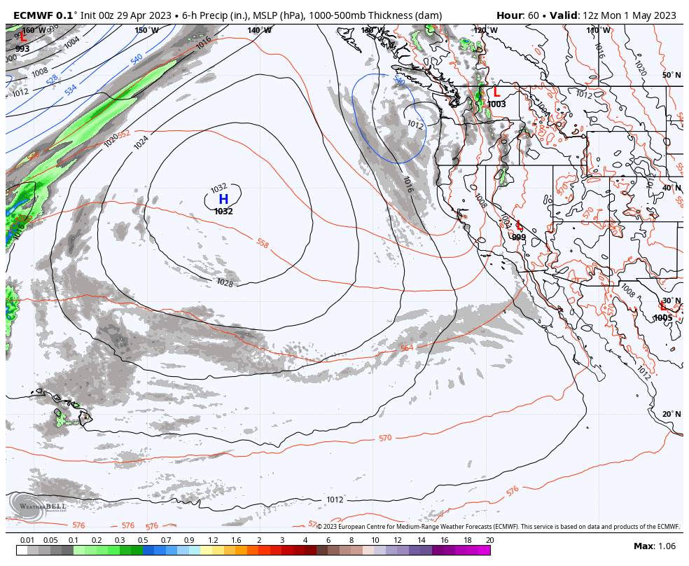
By late afternoon-evening on Monday, moisture will begin to move into the northern Sierra as a low off the coast wobbles south down the CA coast through the week, before moving inland by Thursday and showers possibly lingering into Friday.
The showers Monday afternoon through Monday night look to be fairly light and scattered, as well as the shower chances on Wednesday and Friday. We could see partly sunny skies Monday, Wednesday, and Friday, with the best chance for showers during the afternoon-evening hours with added lift from daytime heating.
Tuesday looks to be the day that the models agree we could see the heaviest precipitation over the Tahoe basin, and then another chance for some steadier showers again on Thursday as the low moves inland. In total, through Friday the models show up to 0.9 – 1.7 inches of liquid over the mountain through Friday.
Highs will be in the 30s on the mountain and 40s at times at the base. Colder under steadier precipitation Tuesday and again Thursday. Snow levels will fluctuate a lot with the milder air expected Wednesday and again Friday with some colder air working in Tuesday & Thursday as the coldest air is at the center of the low near the coast and as it moves inland.
Potential Snowfall:
The latest model runs show snow levels dropping to around 6500-7500 ft. Monday evening with the initial showers and falling to around 5500-6500 ft. Monday night into Tuesday morning which is near the base. Then with the heaviest precipitation Tuesday then could fluctuate between 6000-7000 ft.
Warmer air works in Wednesday with snow levels rising as high as 9000-10,000 ft. by Wednesday evening. Then colder air moves in Thursday as the low moves inland with snow levels dropping as low as 5500-6500 ft. for a few hours later in the day. Then rising back up above 8000 ft. Friday and continuing to rise into Friday night.
With fluctuating snow levels, it is hard to forecast snowfall and snow ratios. Overall for the week, they could average around 9:1 at 8000 ft., but high snow ratios Tuesday & Thursday during the heavier precipitation. Around 2/3rds of the snowfall forecast could fall Tuesday and around 1/3rd Thursday. Here is the updated forecast for the week.
- 1-5 inches at the base.
- 5-9 inches at mid-mountain elevations.
- 7-12 inches up top.
The snow that falls Tuesday will likely melt through Wednesday before we could add up to a few more inches on the mountain Thursday. Overall an unsettled and cooler week ahead with the stormiest days likely to be Tuesday and Thursday.
Long-Range Forecast:
Troughing is forecast to remain near/over California through the 10th-12th. Another cut-off low could be off the coast by next weekend the 6th-7th before moving inland the week of the 8th. That could continue to feed moisture in over the Sierra with afternoon showers possible most days and no big warmups. Snow levels may stick to the higher side if the low stays to our north.
By mid-month, the long-range models continue to show ridging returning over the West Coast. That could be the end of the cooler and unsettled pattern, with a drier and milder pattern setting back in over the region. We could lock into the drier and milder pattern into Summer as we tend to do by later in May, but a late-season trough with some showers isn’t out of the question into early June.
BA
P.S. I plan to write one final forecast for the season on Monday, May 1st, and then the forecasts pick back up again in November.