Snowfall Report:
The mountain is reporting 16 inches of new snow in the past 24 hours as of 5 AM Monday, exactly what we were expecting from the Sunday storm. That brings the 6-day storm total to 70 inches so far on the upper mountain, with a lot more on the way for Monday – Wednesday!
Monday – Wednesday Storm:
The winds are gusting up to 50-60+ mph up top from the southwest Monday morning, and will increase to 80-90+ mph Monday afternoon through Tuesday before falling Wednesday. Highs in the teens up top and 20s at the base through Wednesday. That will bring cold powdery snow that will blow around easily creating blizzard conditions. Upper mountain lifts will likely be affected through Tuesday.
Lighter snow showers are falling Monday morning. Then heavy snow moves in Monday afternoon as the next storm moves in, with heavy snow expected through Tuesday. Snow showers linger into Wednesday morning before clearing during the afternoon.
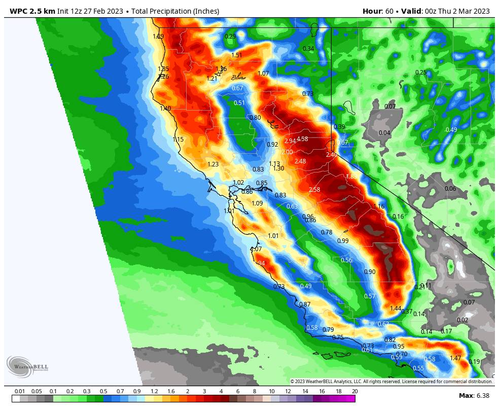
This is another cold storm with high snow ratios and powdery snow expected. Here is the updated snowfall forecast for new totals expected by midday Wednesday.
- 40-50 inches at the base.
- 47-56 inches at mid-mountain elevations.
- 52-62 inches up top.
That means we could see up to 130 inches of snow in total by Wednesday afternoon for 8.5-day totals!
Thursday – Friday:
We will see a break in the active pattern from Thursday into Friday, with mostly sunny skies and highs into the 30s.
Long-Range:
Another cold trough digs into the West Coast Saturday into next week. That will reopen the door to more cold storms by Saturday afternoon into possibly next Wednesday the 8th. We could see a slow-moving storm bring waves of snow Saturday through Wednesday. We’ll have more details as we get closer.
We could transition from a cold/wet pattern through the 9th to a warm/wet pattern starting around the 10th through mid-March. We’re watching for the possibility of a strengthening Pacific jet stream streaming across the Pacific into CA during this period, sending storms into CA with fluctuating snow levels, with rain possible at times.
We’ll continue to watch the trends as we get closer.
BA


