Another Week+ of Dry Weather:
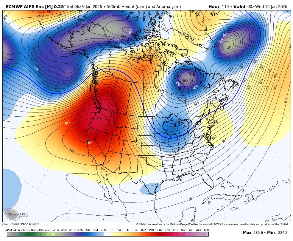
We continue to experience overnight inversions and mild temperatures, thanks to high pressure that remains over the region. That is keeping storms away from the West Coast with sunny days and highs into the 40s. We could break into the 50s for the lowest elevations by the weekend.
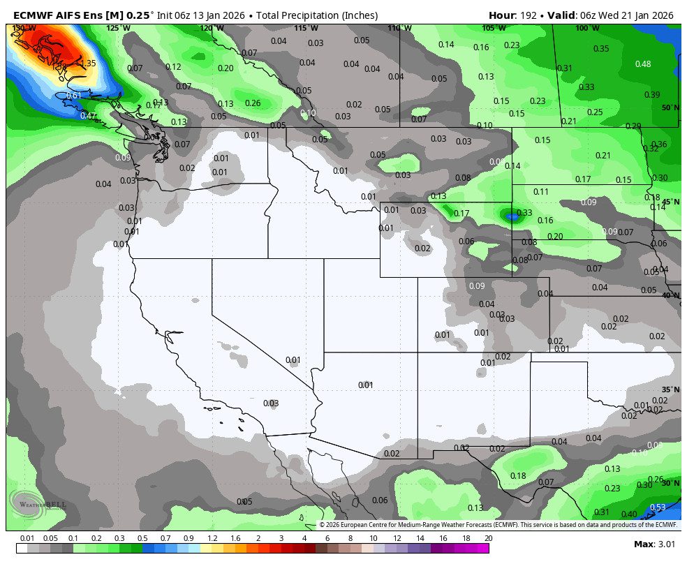
The pattern will start to shift by the 20th with the ridge starting to shift NW away from the region, but most model runs keep us dry through at least the 21st.
Long-Range Outlook:
By the 22nd through the 25th – 26th, the long-range ensemble mean models continue to show a trough trying to back west towards the West Coast. That pattern will help to drive colder air into the West. It could also open the door to storms starting to drop down from the north, trying to reach the northern Sierra.
For now, we are only expecting the chance for weaker systems from the north, if any, between the 22nd – 25th/26th. We’ll continue to watch the trends closely to see if the door opens up enough for some snowstorms and not just colder air during this period.
Beyond the 25th/26th, the long-range models suggest that high pressure could start to build back in over the region. That could make it harder for any storm to move through again.
Some models show the jet stream strengthening and extending towards the West Coast by the end of the month. That could eventually push some wetter storm closer, or it could not extend as far and just help to keep high pressure over the region. Let’s hope it’s the former…
BA