

Snowfall Report:
No surprises Wednesday night as we saw a dusting of snow at the base and 2 inches of new snow on the upper mountain.
The Snow Lab’s official Tahoe measurement (just north of the mountain) will be at 8 AM. The snowfall average for March since 1970 is 76 inches. If they measure 1.5 inches of snow that would officially make March 4 out of 5 months Nov-Mar this season that we received above-average snowfall.
Thursday – Saturday Weather:
The storm track has shifted north with a weak and flat high-pressure area to our south. We are going to get brushed by clouds through Saturday from storms moving through to our north. Highs in the 30s for the upper mountains and 40s near lake level through Saturday, with drier days expected for Thursday and Saturday.
The latest model runs suggest that precipitation on the southern edge of a system moving through on Friday reaches a bit farther south with a few showers possibly reaching the Tahoe Basin. The latest GFS and ICON model runs now suggest that we could see similar amounts as Wednesday night.
We’ll take another look early Friday morning. For now, I’m expecting only a few scattered showers with snow levels around 7000-7500 ft. and maybe a dusting of snow. If the GFS & ICON models are right we could see up to 1-2 inches above 8k’ again.
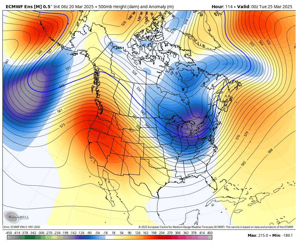
Mild and Dry Pattern:
By Sunday through Wednesday a strong area of high pressure builds in over the West Coast. We’ll see sunny days with highs into the 50s for the lower elevations on Sunday, and then into the 60s Monday – Wednesday! 50s for the higher elevations. Time for some spring skiing.
Long-Range Forecast:
By next Thursday the 27th, the long-range models continue to show a shift in the pattern with a large trough in the northeast Pacific, which could hang around into the first week of April. We may only see weak systems and storms just brushing us on the southern edge with a few showers through the period. But it will be a cooler and unsettled period.
With any moisture around and a higher spring sun angle with daytime warming, we will be going into a spring weather pattern where that moisture will rise and form clouds and convective showers over the mountains during the day. If we only see weak systems we may be going into a pattern where we see those convective rain and snow showers each afternoon.
We’ll continue to keep an eye out for any more organized stronger storms developing that could bring a better chance of significant snowfall.
BA
