Snowfall Report:
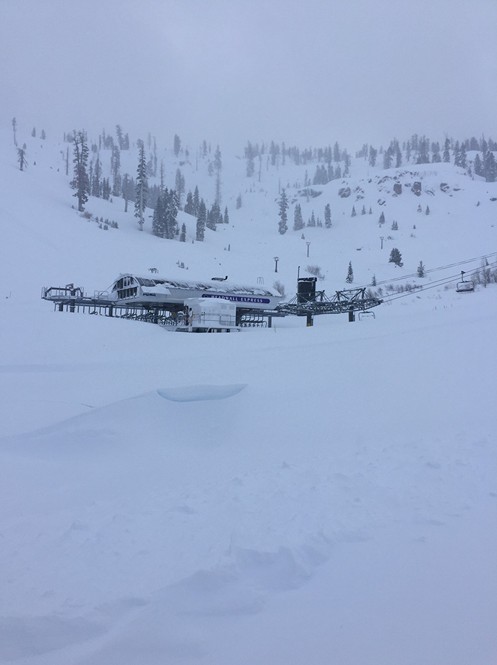
The mountain picked up 21 inches of additional snowfall Sunday and Sunday night, which brings the storm total to 23 inches so far. 9 inches fell overnight in the Village and 18 inches at Alpine lodge.
Monday – Tuesday Storm:
The storm continues for Monday with snow levels near the base. That is bringing some wetter snow at the base. That should continue until Monday night when the cold front moves through. That is also when we expect the heaviest snow of the storm. Ridgetop winds continue to gust to 100+ mph up top.
The snow should start to taper later in the morning Tuesday with scattered snow showers possible into the afternoon as the storm begins to clear the region. It will be cold with highs in the 20s and the winds will drop off.
The latest forecast model runs for Monday morning through Tuesday afternoon have up to 3-4 additional inches of precipitation over the mountain. That’s enough for an additional 3-4+ feet on the mountain above 7k. That would put us right into the forecast range for the storm of 5-7 feet. At the base, an additional 2-3 feet possible.
Wednesday – Thursday Storm:
The winds increase again Wednesday ahead of the next storm. West winds to 60+ mph over the ridgetops in the morning increasing to 100+ mph in the afternoon. Highs only in the 20s with the winds making it feel even colder.
The latest model runs show some sun and clouds Wednesday morning with increasing clouds during the afternoon. There could be a few snow showers during the afternoon, but most models hold off on steady snow for most areas until Wednesday evening into Thursday morning. Then a few scattered snow showers are possible into Thursday afternoon as we begin to clear, and the winds drop off.
This is a fast-hitting storm. The latest model runs have a range of 1 – 1.75 inches of total precipitation. It looks like this storm is slightly colder to start than the current storm. Snow levels could start out below 5000 ft. and then rise to around 5000-5500 ft. Wednesday night before falling back below 5000 ft. Thursday, which is below the base the entire storm.
We could see an additional 8-13 inches of snow at the base and 12-19 inches on the mountain with this storm by Thursday afternoon.
Friday – Sunday:
High-pressure is expected to build in over CA Friday into the weekend. That should bring us sunny skies through at least Saturday. It remains cold with highs in the 30s at the base and 20s for the upper mountain. It should be a nice weekend as the ski resorts open more terrain.
There are a few models that suggest a weak system moving down from the north could bring light snow Sunday, so we will keep an eye on that.
Long-Range:
By the beginning of next week we could begin to see troughing start to return to the West Coast. We could see storms drop down from the north. If they track south over land they will be drier. If they track just off the coast they could pull in Pacific moisture.
The long-range models suggest an area of low pressure drops south off the coast by next Monday – Tuesday, but they are suggesting it could stall off the coast keeping us dry. At some point, it could move inland later in the week. We will have to keep watching the trends with this system.
The Holidays:
As we move later into the month through Christmas and into the end of the month, the ridge and trough could shift west. That could open the pattern to storms having an easier time of tracking down off the West Coast and drawing in Pacific moisture. The long-range models suggest a decent storm for Christmas Eve – Christmas Day.
We will keep an eye on this as well as this is heading into a busy travel time for the region. No matter what happens with each storm, the pattern looks to remain at least somewhat active and cold. We will have to track each storm for clearer details as they get closer.
BA


