We’re excited about the snow totals in the forecast. From Friday to Tuesday, we’re looking at more than 20 inches on the upper mountains. We need this snow as we currently are just above 50% of our average snowpack for this time of year, and any moisture is good moisture for the Tahoe region. We do expect to see some wind impacts on Saturday, and because these storms will move in wet, icing could lead to delayed openings throughout the weekend.
Weather Outlook
- Friday Night: Precipitation starts late in the evening, after 10pm. Storm will start with rain then turn into snow.
- Saturday Morning: Wind gusts upwards of 70 mph. Steady snowfall throughout the day. Snow levels may be fluctuating between 6000-6700 feet.
- Saturday Night: Steady snowfall through the evening. Again, snow levels may be fluctuating below 7,000 feet.
- Sunday: Heavy snowfall in the second half of the day.
- Monday: Heavy snowfall that should slow down by the end of the day.
Get daily storm updates on our Weather Blog, powered by OpenSnow.
What You Should Expect This Weekend
- There is an active winter storm warning throughout the whole weekend. This can make for some very, very fun skiing and riding, but be sure to dress warm with waterproof layers.
- The Friday storm cycle comes in a bit on the warmer side — Snow levels will probably be around the Alpine Lodge / Headwall chairlift elevation. This means we will be de-icing chairlifts on Saturday morning. It can take some time to break chairlifts free after warmer storms, so we ask for your patience. (There’s more on ice impacts further down in this blog).
- We anticipate having to perform snow safety on both Saturday and Sunday mornings. Some lifts may be delayed past 9am for this reason.
- Saturday is the day that we are most likely to see wind impacts on the upper mountain lifts at both Alpine and Palisades.
- Road conditions will be impacted by winter weather on key travel days like Friday and Monday. Please review our Road Conditions page for the best ways to check road conditions & status.
- Free parking is sold out on both Saturday and Sunday at both Alpine and Palisades. Some paid reservations are still available. If you do not have a reservation, you will need to use one of our alternative transportation methods.
Lift & Terrain FAQs
Why has Wa She Shu been closed?
All of the terrain accessed by Wa She Shu has still been open and accessible as weather and conditions allow. We frequently fluctuate chairlift priorities based on resources, and when there is redundancy with chairlifts that access the same terrain, you may see us shifting which chairs are open. Chairs with potential impacts include Wa She Shu, Emigrant, Far East, Alpine Bowl Chair, and Yellow.
With Wa She Shu specifically: Prior to COVID-19, Wa She Shu had historically been our “backup” chairlift that ran on weekends and holidays, or as support to get people to the upper mountain if the Funitel experienced an issue. During COVID, with the need to have more people outdoors and on chairlifts that were not enclosed, we shifted to spinning it more frequently. We are now working back to having Wa She Shu return to its pre-COVID schedule. Additionally, Wa She Shu is an older lift that requires a decent amount of maintenance. As maintenance is required, we will be doing this maintenance midweek when demand is lower, so you may see closures related to that as well. All of the terrain accessed by Wa She Shu will still be open, weather and conditions permitting.
What’s going on with Headwall?
1/20 Headwall Update:
- As soon as we can get Headwall open, the chair will be 7 days a week. It will not follow the weekend schedule like Wa She Shu.
- Our grooming team got the Saddle road in early this morning which is a huge benefit — It is now significantly easier to move resources like snowcats and ski patrol equipment up the mountain to Headwall from the base area. The KT-East road that we have been relying on until today takes a ton of time to traverse and is not an efficient way to get up the hill. In fact, we rarely even build this road in the winter due to how time-consuming it is to maintain or utilize. In asking around to some of our operations employees who have been with us for several decades, none of them could remember a time when we used the KT-East road for more than a few days. So not having the Saddle until this point really is a unique situation.
Original 1/19 Post:
We hope to have Headwall spinning as soon as possible. We will aim to provide our next update on Monday once the bulk of these storms have moved through. There are three things to consider when it comes to Headwall, but the main thing to know is that – as strange as it might sound for a chairlift – storms are setbacks for Headwall. Here’s why:
- Headwall chair is not simple to set up. You cannot just flip a switch in the morning. In addition to building roads and ramps, each chair needs to be put back on the lift after every storm. This can cause issues especially when there is icing. For example, this past Sunday, with the rainfall we received, all of our chairlifts had a significant buildup of rime ice. Rime ice occurs when water droplets freeze instantly upon contact with a surface. For more context: On Sunday, it took 2 separate crews until 12pm to get Gold Coast and Shirley spinning because the ice buildup was so significant.
- Headwall is often right at the snowline when storms come in warm. Warmer storms tend to hover around 7,000 feet, which can lead to unpredictable conditions – and not only with icing. There are also creeks under the snow near the base of Headwall, so rainfall can impact the bottom terminal significantly. This is not new: We talked about this in some of our Operations Blogs last year as we had several storms (especially in the Spring) that were warmer and impacted Headwall specifically.
- Headwall also has the furthest-out avalanche mitigation route from the base area. Our patrol teams must get to the top of KT-22, and then across the ridge, down to Headwall in order to perform control work in that zone. We do not have the Saddle road in on KT-22 yet this season due to our lower-than-average snowpack, so we cannot send Patrollers up this usual route.
What is Rime Ice?
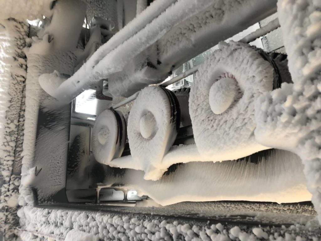
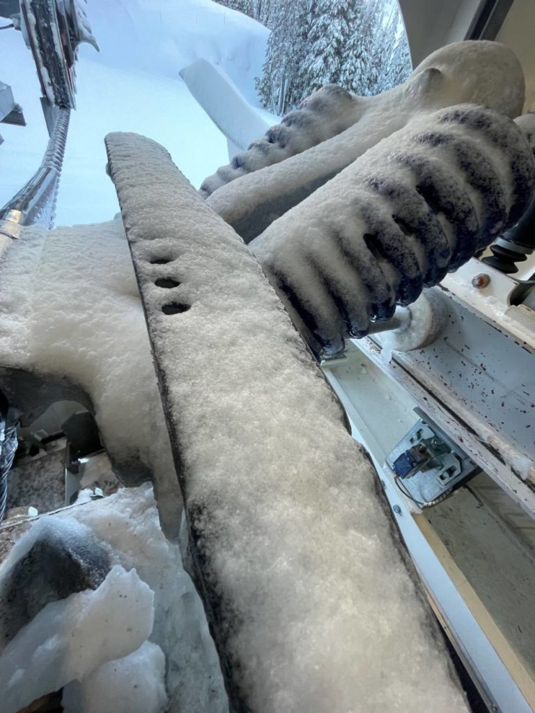
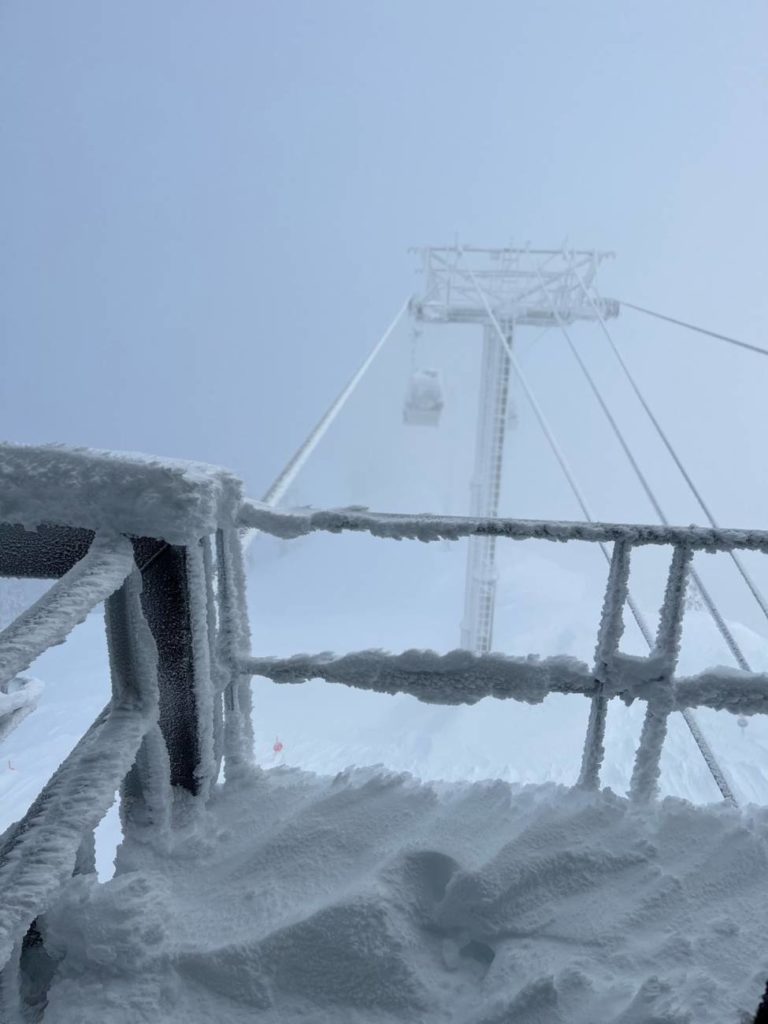
These photos are from LAST YEAR, but they are great examples of what rime ice can look like on the mountain, and it is what we are expecting to see this weekend. Our Lift Maintenance Technicians and Lift Operators must break each individual chair and the haul ropes free before the lifts can spin in the morning.
 Rime Ice on Summit in 2021.
 Rime Ice on Shirley in 2022.
 Rime Ice on the Base to Base Gondola in 2023.
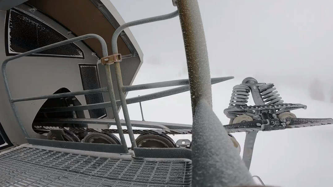
These videos were shot on GoPro by Upper Lift Maintenance this past weekend. They are a great example of what the de-icing process looks like even on a day when the rime ice buildup is not hugely significant.
Safety Tips For Storm Days
Visibility is going to be low this weekend. Here are some ways you can be prepared.
- Don’t ski alone. Ski with a trusted friend or a group of people. Have designated meeting points for each run you take.
- Ski in terrain you are familiar with, within your ability level.
- Track with the Palisades Tahoe app – this is NOT a marketing ploy but an incredible safety feature that can help us pinpoint your coordinates in an emergency. You can also create a group (public or private) with your friends/family and check on their locations if needed.
WANT THIS BLOG TO COME TO YOUR EMAIL INBOX?
Sign up for our Mountain Operations email list, and we’ll send this blog directly to you every time we have an update. We’ll share another update soon. SUBSCRIBE NOW.
HOW TO GET OPERATIONS UPDATES THIS SEASON
Bookmark these pages:
Not wanting to check the website constantly? Try these other methods:
- Follow our Mountain Operations X (formerly Twitter) account
- Sign up for the Palisades Tahoe Ski & Ride Report (Weather Blogs + Conditions Blogs are included here)
- Download the Palisades Tahoe App
Do you have any requests for this season’s Operations Blogs? Topics you’d like to see covered or information you think is missing? Send us an email at chatter@palisadestahoe.com with your feedback.


