Snowfall Report:
We saw wind gusts up to 190+ mph at the top of the mountain Friday night! That was along with heavy snow and colder air moving in. An additional 17 inches of snow was measured at the base and 24 inches up top, bringing the storm total to 41 inches so far. But the strong winds are messing with the snowfall.
The 24-hour SWE (snow water equivalent) increase at the 8k’ sensor was 4″ & precipitation recorded was 2.8″, but the snowfall only measured at 24 inches. That would mean a SLR (snow to liquid ratio) of only 6-8.5:1, while temperatures were between 18-27 deg. With lighter winds, the SLR should have averaged around 16:1 for those temperatures with 24-hour snowfall of around 44-64 inches!
So the strong winds are greatly diminishing the SLR & snowfall totals. That can happen from the snowflakes crashing together and breaking into much smaller crystals that pile up more densely with less snowfall height, the snow on the ground will blow and break up and compact, and winds can blow some snow off of the measuring areas.
The mountain is closed again on Saturday because of the strong winds and heavy snowfall.
Saturday – Sunday Storm:
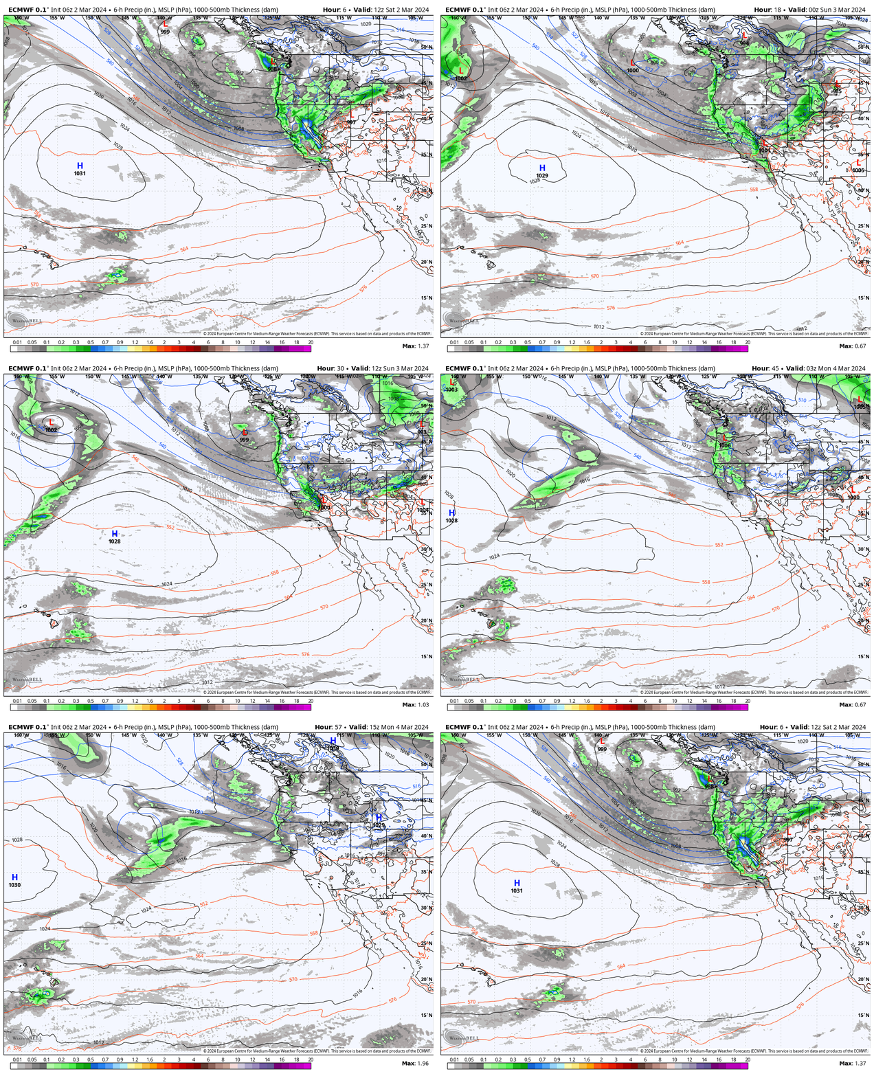
The snow continues Saturday but the intensity is expected to diminish some through the day. Then a final surge of some heavier snow is being shown on the models for Saturday night, and then lighter snow showers for Sunday into Sunday night, with the steadier showers looking to be confined near the crest.
This is the colder and more convective part of the storm where we could see bands of heavy snow move over some areas while we see lighter snow showers over other areas. Highs will only be in the 20s with teens for the peaks. The ridgetop winds come down some Saturday, but could still be gusting up to 70-80+ mph up top through the afternoon, and they could gust up to 60-70+ mph through Sunday.
That is the frustrating part of the 2nd half of this storm as the strong winds over the ridges may prevent some upper mountain lifts from opening Sunday. But I would expect the mountain to have a better chance of being open.
We should see higher snow ratios for the rest of the storm. With the winds coming down some I’m hoping that the snow ratios increase below the peaks. By Monday morning we could see an additional 2-3 feet on the lower mountain and 2.5 – 3.5 feet on the upper mountain.
Monday – Tuesday Storm:
The next storm is right on the heels of the first. The weekend storm clears out by Monday morning, and snow showers from the next storm could be filling in by late morning. Then the snow could increase in intensity through the afternoon and into Monday night, with steady snow showers possible for Tuesday before becoming lighter Tuesday night.
Highs into the 30s for the lower elevations near the base and 20s on the mountains as this storm is a little milder than the weekend storm. Ridgetop winds from the WSW could gust up to 60-70+ mph Monday and then could slowly drop through Tuesday afternoon but could be gusting up to 40-50+ mph by the end of the day.
That means the winds don’t really drop off until Wednesday. We will have to see if the upper mountain of exposed lifts will be able to open on Monday and Tuesday, probably a better chance by Tuesday afternoon. Snow levels stay below the base with this storm.
We could see an additional 11-16 inches near the base, 14-19 inches near mid-mountain, and 16-22 inches of snow up top for the two-day totals by Wednesday morning.
Drier Later Next Week:
We should clear out at least some on Wednesday with partly sunny skies possible and lighter winds. Then high pressure builds in over CA for the end of the week. That should bring us mostly sunny skies for Thursday through at least Saturday. Highs into the 30s, and maybe getting close to 40 degrees near the base.
Long-Range Forecast:
The long-range models are still showing a final cold trough trying to dig down the West Coast between the 10th-12th. The trend is weaker with this system. We’ll continue to watch the trends to see if a final storm could bring measurable snowfall.
The neutral PNA pattern is forecast to continue through mid-month, and into the 3rd week of March. That could put the ridge near but off the West Coast. That is likely a drier pattern, but if the ridge is off the coast colder air could still flow in from the north, which would keep us from warming up significantly. It could also allow drier/weaker storms to drop down from the north.
BA


