

We continue to track a storm for Wednesday, with the latest trends having the storm farther north with slightly less precipitation for the northern Sierra, and a slightly milder trend as well.
We have two more decent days to start the week for Monday and Tuesday before the storm moves in on Wednesday morning. Partly – mostly sunny skies and highs into the 50s for the lower elevations and 40s up top.
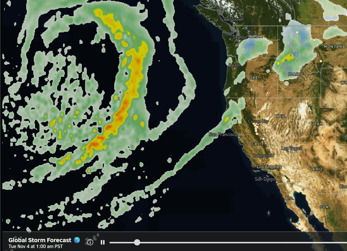
Wednesday Storm:
This storm will mainly be impacting the Pacific NW, with the southern edge sweeping through northern CA Wednesday morning into Wednesday evening, and weakening as it does. We will see cooler temperatures and gusty winds. Highs in the 40s for the lower elevations and 30s for the higher elevations. Ridgetop winds gusting up to 100+ mph from the west during the day on Wednesday.
The latest model runs are forecasting a range of 0.65 – 1.5 inches of total precipitation falling over the mountain by early Thursday morning, with the total model average being around 1 inch this morning.
There will be a lack of cold air with the center of the storm staying to our north. The dry air in place as the storm initially starts will help with evaporational cooling, and snow levels may dip close to 8000 ft. Wednesday morning. Then rising up to around 9000 – 9500 ft. by Wednesday evening.
Wednesday morning, we could see a coating up to a few inches of snow on the mountain above 8000 ft., with the highest totals on the highest peaks above 9000 ft., with only rain to the base through Wednesday evening.
Thursday – Sunday:
Behind the storm, we will see high pressure build back in over the region. We should resume our current pattern of mostly sunny days and highs into the 50s for the lower elevations and 40s for the higher elevations. No cold air yet, so not expecting much in the way of snowmaking on the mountains, or at least good snowmaking.
There is a system approaching around the 9th, but the latest model runs agree that it will split, but we’ll keep an eye on that… The long-range models suggest that the dry pattern lasts through at least the 11th of November.
Colder and Unsettled?
The longer-range forecast models continue to suggest that the pattern shifts around the 12th-13th, with a high-pressure ridge setting up south of the Aleutian Islands in the north Pacific, and a downstream trough over the West Coast.
The latest trends suggest that this pattern could settle in for up to a week or more, possibly from at least the 12th – 19th of November. This pattern not only opens the door to storms digging farther south into the base of the trough in southern CA, but it also helps to drive colder air and colder storms south into the West Coast and West of the Rockies.
The ensemble mean models, which average dozens of model runs, suggest that we could see a few storms and above-average precipitation for most of California during this period.
It’s still 10+ days out, but we’ll continue to watch closely, hoping for some early-season cold storms and colder air. Between storms, cold, dry nights are important for optimal snowmaking conditions, and they look to become more favorable as we get closer to mid-month.
BA
