Skip to content
Palisades Tahoe Logo Palisades Tahoe Logo Palisades Tahoe Logo
Explore
Main Menu
  • Explore Palisades Tahoe
  • Base to Base Gondola
  • Our New Name
  • Explore Legendary Lifts
  • Palisades Tahoe Blog
  • About Lake Tahoe
  • About Us
Plan Your Visit
Main Menu
  • Tickets & Passes
  • Lodging
  • Lessons & Guides
  • Deals & Packages
  • Rentals & Demos
  • Travel Here
  • Getting Around
Mountain Information
Main Menu
  • Snow and Weather
  • Lift and Grooming Status
  • Webcams
  • Hours of Operation
  • Trail Maps
  • Parking & Road Conditions
  • Snowfall Tracker
Events & Activities
Main Menu
  • Events Calendar
  • Activities
  • Dining & Apres
  • Shopping
  • Things To Do In Lake Tahoe
  • Groups, Meetings & Weddings
  • Ski & Snowboard Teams
IKON PASS HOLDER LODGING DISCOUNT

Ikon Pass holders save up to 20% on slopeside lodging at The Village at Palisades Tahoe.

SLOPESIDE LODGING
Icon / FlashCreated with Sketch.
View All Offers
  • Weather

Windy Sun-Mon, Snow Showers & Colder Monday Night

  • Apr 15, 2023
  • 8:16 am

Saturday – Sunday:

Saturday & Sunday we expect mostly sunny skies with highs into the 50s at the base and 40s up top. The winds look to be lighter through Saturday. Sunday we expect increasing southwest winds with ridgetop gusts up to 50-60+ mph, possibly affecting a few upper mountain lifts.

Monday:

Monday we should stay dry during the day with partly sunny skies and increasing clouds later in the day. Ridgetop winds could increase to 70-80+ mph from the southwest, which could continue to affect some upper mountain lift operations. Highs cool into the 40s at the base and 30s up top.

Monday Night – Tuesday Night Snow Showers:

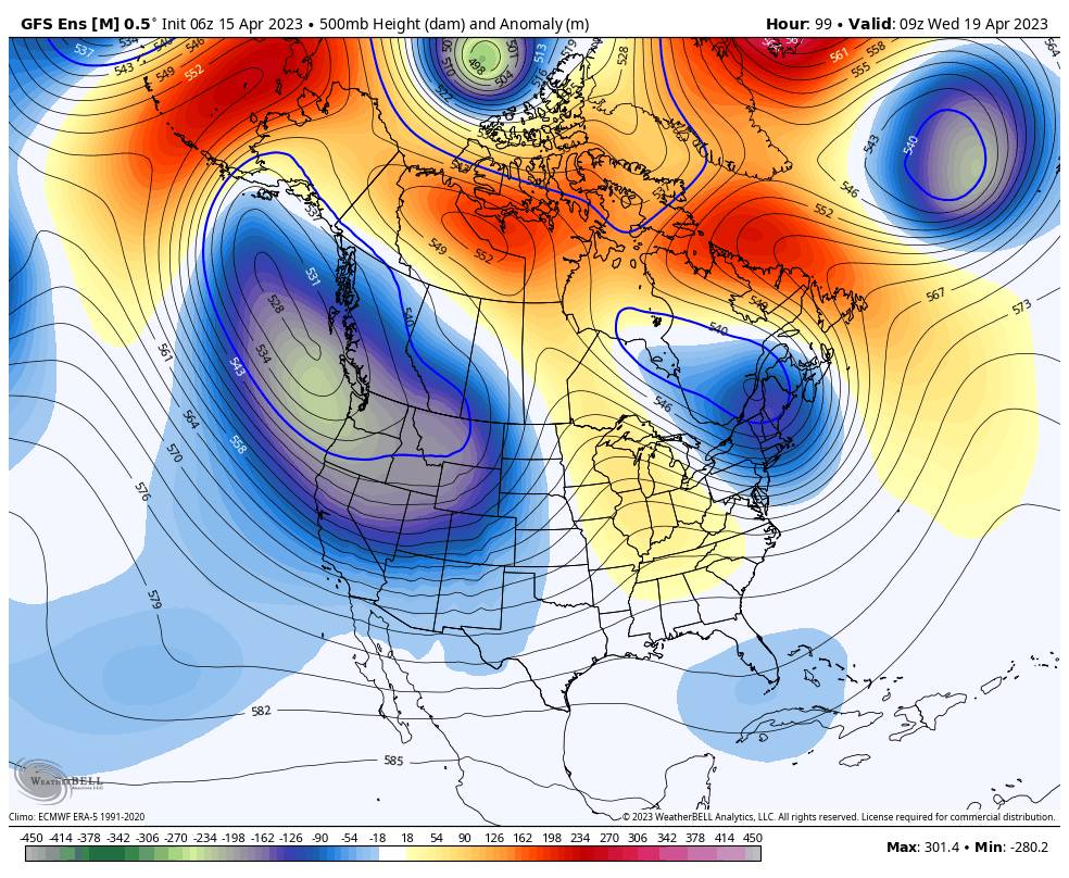
By Monday night a large trough digs into the West through Wednesday bringing in colder air. Snow showers are expected to move in sometime Monday evening bringing a few-several inches of snow overnight. Then scattered snow showers are possible Tuesday into Tuesday night, with some breaks of sun possible during the day on Tuesday between showers.

Highs dip into the 30s for Tuesday with 20s up top. Ridgetop winds from the WSW could gust up to 30-40+ mph. The snow levels could start out near the base Monday evening and then fall well below the base. They could rise to near the base during the day Tuesday before dropping well below again Tuesday night.

Most of the snow is expected to fall by Tuesday morning with light amounts possible Tuesday – Tuesday night from the scattered snow showers. Here is the updated snowfall forecast for the potential snowfall totals by early Wednesday morning.

  • 1-4 inches at the base.
  • 2-5 inches at mid-mountain elevations.
  • 3-6 inches up top.

Wednesday – Saturday:

The latest model runs are trending the next system moving through on Wednesday farther north and missing the Tahoe basin. We should remain cold with highs in the 30s along with partly-mostly sunny skies and lighter winds.

Thursday through Saturday we should see mostly sunny skies and warming high temperatures. Highs could warm into the 40s for Thursday and Friday, near 50 degrees at the base on Friday, and then possibly into the 50s for Saturday the 22nd.

Long-Range:

Another trough could dig in over the West from around Sunday the 23rd through the 26th. That could cool temperatures a little and could allow some weak weather systems to move through northern CA at times. We’ll continue to watch the trends to see if any stronger systems could show up that could bring accumulating snow to the mountain.

Beyond the 26th, the long-range models suggest that weak high pressure could build in over the West through the end of April. That could bring a drier and milder pattern if strong enough, or if weak then weak systems could still move through the region at times.

BA

lake tahoe weather palisades tahoe weather forecast snowfall forecast
Bryan Allegretto
Bryan Allegretto

Share this article:

Recent Posts

  • Weather ·
  • May 8, 2023·

Final Forecast of the 2022-23 Season

First Week of May Snowfall Report: The first week of May was a cold and snowy one. The upper mountain…
Read more
  • Weather ·
  • May 1, 2023·

Snowy First Week of May

Monday – Friday Snow Shower Chances: A low-pressure system will be making its way south down the coast on Monday…
Read more
  • Weather ·
  • April 29, 2023·

Cooler with Rain & Snow Showers Possible Starting Monday

Saturday – Sunday Weather: It’s another mostly sunny day with some high clouds on Saturday. Highs into the 60s to…
Read more

Social

Instagram Twitter Facebook Youtube

Contact

   Email Us
   1.800.403.0206

Our Partners

U.S. Forest Service Logo
1960 Olympic Valley Road
Olympic Valley, CA 96146

©2022 Palisades Tahoe

Alterra Mountain Company
  • Privacy Policy
  • Terms of Service
  • Photo Upload Terms of Use
  • Accessibility
  • Do Not Sell My Personal Information
  • Privacy Policy
  • Terms of Service
  • Photo Upload Terms of Use
  • Accessibility
  • Do Not Sell My Personal Information