

Monday – Tuesday Weather:
The trend on the latest model runs is for the Monday system to stay to our north and just bring us some clouds and maybe a little sun. The winds won’t be as strong on Monday but still breezy up to 30-50+ mph over the ridges, and then lighter into Tuesday. Highs in the 30s on the mountain and 40s at the base by Tuesday.
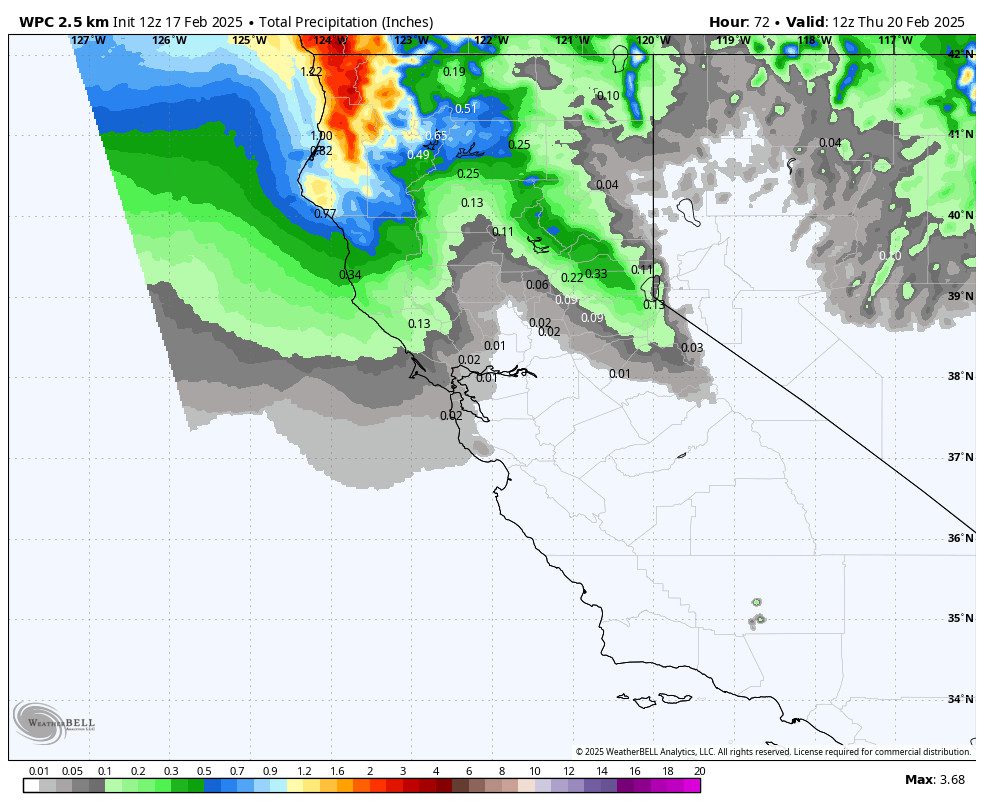
Wednesday Rain & Snow Showers:
We are going to catch the southern edge of another system during the day on Wednesday. Similar to Sunday we will see another windy day with some showers. Ridgetop winds could be gusting up to 60-80+ mph over the ridges, affecting some upper mountain ski lifts. Highs in the 30s.
Snow levels could drop close to the base for this system, in the 6000-6500 ft. range. The wettest models would bring up to 2-4 inches of snow for the upper mountain, and 1-2 inches for the lower mountain at best. We’ll continue to watch the trends.
Drier & Milder Pattern:
High pressure starts to build in over CA on Thursday with a pretty strong high-pressure ridge forecast to be sitting over the region by next weekend. That will block all storms well to the north and bring a warming trend. Highs are only in the 30s on Thursday to near 40 degrees down at the base, but then warming into the 40s on the mountain by the weekend with 50s near the base.
Long-Range Forecast:
The long-range models agree on the dry and mild pattern continuing into the week of the 24th. But they disagree on the pattern by the end of the month.
Some suggest that high pressure stays near the West Coast with a dry pattern continuing. Others suggest a flatter ridge with a trough and active storm track returning to the Pacific NW. That could bring back storms that brush us on the southern edge.
The models trend towards a slightly wetter pattern going through the 1st week of March into the 2nd week. We’ll continue to watch the trends to see if a wetter storm could reach us.
BA
