

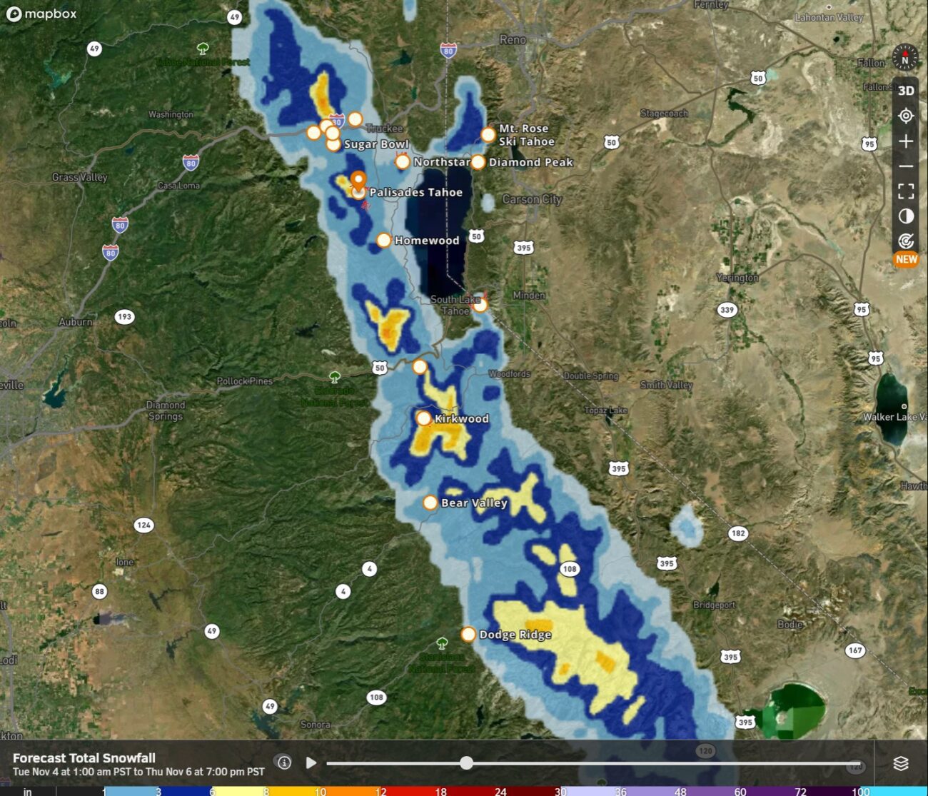
Wednesday Storm:
Looking at the latest model trends Tuesday morning, they are coming in wetter and slightly colder for the storm on Wednesday. Looking at the current radar Tuesday morning, we can see that moisture is already streaming into northern CA.
We aren’t expecting the main push of precipitation through the northern Sierra until Wednesday morning into the afternoon, and then a few showers into the evening before clearing Wednesday night. Rain and high-elevation snow for Wednesday with strong winds. Highs in the 30s on the mountains and 40s for the lower elevations near lake level.
With the heavier precipitation pushing a bit farther south than previous forecasts, the snow level forecast has dipped a bit again for Wednesday morning at the start, dropping as low as 7000 ft. briefly. Then warmer air mixes in with snow levels rising through the afternoon and evening, up to around 8000 – 8500 ft., and a bit higher by evening.
That will bring a chance for accumulating snow above 7000 ft. in the morning and above 8000 ft. most of the day, especially for the peaks above 8500 ft. By Wednesday night, we could see a coating up to a few inches of wet snow near mid-mountain, and 3-7 inches up top, maybe a tad more on the peaks.
Beyond the Storm:
It does still look like a colder and active pattern around mid-month, starting around the 12th-13th. So we will continue to track that as well.
BA
