

Thursday – Friday Weather:
We have inversions that set up Tuesday night and will likely the rest of the week. That brings warmer temps to the higher elevations overnight and fog to the valleys. We will likely see this each morning. Above the fog mostly sunny each day through Friday, and partly sunny below the fog. Highs in the 40s to near 50 degrees down at the base. Ridgetop gusts up to 40-50+ mph Friday.
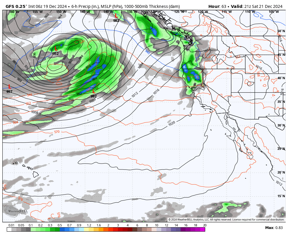
Weekend Storms:
We will be on the southern edge of the storm track as storms move through to our north Saturday through Sunday night. Most models brush us with some rain & high-elevation snow showers on Saturday & Sunday. Then possibly the wettest system could bring in some steady rain & high elevation snow Sunday night.
Highs into the low 40s for the lower elevations near the base and 30s up on the mountain. Ridgetop winds gusting up to 80-100+ mph on Saturday should close quite a few upper mountain ski lifts. Then SW winds gusting up to 40-60+ mph on Sunday.
Snow levels on the latest model runs don’t change much through the weekend. They look to fluctuate between 7000-8000 ft. with rain below that down to base all weekend. Snow levels could be a bit higher during light precipitation. Based on that, we could see a coating up to 2 inches of snow above 7000 ft. and 3-7 inches of snow above 8000 ft. by Monday morning.
Monday:
The storm should clear out during the morning with a little sun possible into the afternoon. Highs into the 30s for the mountain and 40s down near the base.
Christmas Eve Storm:
The rain could return early Tuesday morning before sunrise with snow levels up around 8000-8500 ft. but then the front moves through during the day and the snow levels show crash pretty fast to the base during the morning hours, with snow into the afternoon, and snow showers into Tuesday evening before clearing Tuesday night.
Ridgetop winds will be gusting up to 60-80+ mph in the morning ahead of the front but should drop through the afternoon. Highs in the 30s with temperatures falling into the evening.
Based on the model average this morning, we could see around 5-10 inches of snow at the base, 7-12 inches near mid-mountain, and 12-17 inches up top by Wednesday morning.
Christmas Day:
The weather for Wednesday looks pretty nice behind the storm. We could see mostly sunny skies with lighter winds and highs in the 30s down to the lower elevations, and maybe only 20s above 8000 ft. It could be a fun little Christmas morning powder day.
Active Pattern Continues:
A broad trough in the northeast Pacific noses into the Pacific NW with a strong jet stream underneath spinning up and pushing storms into the Pacific NW, with the northern Sierra on the southern edge during the 5-day period.
We will have to see how far south these storms track. They could bring light or heavier precipitation to the northern Sierra down to the Tahoe Basin with slight adjustments north or south with the track. Overall we expected to see some rain and snow from a few storms during the period as we sit on the southern edge of the wet pattern.
We may have to deal with snow-level issues with these storms similar to the ones this upcoming weekend. So I’m not expecting big powder dumps. But some snow for some parts of the mountain. We will likely see gusty winds through the period as well.
Long-Range Forecast:
By the last day of December into the first few days of January, we expect the pattern to shift with the jet stream retracting and high-pressure building in over the West Coast. That could shut off the storms up and down the West Coast, with a drier pattern for everyone.
We will be watching the long-range patterns as we go into the heart of January to see when the pattern will change. I would expect the ridge to back up a bit at first with a colder pattern possible, but eventually a wetter pattern possibly by mid-month. We’ll see…
BA
