

Wednesday – Thursday:
Partly-mostly sunny skies continue through Thursday. Highs warming into the 30s up top 40s for the lower mountain and base. Lighter winds into Thursday morning and then the winds increase from the southwest with ridgetop gusts up to 30-40+ mph by afternoon, along with increasing high clouds.
Weak Friday System:
A weak system moves through Friday with some light rain & snow showers possible. Ridgetop winds could be gusting up to 60-70+ mph Friday morning, which could affect some upper mountain lifts. Then falling through the afternoon. Highs in the 30s.
The snow levels could be near to just above the base, so some rain is possible in the village with some drizzle possible up to 6500-7000 ft. Some models show no precipitation at all while others show enough for a coating to an inch of snow on the upper mountain by Friday night.
Saturday Daytime Hours:
We will have a break between storms Saturday as high pressure builds in briefly. Partly sunny skies early with increasing clouds through the afternoon, and slightly milder temperatures. Highs in the 30s on the mountain and near 40 degrees at the base.
Ridgetop winds start light but increase through the day ahead of the next storm, with gusts up to 50-60+ mph from the southwest during the afternoon. That could cause some upper mountain lift closures before the end of the day.
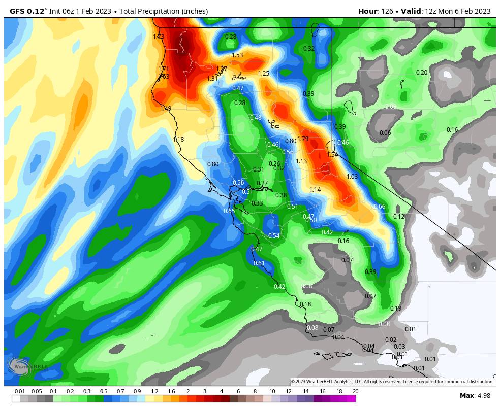
Saturday Night – Sunday Storm:
The latest forecast model runs have all trended towards the wetter/snowier scenario with the Saturday night – Sunday night storm. Snow could push in between 6-9 PM Saturday with snow levels dropping below the base. The heaviest snow could fall early Sunday morning into the afternoon. Then lighter snow showers by evening becoming more scattered into Sunday night and ending by Monday morning.
Highs are only in the 20s for the upper mountain and low 30s or near 30 degrees at the base. Ridgetop winds from the west gusting up to 60+ mph Sunday morning and dropping to 30-40+ mph during the afternoon. that could cause some upper mountain lift opening delays Sunday.
Here is my updated snowfall forecast for Saturday night through Sunday night, for totals by early Monday morning.
- 12-18 inches at the base.
- 15-21 inches at mid-mountain elevations.
- 18-24 inches up top.
Long-Range:
Monday through Friday the 10th, high pressure builds in over CA. That will bring us a drier pattern with mostly sunny skies most days through the period. Highs in the 30s Monday and then warming into the 40s for the lower elevations starting Tuesday.
By the 11th, the long-range models continue to show the ridge building in the eastern Pacific away from the West Coast with a trough over the West, with that pattern possibly lasting through the 17th. Slightly colder air could be driven into the region during this period. We could also see an uptick in weak systems dropping down into CA from the north, with shots of light snow possible every couple of days or so.
We’ll continue to watch each system closely as we go into this pattern through mid-month. If a storm or two tracks farther west just off the coast, they could tap into additional moisture from off of the Pacific Ocean, which could bring us a bit more snow. Until then we’ll just expect weak systems with light snow to continue for now.
BA
