Skip to content
Palisades Tahoe Logo Palisades Tahoe Logo Palisades Tahoe Logo
Explore
Main Menu
  • Explore Palisades Tahoe
  • Base to Base Gondola
  • Our New Name
  • Explore Legendary Lifts
  • Palisades Tahoe Blog
  • About Lake Tahoe
Plan Your Visit
Main Menu
  • Tickets & Passes
  • Lodging
  • Lessons & Guides
  • Deals & Packages
  • Rentals & Demos
  • Travel Here
  • Getting Around
Mountain Information
Main Menu
  • Snow and Weather
  • Lift and Grooming Status
  • Webcams
  • Hours of Operation
  • Trail Maps
  • Parking & Road Conditions
  • Snowfall Tracker
Events & Activities
Main Menu
  • Events Calendar
  • Aerial Tram
  • Activities
  • Dining & Apres
  • Shopping
  • Groups, Meetings & Weddings
  • Ski & Snowboard Teams
Winter Lodging Exteriors of the Village at Palisades Tahoe
Book Winter Early

Ikon Pass holders save up to 25% when you book with The Village at Palisades Tahoe this winter.

SAVE ON LODGING
Icon / FlashCreated with Sketch.
View All Offers
  • Weather

Tracking the Next Storm for Wednesday Night

  • Dec 15, 2020
  • 8:35 am

Tuesday – Wednesday:

Partly sunny Tuesday & Wednesday with increasing clouds later in the day both days, as a system moves through to our north Tuesday and the next storm approaches Wednesday. A chance for a stray snow shower. Highs in the 30s on the mountain and low 40s at the base.

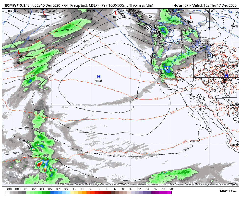
Wednesday Night – Thursday Storm:

The next storm moves in Wednesday night around midnight with heavy snow with the cold front around sunrise Thursday, and then snow showers lingering into Thursday afternoon before clearing by sunset. Snow levels may start out just above the base around 6500-7000 ft. Wednesday night, but should fall below the base fairly quickly with all snow into Thursday.

The updated forecast this morning is for 3-6 inches at the base and 6-11 inches on the mountain by Thursday afternoon. Ridgetop winds gusting to 60+ mph early Thursday morning but coming down through the day.

If you plan to ski or ride this week while the snow and wind roll through, please check out tips of staying on a storm day.

The Weekend:

We should see mostly sunny skies and lighter winds Friday through Sunday. Highs in the 40s at the base and 30s on the mountain. The dry pattern may continue into Monday.

Long-Range:

The next chance for a storm is next Tuesday-Wednesday, but that system may split apart before reaching the Sierra. We will keep an eye on that over the next week.

We look to go into a drier pattern starting around the 23rd through Christmas week. Then possibly transitioning back into an unsettled pattern for the last few days of the month into January. 

BA

lake tahoe weather snowfall forecast Squaw Weather Forecast
Bryan Allegretto
Bryan Allegretto

Share this article:

Recent Posts

  • Weather ·
  • September 19, 2023·
The predicted El Nino pattern for this winter

2023-24 Palisades Tahoe Winter Forecast Preview…

As we look ahead to the 2023-2024 winter season, it's important to remember that any winter outlook will contain an inherent degree of uncertainty. However, there are a few clues that we can keep an eye on.
Read more
  • Weather ·
  • May 8, 2023·

Final Forecast of the 2022-23 Season

First Week of May Snowfall Report: The first week of May was a cold and snowy one. The upper mountain…
Read more
  • Weather ·
  • May 1, 2023·

Snowy First Week of May

Monday – Friday Snow Shower Chances: A low-pressure system will be making its way south down the coast on Monday…
Read more

Social

Instagram Twitter Facebook Youtube

Contact

   Email Us
   1.800.403.0206

Our Partners

U.S. Forest Service Logo
1960 Olympic Valley Road
Olympic Valley, CA 96146

©2022 Palisades Tahoe

Alterra Mountain Company
  • Privacy Policy
  • Terms of Service
  • Photo Upload Terms of Use
  • Accessibility
  • Do Not Sell My Personal Information
  • Privacy Policy
  • Terms of Service
  • Photo Upload Terms of Use
  • Accessibility
  • Do Not Sell My Personal Information