

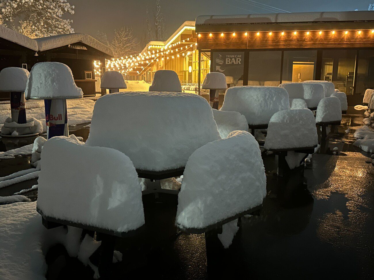
Snowfall Report:
An additional 27 inches of snow fell on the upper mountain in the past 24 hours as of 6 AM Christmas morning, and 7+ inches at the base. That brings the 2-day storm total to 29 inches so far on the upper mountain, and the 5-day total up to 43 inches and counting!
Christmas – Friday Storm:
The snow, heavy at times, will continue through Thursday night. The precipitation shield won’t be as solid on Thursday afternoon and later Thursday night between waves of broader precipitation, but the lift over the mountains will help to keep steady snow going.
The center of the low-pressure system spinning off the CA coast on Christmas Day will move inland on Friday, keeping the snow and snow showers going all the way into Friday night, but becoming more scattered eventually and tapering off by Saturday morning.
Highs in the 20s on the mountain both days to near freezing down at the base. Ridgetop winds gusting up to 70-80+ mph on Thursday. Then they drop through the day on Friday. The snow levels are below the base with the colder storm. That will increase snow ratios on the mountain with some drier snow falling.
2-3 feet of additional snow is possible by Saturday morning. I was thinking this morning of the scene from Christmas Vacation where his boss decides (after being kidnapped by Eddie) to increase his bonus over the previous year by 20%. For our Christmas Bonus, let’s take what we received so far with this storm, double it by Saturday, and maybe add 20% on top.
The Weekend:
The sun comes back out Saturday and Sunday, but it stays cold, with highs in the 30s down near the base and 20s for the upper mountain. Lighter winds will help to bring us a cold but beautiful weekend for skiing.
Dry Pattern Continues:
High pressure building over the West is forecast to be pretty strong by early next week. That will keep the drier pattern, and the weather will become even nicer (if you like sun and milder temperatures) as high temperatures warm into the 40s for the lower elevations and 30s up on the mountain. The dry weather is still expected to last through the 31st and likely New Year’s Eve.
Long-Range Outlook:
The long-range models continue to show the trough digging back south over the West Coast during the 1st week of January. That will at least bring back colder temperatures, with highs dropping back into the 30s.
Most of the forecast models keep us dry through New Year’s Eve, and then several of them bring some moisture up from the south into the northern Sierra on New Year’s Day. Then a storm moving in from the NW for next Friday, the 2nd.
Additional storms are possible during the 1st week of January. None of them looks as big as our current storm, but each has the chance to bring us some fresh snow. We’ll continue to watch the trends with more details as we get closer to each.
Merry Christmas!
BA
