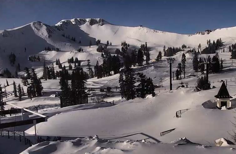
Skip to content
Palisades Tahoe Logo Palisades Tahoe Logo Palisades Tahoe Logo
Explore
Main Menu
  • Explore Palisades Tahoe
  • Base to Base Gondola
  • Our New Name
  • Explore Legendary Lifts
  • Palisades Tahoe Blog
  • About Lake Tahoe
  • About Us
Plan Your Visit
Main Menu
  • Tickets & Passes
  • Lodging
  • Lessons & Guides
  • Deals & Packages
  • Rentals & Demos
  • Travel Here
  • Getting Around
Mountain Information
Main Menu
  • Snow and Weather
  • Lift and Grooming Status
  • Webcams
  • Hours of Operation
  • Trail Maps
  • Parking & Road Conditions
  • Snowfall Tracker
Events & Activities
Main Menu
  • Events Calendar
  • Activities
  • Dining & Apres
  • Shopping
  • Things To Do In Lake Tahoe
  • Groups, Meetings & Weddings
  • Ski & Snowboard Teams
IKON PASS HOLDER LODGING DISCOUNT

Ikon Pass holders save up to 20% on slopeside lodging at The Village at Palisades Tahoe.

SLOPESIDE LODGING
Icon / FlashCreated with Sketch.
View All Offers
  • Weather

Sunny Skies Into the Weekend, More Snow Sunday Night

  • Mar 12, 2021
  • 8:12 am

Snowfall Report:

Additional snow showers on Thursday afternoon and night dropped a final 2-4 inches on the mountain, bringing the final 4-day storm total to 24-29 inches on the upper mountain and 17 inches at the base! 

Friday – Sunday:

High pressure builds in over CA Friday into Saturday with mostly sunny skies and warming temperatures. Highs into the 40s at the base and 30s on the upper mountain.

Sunday should start out with similar weather but we could see increasing clouds & winds later in the day as the next storm approaches the region. Strong ridgetop winds may hold off until just after the mountain closes.

Sunday Night – Monday System:

The forecast models have come into better agreement that we will see several inches of new snow from the next storm Sunday night into Monday. Snow levels starting out right near the base as snow pushes in Sunday evening, then a period of steadier snow and falling snow levels into Monday morning with the cold front. Snow showers could linger through the day on Monday before clearing out by evening. 

It will be much colder Monday with highs in the low 30s at the base and 20s on the upper mountains. Ridgetop winds could be gusting 50-60+ mph from the southwest into early Monday morning, possibly causing a few lift delays. Then dropping through the day. By Monday afternoon we could see snowfall totals of 3-7 inches at the base and 6-10 inches on the upper mountain.

Long-Range:

We may see another break Tuesday into next Wednesday with mostly sunny skies and highs warming back into the 40s on the lower mountain.

We may be right on the edge of the storm track when storms return later next week. That means the forecast could go either way, dry/wet. We will be watching closely and will let you know as we get closer.

BA

lake tahoe weather snowfall forecast Squaw Weather Forecast
Bryan Allegretto
Bryan Allegretto

Share this article:

Recent Posts

  • Weather ·
  • March 30, 2023·

Drier thru Saturday, Snow Showers Sun-Mon

Snowfall Report: An additional 2 inches of snow fell on the mountain Wednesday from the snow showers. That brings the…
Read more
  • Weather ·
  • March 29, 2023·

Partly Sunny Wed-Sun w/ Snow Showers Possible

Snowfall Reports: 12 inches of new snow fell on the mountain in the past 24 hours as of 5 AM…
Read more
  • Weather ·
  • March 28, 2023·

Snow & Strong Winds Tuesday

Tuesday  – Wednesday Storm: Snow showers are pushing in Tuesday morning, with heavier snow expected later in the morning into…
Read more

Social

Instagram Twitter Facebook Youtube

Contact

   Email Us
   1.800.403.0206

Our Partners

U.S. Forest Service Logo
1960 Olympic Valley Road
Olympic Valley, CA 96146

©2022 Palisades Tahoe

Alterra Mountain Company
  • Privacy Policy
  • Terms of Service
  • Photo Upload Terms of Use
  • Accessibility
  • Do Not Sell My Personal Information
  • Privacy Policy
  • Terms of Service
  • Photo Upload Terms of Use
  • Accessibility
  • Do Not Sell My Personal Information