Monday – Tuesday Weather:
We are back under the control of high pressure over CA with dry and mild weather. We will see mostly sunny skies Monday and Tuesday with highs into the 50s for the lower elevations near the base, and 40s for the upper mountain.
Wednesday – Thursday Systems:
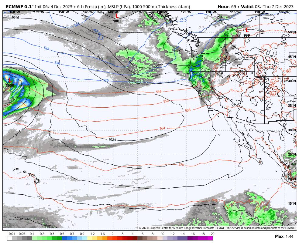
We are still tracking a pair of weak systems that will brush us on the southern edge, just like most storms have so far this season. Not including all the storms missing us just to our north. The first system is warmer and could be slightly wetter. The latest model runs still suggest rain and snow showers could reach the northern Sierra around late morning.
We will have strong ridgetop winds if you are looking to get up in elevation to avoid the rain in the lower elevations. Watch for ridgetop gusts from the southwest up to 80-90+ mph and likely some upper mountain lift closures. Highs drop into the 40s near the base and 30s on the mountain.
The snow levels look to start up around 7500-8000 ft. Wednesday morning and only lower to around 6500-7000 ft. during the afternoon. Of the two systems most of the rain and snow are expected to fall during this warmer period during the day on Wednesday. Then lighter showers could linger into Wednesday night with snow levels falling below 6000 ft. (the base).
We could see a break in the action Thursday morning before a colder and weaker system tries to brush us with a few more snow showers later in the day into Thursday night. A few model runs even miss us completely, but most brush us with some very light precipitation amounts. The winds will still be gusty Thursday with ridgetop gusts up to 50-60+ mph. Highs will be a bit colder, only in the 30s down to the lower elevations.
Mostly rain is expected for the base with maybe a dusting of snow Wednesday and again Thursday night. The upper mountain could pick up most of the snowfall Wednesday with 1-3 inches possible, and then a dusting to an inch of additional snowfall is possible Wednesday night and again Thursday night.
The good news is colder will move in with the 2nd storm with colder nights for snowmaking Thursday night and again Friday night along with drier air Friday night for what should be prime conditions for making snow.
The Weekend:
High pressure is forecast to start building in again by Friday through the weekend bringing back a drier pattern. We look to be on the east side of the high off the coast which should keep us a little cooler than if we were on the west side. We should see mostly sunny skies each day with highs into the 40s near the base and 30s up top.
Long-Range Forecast:
We continue to look into our crystal balls for any signs of bigger storms. Unfortunately, the pattern looks pretty dry for the next 10 days through at least the 13th-14th.
Beyond 10 days out into the fairly unpredictable and speculative “fantasy” range, the long-range models continue to show a better pattern for West Coast storms possibly setting up by mid-month into the 3rd week of December. This pattern may not last, but it could open the door to a few storms.
BA


