Friday – Sunday:
High pressure will be near the West Coast through the weekend. We will have mostly sunny skies through the weekend. We start out colder Friday with highs in the 20s along with some gusty northeast winds that come down through the day. Then warming into the 30s for the weekend with lighter winds Saturday.
Gusty north-northeast winds again for Sunday with ridgetop gusts up to 50-60+ mph. That will make it feel colder and may affect a few upper mountain lifts. The gusty NE winds could continue into Monday morning before coming down.
Dry Pattern Continues:
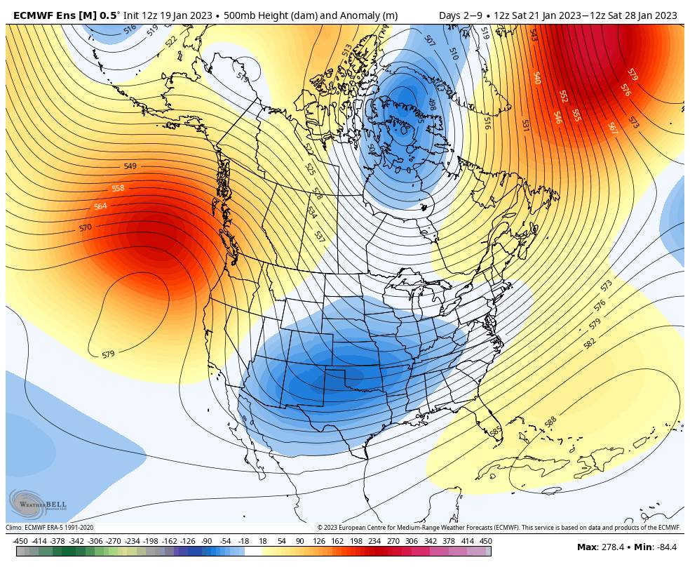
High pressure is forecast to stay near the West Coast through the 28th. That should block storms from reaching the West Coast with a dry pattern expected for this period. It should stay fairly cold through the period as we are on the east side of the ridge with a cold northerly flow into the West.
Long-Range:
The long-range models continue to show the ridge retrograding northwest away from the West Coast the last few days of the month through the first week of February. That could allow a weak system into northern CA by the end of the month, and then a more active pattern is possible for the 1st week of February.
We’ll continue to watch the trends as we get closer.
BA
P.S. I will likely shift to posting forecasts every other day until we have storms back in the 5-7 day window. I don’t want to bore you with daily forecasts calling for a dry weather pattern.


