The Drier Week Ahead:
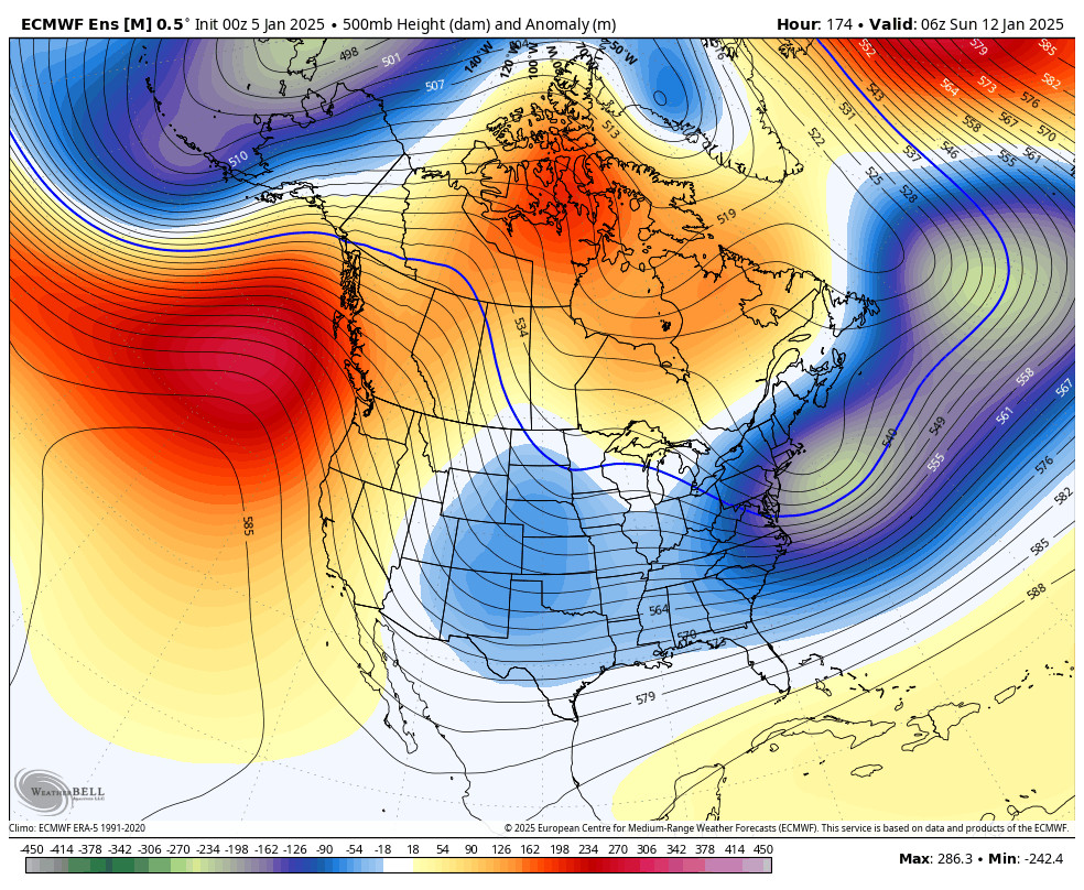
We have begun our prolonged dry period. High pressure will be stuck over the West Coast through next weekend and beyond.
We will see some gusty northeast winds some days with the position of the ridge to our northwest and low pressure to our south. Tuesday looks to be the strongest winds this week.
Outside of that, the weather will mainly be mostly sunny days with highs in the 30s for the higher elevations and 40s for the lower elevations through next weekend into the week of the 13th.
Long-Range Forecast:
The long-range models show the storms being blocked and pretty much a completely dry forecast through the 15th.
We are still watching signals that a pattern change will begin during the 3rd week of January, maybe just beyond the 15th, as we could transition toward a -PNA (Pacific North American) teleconnection pattern (western trough) as the mean ridge position shifts up towards Alaska.
That would at first help to drive colder air into the Western U.S. and maybe some weak systems from the north. We will watch for that to possibly start happening around the 17th. The European ensemble mean model’s 3-day preciptiation forecasts start to show some precipitation returning between the 17th-19th along with the colder air.
We will be watching closely and will let you know as soon as we have confidence in storms returning!
BA


