Dry Pattern:
We have 4 more days of partly-mostly skies. Highs into the 40s for the lower elevations and 30s for the upper elevations. One good thing is that the east flow helped wash out the inversions and we saw colder temperatures from top to bottom on the mountain overnight. That should have helped with snowmaking on the upper mountain.
The Storms Return:
We will be dealing with a storm or two that are cut off from the west-east flow and will drop down the West Coast. That makes their timing a pain to forecast and their track inland is in question as well. We’ve been watching a pair of potential cut-off lows for next week for a while now, and all we can do is break down what the latest forecast model runs are showing.
The latest model runs show the first system pushing precipitation in sometime between Sunday morning and Sunday evening, with very high snow levels above 8000 ft. to start. Then rain and snow continue through Monday night with snow levels falling to around 6500-7000 ft., so we could see some rain at the base through this period.
The second system may drop down the coast and brush us on the eastern side Tuesday, or it could be more progressive and swing through northern CA, with snow showers possibly lingering into Wednesday. The latter is a colder scenarios with snow levels dropping well below the base on Tuesday through Wednesday.
We are going to deal with these differences and changes daily over the next few days. For now, taking an average of the latest model runs it looks like we could see around 5-10 inches of snow at the base by Wednesday, and 1-2 feet of new snow on the mountain. We’ll continue to adjust daily based on the latest trends.
Long-Range Forecast:
With the faster progression of the second system moving through by Wednesday, the latest model runs have extended the drier pattern behind the storms from next Thursday the 21st through Sunday the 24th, Christmas Eve. Some model runs keep us dry into Christmas Day as well.
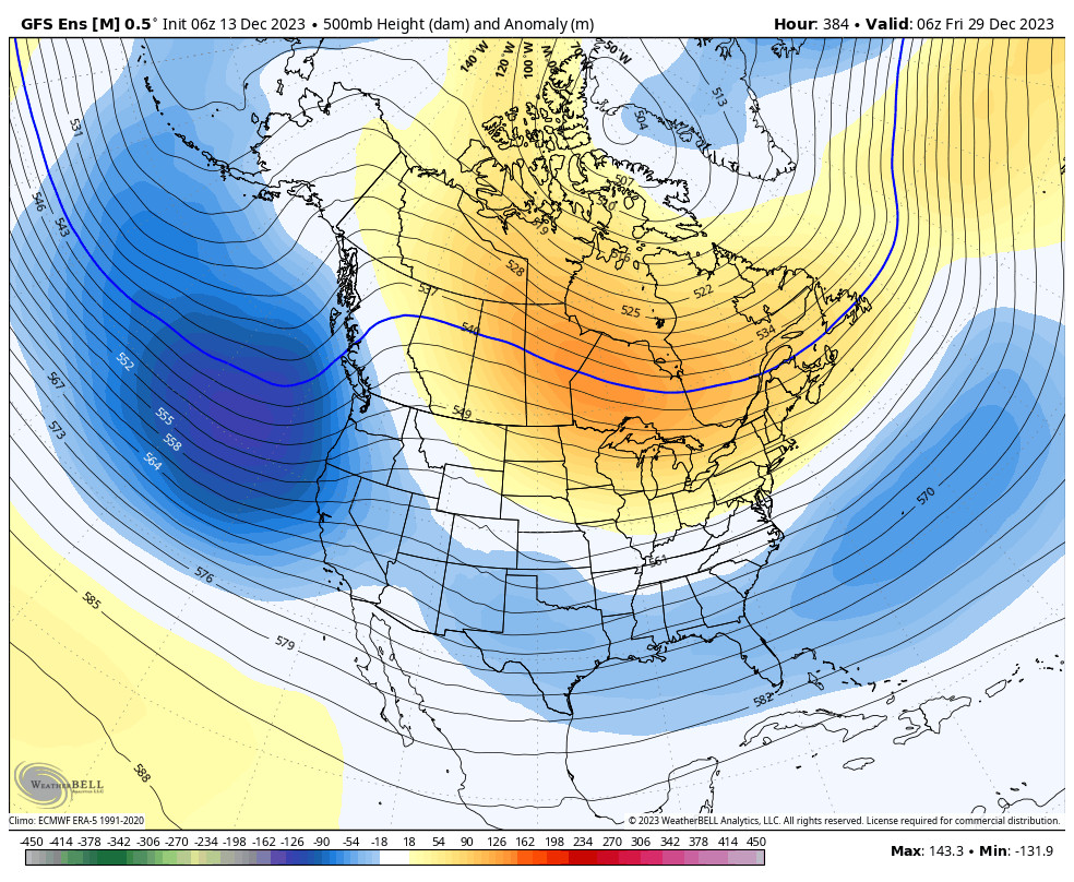
Beyond that, the long-range models have been suggesting for at least a week now that a large trough sets up in the northeast Pacific with the jet stream cutting underneath toward the West Coast during the week of December. That still looks favorable for storms to start moving into CA again starting around the 25th-26th through the end of the month, with a decent amount of precipitation and snow possible through the period.
BA


