

Weekend Clouds:
A storm is close enough to the West Coast over the weekend to stream in some clouds through Sunday. Unfortunately, that’s just another storm that will be stopped by high pressure over the West before it can move inland. We’ll see highs in the 40s to near 50 degrees at the base.
Another Week of Dry Weather:
The dry pattern will continue through next weekend, and likely with fewer clouds and mostly sunny days, with high pressure strengthening a bit this upcoming week. Similar temperatures are expected through the period.
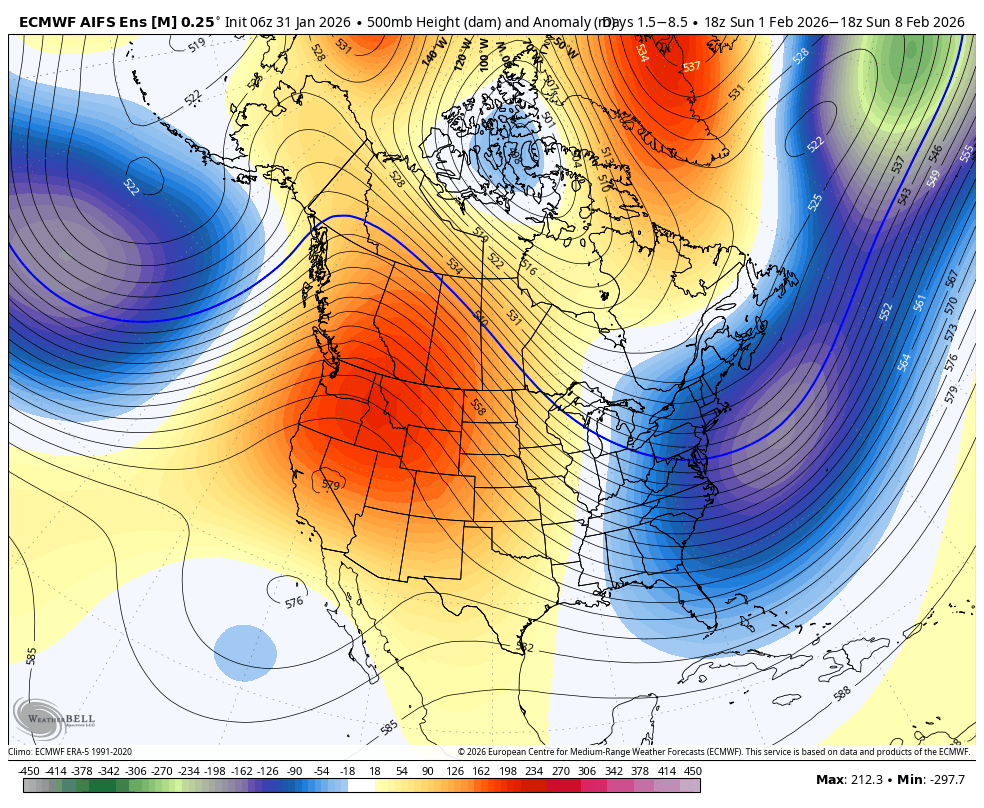
Long-Range Outlook:
The long-range models continue to show the pattern starting to shift during the week of the 9th, with high pressure over the West weakening and shifting east, with a ridge developing in the eastern Pacific replacing the trough, and a trough replacing the ridge over the West.
That should at least bring in some cooler temperatures. It could also open the door to weak systems dropping into the western side of the trough from the northwest. How close to the coast the ridge sits will likely be the key. Too close and we could stay mainly dry even with some light precipitation at times, farther off the coast, a better chance of storms.
The longer-range models continue to suggest that we could see the ridge off the West Coast shift a bit farther offshore during the 3rd week of February, possibly opening up the door to storms just enough for wetter storms to move through northern CA. That’s pretty far out, so don’t get too excited yet.
We’ll continue to watch the trends as we get closer. My next update will be on Monday morning. Hopefully, we will have some snow within the 10-day forecast window.
BA
