

Tuesday – Wednesday Weather:
Mostly sunny for Tuesday with highs warming into the 40s. Similar weather for Wednesday with a few clouds possible later in the day ahead of the next storm. Ridgetop winds increased later Wednesday with gusts up to 40-50+ mph from the southwest during the afternoon.
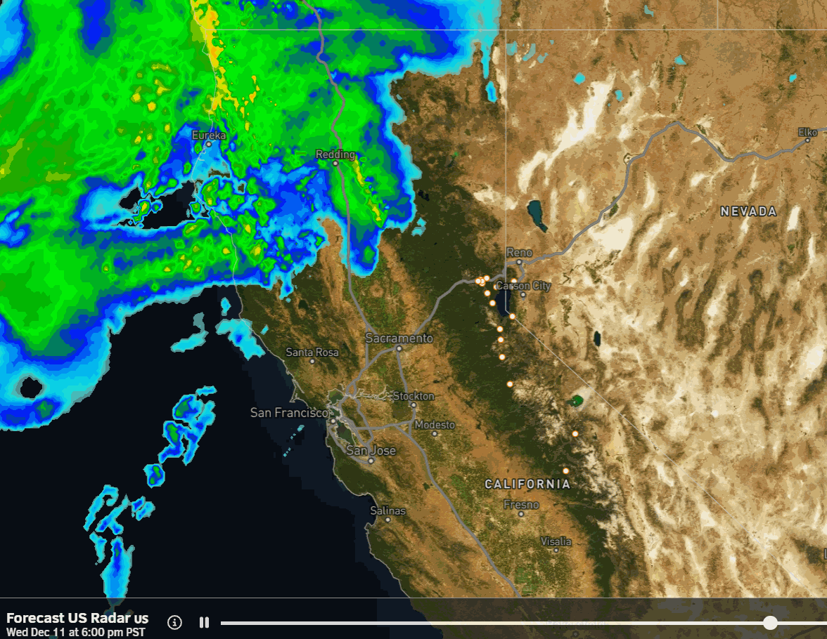
Thursday Quick Snowstorm:
A fast-moving storm will bring light-moderate snow by early morning Thursday. We expect steady snow Thursday morning into the afternoon as the system moves through, with snow showers tapering off by Thursday evening. Highs in the 30s for the lower elevations and 20s for the higher elevations. Winds decrease throughout the day.
Snow levels drop quickly as this storm starts, down near the base by early Thursday morning, and falling lower by the end of the day on Thursday. This fast-moving storm could bring 2-5 inches of new snow near the base, 3-6 inches near mid-mountain, and 4-8 inches up top by Thursday night.
Friday Weather:
We will see a break Friday between storms with partly sunny skies and highs in the 30s. The winds will be increasing again ahead of the next stronger storm that is approaching the West Coast. Gusts from the WSW up to 40-50+ mph by afternoon.
Friday Night – Sunday Storm:
I have extended the storm into Sunday morning with some models lingering the snow showers, but the biggest change is the models showing the front and moisture plume taking aim at northern CA stalling and tilting Friday night, keeping the heaviest precipitation from pushing through until Saturday into Saturday evening before tapering into Sunday morning.
The snow levels will rise as we are on the warmer south side of the moisture flowing into northern CA Friday night. Snow levels may start near the base Friday evening but then rise to around 7000-8000 ft. by Saturday morning. Then colder air moves in with the front Saturday into Saturday night, dropping snow levels to the base by midday, and lower Saturday night.
Snow showers could linger into Sunday morning as the storm clears by afternoon. Highs in the 30s for Saturday. Ridgetop winds will be gusting up to 100+ mph, so I would not plan to get above the snow line on lifts as most upper mountain lifts will likely be closed on Saturday.
By Sunday morning we could see additional snowfall totals of around 5-9 inches near the base, 9-14 inches near mid-mountain, and 12-17 up top. On top of the Thursday storm, we could see 1-2 feet of new snow in total for the 3-4 day period.
Sunday Weather:
We have another break between storms on Sunday. The winds will come down but could still be a little gusty over the exposed ridges. Highs in the 30s. We will see clearing into the afternoon with partly – mostly sunny skies possible.
Monday System:
Another weak and fast-moving system is still expected to move through Monday into Monday night. That could bring a final round of snow showers and light snowfall accumulations for the mountains. We’ll start to look at potential snowfall details over the next few days as the storm gets into the 5-day forecast window.
Long-Range Forecast:
Starting Tuesday the 17th the long-range models continue to show high pressure building back in over the West and West Coast. That is expected to bring us a drier pattern for the middle of next week, possibly from Tuesday through Friday the 20th. We’ll likely see high temperatures warming into the 40s for the lower elevations.
By the 21st the long-range models continue to show a broad trough in the northeast Pacific pushing in very close to the West Coast. The jet stream coming in underneath and trying to push storms into the West Coast as they encounter the backside of the ridge over the West.
We’ll be watching the period of the 21st – 22nd closely to see if a good storm could accomplish reaching the Sierra, hopefully bringing a decent dump of snow for the mountains right before the holiday period.
The trough is forecast to pull back to the NW by Christmas with high pressure trying to rebuild over CA. We’ll have to see if that is enough to keep the storms from reaching the West Coast. Not a good-looking pattern for storms through the end of the month, but that doesn’t mean a strong storm doesn’t have enough gusto to reach us.
BA
