Weekend Showers:
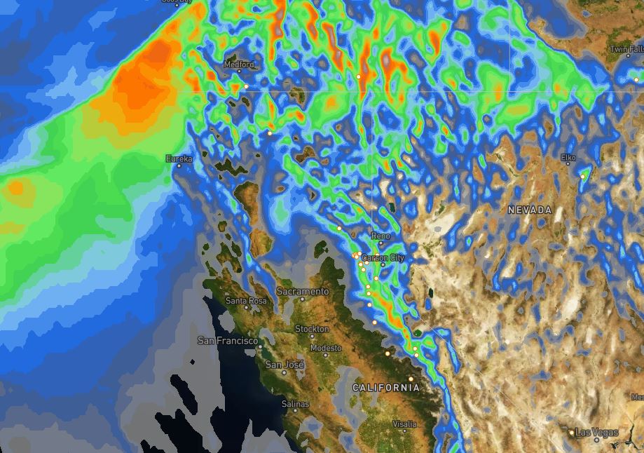
Storms take aim at the Pacific NW over the weekend. We are on the southern edge of moisture streaming into off the Pacific all weekend. We should see clouds with the chance for very light and scattered showers Saturday evening into Sunday morning. Snow levels could fluctuate between 6000-7000 ft. through Sunday with rain showers possible at the base.
For snowfall, we could see a dusting up to 1.5 inches of snow on the upper mountain by Sunday morning. Ridgetop winds could be gusting from the southwest up to 40-50+ mph all weekend, possibly affecting a couple of upper mountain lifts. Highs in the 30s on the mountain.
Monday Storm:
The next storm moves in early Monday morning with some heavier snow during the day, and showers lingering into Monday night before ending before Tuesday morning. We may see snow levels start out above the base Monday around 6500-7000 ft. Then dropping to the base by evening. Ridgetop winds could be gusting to 80+ mph and could close down some upper mountain lifts.
Snowfall amounts around 3-6 inches at the base after a change to snow later in the day, 9-13 inches at mid-mountain, and 12-16 inches up top by Tuesday morning.
Tuesday – Wednesday:
We should see a break for Tuesday with mostly sunny skies and highs in the 30s. Winds drop off in the morning and then turning southerly and increasing to 30+ mph up top during the afternoon.
The next storm could move in Wednesday afternoon into Wednesday night. This storm looks to weaken as it moves into northern CA. We will have to see if it reaches the northern Sierra. If it does we could see 1-3 inches of snow Wednesday night.
Long-Range:
We may have another break Thursday with mostly sunny skies likely and highs in the 30s. Then the next system may fall apart as it approaches the coast Friday. A few models hold it together so we will keep an eye on that for Friday.
Another weak system is possible for Sunday the 10th. Then a drier pattern could be setting up for the week of the 11th.
BA


