
The Next 7 Days:
The storm track looks to mainly stay to our north over the next 7 days. We should see mostly sunny skies and highs in the 30s on the upper mountain, and 40s at the base through Tuesday. Overnight lows in the teens and 20s will be cold enough for continued snowmaking.
A system moving through to our north on Wednesday could dip far enough south for a few snow showers over the mountain. Not expecting more than a dusting of snow. Ridgetop winds gusting to 60+ mph Wednesday. Highs dropping into the 30s.
Thanksgiving Day through the weekend high pressure builds back in with mostly sunny skies and lighter winds expected. Highs in the 30s Thursday, and then 40s for the weekend.
Long-Range:
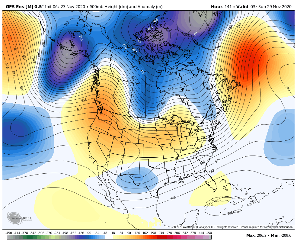
The latest long-range model runs continue to show a drier pattern possibly lasting through the 1st week of December as high pressure builds in over the Western U.S.
The pattern may not flip back into an active pattern until around mid-December into the 3rd week of December. That doesn’t mean we won’t see any storms until then, just that the pattern is not looking favorable for an active storm track or any big storms. We will continue to watch the long-range for the first sign of storms returning.
Until then we will rely on snowmaking on top of the fresh snow from the last 3 storms for continued terrain expansion. Opening day is scheduled for Wednesday!
BA


