

Friday:
We have mostly sunny skies Friday morning with a few clouds around and ridgetop winds gusting up to 40-50+ mph from the southwest. The winds will increase into the afternoon with gusts up to 60-70+ mph by the end of the day, which could affect a few upper mountain lifts. Highs into the 40s.
Friday Night – Saturday System:
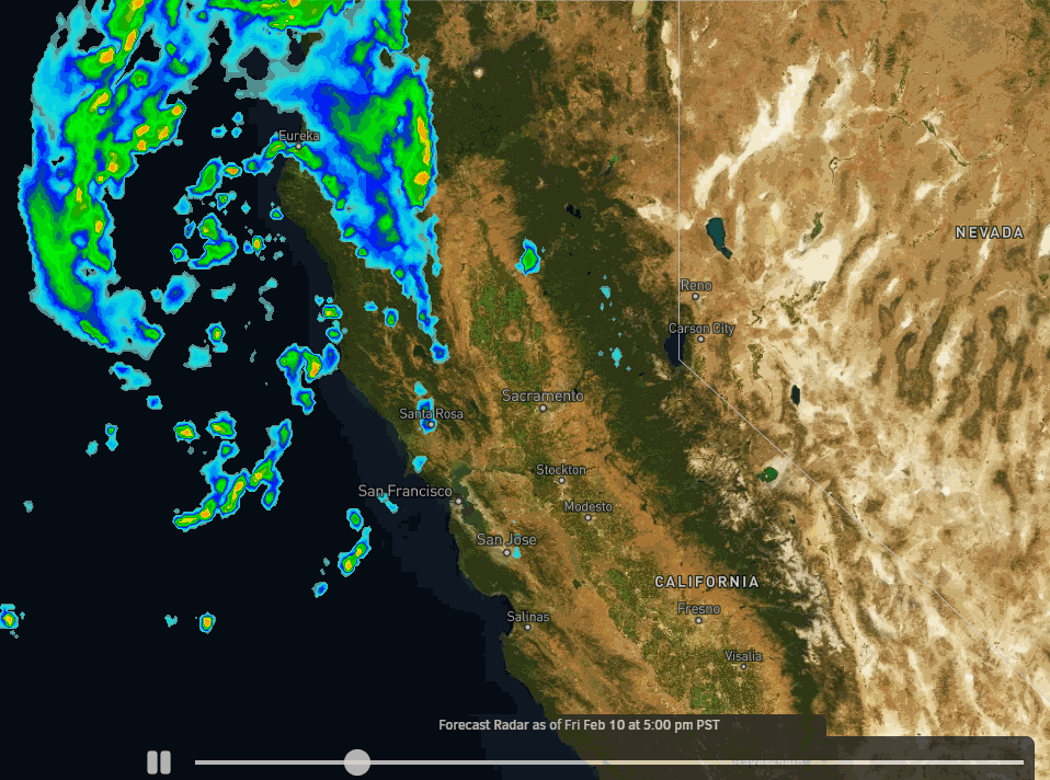
The low spinning into the coast Friday will reach the northern Sierra Friday evening. The latest model runs still show snow showers reaching the mountain around 8-10 PM. Snow levels start near the base and fall below 4000 ft. overnight.
Friday night with the southwest flow we expect most of the showers on the west side of the basin, and then a band of snow moving east to west across the basin through Saturday morning as the flow turns east. We could see some clearing and sun by Saturday afternoon. Highs into the 30s.
The winds will die down early Saturday morning as they turn to the east, and then increase into the afternoon with gusts up to 50-60+mph over the ridges.
Here is the final snowfall forecast for potential snowfall totals by Saturday afternoon.
- 1-2 inches at the base.
- 1-3 inches at mid-mountain elevations.
- 1-4 inches up top.
Sunday – Monday:
Weak high pressure builds in briefly Sunday into Monday. Mostly sunny skies with highs warming into the 30s Sunday and 40s on Monday. Breezy east winds continue Sunday with ridgetop gusts up to 30-40+ mph. Then increasing west winds Monday with ridgetop gusts up to 60-70+ mph by afternoon, which could close some upper mountain lifts.
Tuesday – Wednesday Cold Front:
A cold trough digs in from the north by Tuesday. We could see a few snow showers with the cold front later Monday night into Tuesday. Highs drop into the 20s Tuesday into Wednesday. The latest model runs show very light precipitation with the possible snow showers Tuesday.
We could see a dusting up to an inch or two of new snow with the snow showers. We will likely see a mix of sun and clouds Tuesday with the scattered snow showers, and then mostly sunny and cold Wednesday. The winds becoming lighter starting Tuesday.
Long Range:
High pressure builds back in briefly again by next Thursday into Friday the 17th. That should warm highs back into the 30s with mostly sunny skies continuing each day.
By President’s Weekend another cold trough is forecast to dig into the West. We could see the colder temperatures stick around, but with the ridge near the West Coast and the trough centered to our east, we could stay dry through the weekend.
As we go later into the month through the last week of February, the long-range models show the ridge off the West Coast shifting northwest farther away from the coast and the trough over the West shifting west over the West Coast with time. If that retrogression occurs, we could see weak systems move through from the north going into the week of the 20th that could eventually become wetter with time.
We’ll continue to watch the trends to let you know when we could see more than a using up to a few inches of snow with a storm…
BA
