

Tuesday – Wednesday Forecast:
We have some clouds streaming into CA ahead of the next storm that will move in on Thursday morning. Temperatures will still be mild through Wednesday with some sun and clouds. Highs into the 50s. The ridgetop winds start to increase on Wednesday.
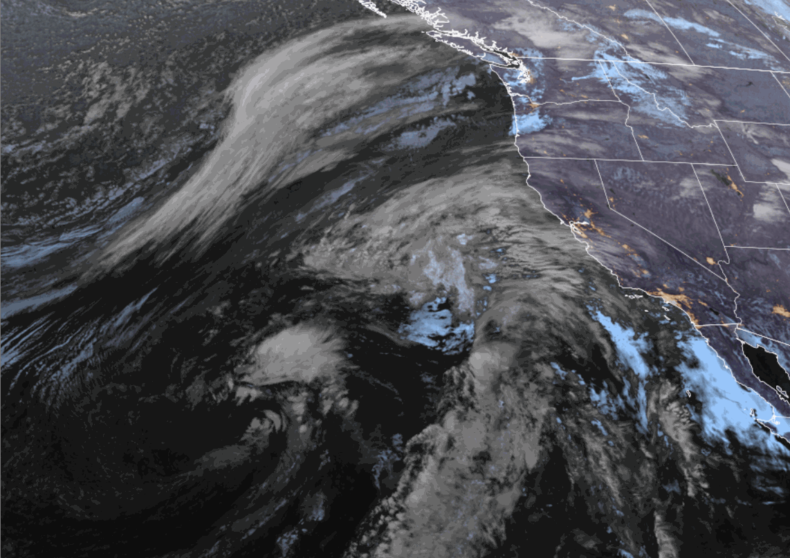
Thursday – Friday Storm:
The winds crank up from the south-southwest on Thursday, gusting up to 80-90+ mph over the ridges. Rain pushes in during the morning hours with a period of heavier rain into the afternoon. Then showers are possible for Thursday night, and scattered showers are possible on Friday as the storm clears the region.
The latest model runs show the center of the low-pressure system off the coast on Thursday dropping south and moving into SoCal through Friday. That is driving some of the heaviest precipitation totals to our south, and the southerly flow is limiting spillover of the heaviest precipitation over the mountain.
What has been a real pain to forecast with this storm is the snow levels. There is cold air with the northern portion of this storm in the northern Pacific, and warmer air with the low from the south being drawn up into CA. It pulls in some colder air to the center of the low off the coast. If the low drops south into SoCal and the air at the center modifies, the colder air could evade the northern Sierra, which is the latest trend this morning.
Two days ago, snow levels were forecast to drop below the base, and now back to a warmer scenario, with some models now keeping snow levels above 8000 ft. through Friday, and mostly all rain with this storm. The snowfall forecasts for several inches near the base of the mountain and up to a foot+ up top has now turned to rain, with maybe a few inches of snow above 8500 – 9000 ft.
We’ll continue to watch the trends over the next 48 hours…
The Weekend:
The winds start to drop on Friday, and the storm clears for the weekend, but colder air is left behind. Partly – mostly sunny skies are expected for the weekend. Highs in the 40s for the lower elevations and 30s for the higher elevations.
Long-Range Forecast:
The longer-range forecast models have been struggling with the pattern from the 17th through the last week of November. They show a high-pressure ridge off the West Coast, but can’t decide how far off the coast it stays.
Two to three days ago, they suggested farther off the coast with troughing over the West Coast, keeping the door open to wetter storms. Today, they are back to having high pressure closer to the coast, with the trough centered more over the Rockies.
That could keep the storm track mainly to our north, but chances for storms to brush us with some snow showers starting around the 17th, and a few more times into the last week of November.
The good news is that we should stay in a colder pattern for the foreseeable future, with highs in the 40s for the lower elevations and 30s for the higher elevations. Some cold, dry nights should allow for snowmaking, and we shouldn’t see much daytime melting.
We’ll continue to search for bigger snowstorms that could give us an early-season boost…
BA
