Monday Rain & Snow:
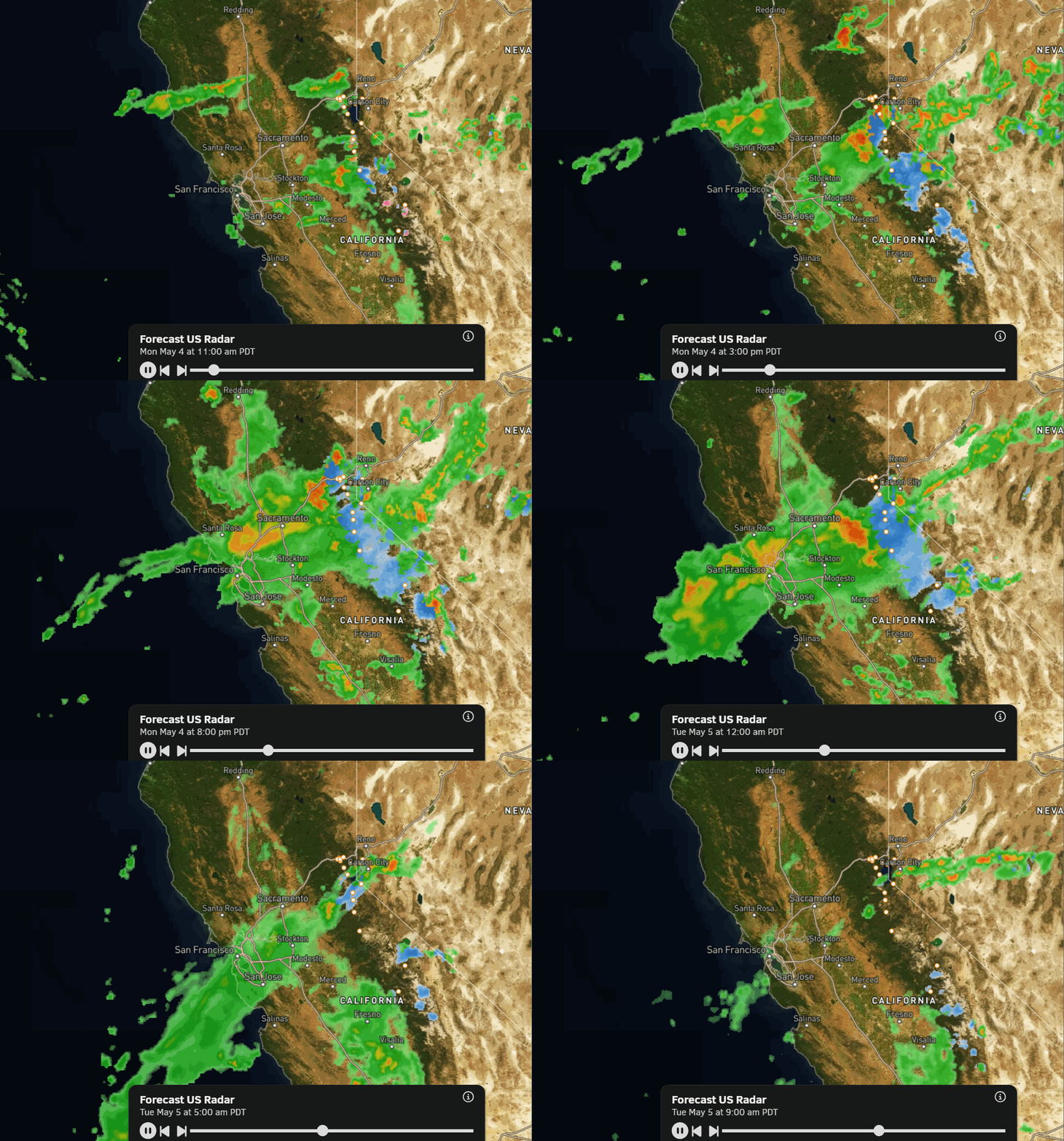
A low-pressure system is spinning through CA to our south on Monday, with a deformation band of precipitation on the north side rotating precipitation in from the northeast during the day. That will get enhanced by the mountains Monday afternoon into the evening.
Highs only in the 30s on the mountains and 40s at the base. Snow levels are starting up above 9000 ft. but will lower to around 8000 ft. during heavier precipitation, with wet flakes possible even lower at times.
We could see snow accumulate on the upper mountain Monday afternoon into the evening, with a few snow showers possible Monday night. Up to 1-3 inches of wet snow is possible on the upper mountain above 8000 ft. on cold surfaces (like snow).
Tuesday Showers/Clearing:
Tuesday we will see clouds and sun as the system begins to clear. There will be enough moisture still around for afternoon showers to possibly pop up over the mountain. Highs into the 50s for the lower elevations and 40s for the higher elevations.
Dry and Mild Pattern:
High pressure begins to build over the region on Wednesday, becoming stronger by the weekend. That will bring us a drier pattern with sunny and mild days. Highs into the 60s for the lower elevations and 50s for the higher elevations Wednesday through Friday, and then into the 60s on the mountain and 70s at the base over the weekend.
Long-Range Outlook:
The dry and mild pattern is expected to continue into the week of the 11th. Around mid-month into the 3rd week of May, the long-range models suggest that we could see a cooler and unsettled pattern return.
We’ll continue to watch the trends, and to see if the mild weather over the next week will allow the mountain to stay open until or beyond the 3rd weekend in May.
BA