

I hope that everyone had a great Thanksgiving Day. I’m not much of a shopper, so I’ll be here at the office today, pulling out my hair looking for snowstorms.
We had inversions again overnight. The snowmaking teams are doing their best to make snow on different parts of the mountain whenever possible.
Friday – Tuesday:
Not much of a change in the forecast. The dry pattern continues. Highs in the 40s and lows in the 30s. The snowmaking will continue to be tricky.
Wednesday – Thursday:
The latest model runs still show the ridge backing off the coast and a cold trough digging far enough west to bring some colder air into the region on Wednesday, lingering some into Thursday. We may see a few snow showers if the front backs far enough west to draw in a little moisture. Some models are farther east and completely dry, and a few show minor amounts of snow.
We’ll continue to keep an eye on that over the next few days. Overall, not the snow we need if we do see some flakes. The good news, at least for a couple of days, is colder nights with lows in the 20s and better snowmaking conditions. Highs in the 30s.
Next Weekend:
The ensemble mean models mostly seem to be trending towards high pressure being closer to the West Coast through the 1st weekend of December. That could continue the dry pattern and delay any storms returning to northern CA. If they do make it farther south, as some models suggest, they may only brush us with light precipitation at best.
A week ago, the models showed us getting cold on Wednesday and staying cold, but over the past week, they have trended the ridge closer to the coast beyond Wednesday, with temperatures rebounding back into the 40s during the day. Overnight lows will not be as cold either, and snowmaking could become tricky again.
Long-Range Outlook:
Beyond a week, the long-range models are all over the place with the pattern. The locked-in -PNA/+EPO with a retracted East Asian jetstream pattern from a week ago has faded, and over the last few days, the models have been struggling.
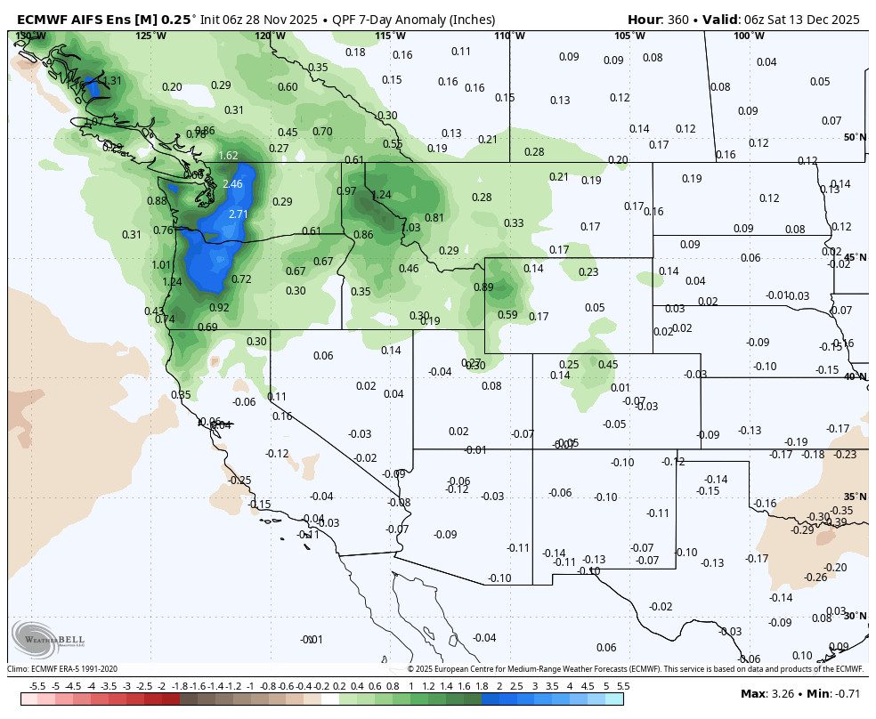
Looking at the European Ensemble Mean model (ensemble mean models average dozens of ensemble member model runs to aim for better accuracy), during the 2nd week of December (8th-14th), it shows the high-pressure ridge staying close to the West Coast, and keeping the storm track mainly to our north.
The GFS Ensemble Mean model has the ridge shifting away from the West Coast, farther with time, with troughing farther west in Canada. It has the trough over the West Coast beyond the 10th, slowly opening the door to bigger storms.
So there is way too much chaos and disagreement in the overall patterns right now to have any confidence in the forecast beyond a week. It’s still only November and lots of winter ahead, so no panicking yet. We’ll continue to watch closely for our next snowstorm…
BA
