Tuesday:
We will see partly sunny skies with some clouds from the approaching storm starting to move in during the day on Tuesday. Highs in the 30s. The winds start to increase later in the day.
Wednesday – Thursday Night AR:
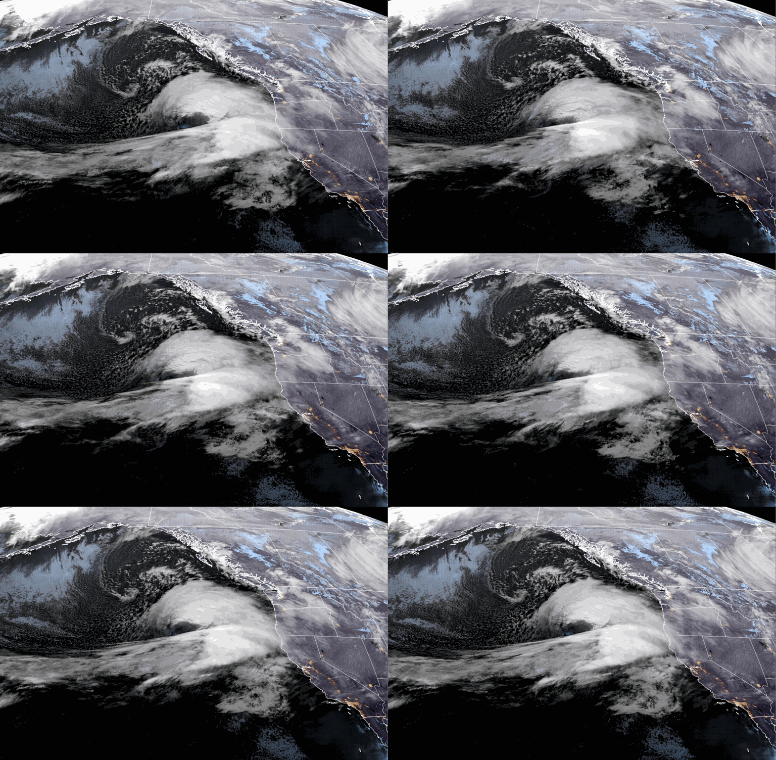
We will see rain & high elevation reach the mountain Wednesday morning. The rain with the atmospheric river is still forecast to lift north Thursday night before dropping south again on Friday. Rain is expected into Thursday and then we should see a lull Thursday night.
The winds ramp up Tuesday night into Wednesday. We could see southwest winds gusting up to 80-90+ mph over the exposed ridges into Friday. Warmer air flows in, especially Wednesday night into Friday. Highs into the 40s for the lower elevations and 30s for the higher elevations.
The snow levels will start somewhat lower on Wednesday, around 7200-8200 ft. in the morning and dropping a bit to around 6000-7000 ft. by late afternoon. That could bring a few wet flakes as low as the base for a few hours. Then Wednesday night as much warmer air flows in they jump quickly up to 8500-9500 ft. and stay there through Thursday.
As we start to see a lull later Thursday into Thursday night they rise even higher, possibly up to 9500-10,000 ft. before starting to very slowly work back down toward 9k’ Friday morning. This scenario means heavy wet snow on Wednesday turns to rain on most of the mountain Wednesday night into Thursday.
We could see a coating up to a few inches of snow Wednesday near mid-mountain, and 5-10 inches up top before we see a change to rain up to 8500+ feet, which will melt down the snow through Thursday night.
Friday – Saturday Storm:
The AR finally pushes south through the region Friday into Saturday as a cold front sweeps through. That will continue the strong winds Friday with gusty winds possible through most of the day on Saturday, up to 60-70+ mph over the ridges. Highs in the 40s for the lower elevations Friday drop into the 30s Saturday behind the front.
We will see precipitation return on Friday with the snow levels still high. Then heavy rain & snow is expected Friday night as the front moves through. Snow showers are expected for Saturday that are expected to taper going into Saturday night.
The latest model runs aren’t showing the air behind the cold front moving in as fast, but cold enough to drop snow levels to the base of the mountain by Saturday afternoon. Snow levels on Friday could lower to 8000-8500 ft. by evening, and then down to 6750 – 7250 ft. by early Saturday morning and down to the base by Saturday afternoon.
The speed of the colder air moving in and lowering the snow levels vs the heaviest precipitation moving through makes the snowfall forecast very tricky. All I can do is use the average of the models for timing and totals. We may not see snow reach areas near the base until Saturday afternoon, limiting accumulations to around 3-7 in total by early Sunday morning, with 9-14 inches near mid-mountain, and 16-22 inches up top.
Sunday – Monday Storms:
The latest model runs don’t agree on the track of the next system moving inland on Sunday. Some bring in more snow later Saturday night into Sunday. Other models track most of the precipitation into Southern CA. A final round of snow showers is possible on Monday as the low off of the Pacific NW finally rotates south through the region.
We have a lot to iron out for the Sunday – Monday time frame with the track and intensity of the two features that could bring more snow on both days. Overall this is a 5-6 day storm event ahead starting Wednesday, with a lot of moving parts that take a long time to put together to try and figure out each day.
I will start to add in a snowfall forecast for Sunday – Monday over the next few days as the picture hopefully becomes clearer. The good news is that the snow levels will be lower. We could see gusty winds still on Sunday that start to come down a little on Monday. Between the Friday night – Saturday and Sunday – Monday snow, we should be able to gain back what we lose from snowmelt from the rain.
Long-Range Forecast:
The long-range models show colder air hanging back over the region next week after the Monday system moves out, but most model runs have removed the chance for any more storms through the end of the month. We will continue to watch the trends to see if that will be a reality.
The long-range models continue to show high-pressure building in near the West Coast during the 1st week of December. That could continue a drier pattern. Any high-pressure areas or ridges through the end of the month and into December don’t look that strong, so it’s not impossible that we see a storm during the period.
BA


