Skip to content
Palisades Tahoe Logo Palisades Tahoe Logo Palisades Tahoe Logo
Explore
Main Menu
  • Explore Palisades Tahoe
  • Base to Base Gondola
  • Our New Name
  • Explore Legendary Lifts
  • Palisades Tahoe Blog
  • About Lake Tahoe
  • About Us
Plan Your Visit
Main Menu
  • Tickets & Passes
  • Lodging
  • Lessons & Guides
  • Deals & Packages
  • Rentals & Demos
  • Travel Here
  • Getting Around
Mountain Information
Main Menu
  • Snow and Weather
  • Lift and Grooming Status
  • Webcams
  • Hours of Operation
  • Trail Maps
  • Parking & Road Conditions
  • Snowfall Tracker
Events & Activities
Main Menu
  • Events Calendar
  • Activities
  • Dining & Apres
  • Shopping
  • Things To Do In Lake Tahoe
  • Groups, Meetings & Weddings
  • Ski & Snowboard Teams
IKON PASS HOLDER LODGING DISCOUNT

Ikon Pass holders save up to 20% on slopeside lodging at The Village at Palisades Tahoe.

SLOPESIDE LODGING
Icon / FlashCreated with Sketch.
View All Offers
  • Weather

Rain & Snow Tuesday & More Snow Possible Saturday

  • Mar 14, 2022
  • 8:12 am

Snowfall Report:

As expected, the Sunday morning system dropped a coating to an inch of new snow on the mountain.

Monday:

A quick rebound back to nicer weather Monday with mostly sunny skies and highs back near 50 degrees at the base and 40s up top, along with lighter winds.
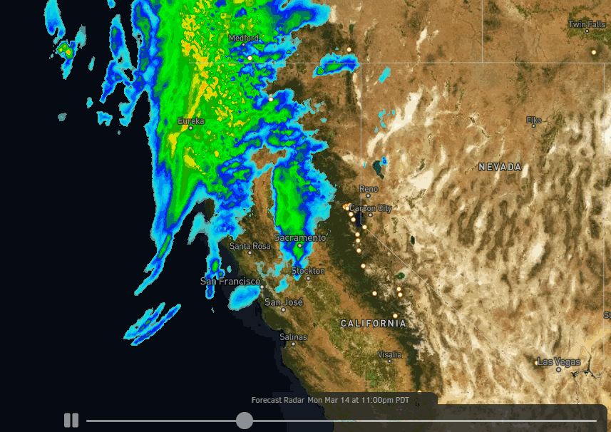
Tuesday System:

Another system digs south into the northern Sierra early Tuesday morning, with scattered showers possible into the early afternoon before clearing by late afternoon. We should see mostly all rain at the base and snow for the upper mountain. Snow levels look to start around 7500-8000 ft. early Tuesday morning and fall to around 7000-7500 ft. Tuesday morning. Maybe 500′ lower at times as the heaviest precip moves through.

Ridgetop winds gusting up to 70+ mph from the southwest, likely causing some lift closures Tuesday morning, then falling through the afternoon. Highs into the 40s at the base and 30s up top. Expecting rain at the base and part of the lower mountain, with a coating up to 5 inches of snow on the upper mountain above 7000 ft.

Wednesday – Friday:

Wednesday through Friday looks to be drier and milder as high pressure builds back in over the region. Expecting mostly sunny skies with highs into the 40s on the mountain and near 50 degrees at the base. The winds should be light as well.

Weekend Storm:

A colder storm moves in during the day on Saturday into Saturday night, with snow showers possibly lingering into Sunday morning before completely clearing. Highs drop into the 30s for the weekend. We could see gusty winds Saturday that fall off for Sunday. The sun should return by later Sunday.

Snow levels should drop below the base Saturday after possibly starting around mid-mountain. We could see several inches of snow from top to bottom by Sunday morning. We will fine-tune the forecast all week as we get closer.

Long-Range:

The week of the 21st the long-range models are suggesting that we could go back into a dry and mild pattern. Then maybe a more active pattern the last 3-4 days of the month. We’ll continue to watch the trends as we get closer.

BA

lake tahoe weather palisades tahoe weather forecast snowfall forecast
Bryan Allegretto
Bryan Allegretto

Share this article:

Recent Posts

  • Weather ·
  • March 21, 2023·

Weak Systems & Snow Showers thru Sunday

Tuesday Storm: The next storm pushes snow showers back in by later Tuesday morning, with steadier snow through Tuesday afternoon.…
Read more
  • Weather ·
  • March 20, 2023·

More Weak Systems Tuesday-Friday

Snowfall Reports: No real surprises with the weak storm that moved through on Sunday. We were expecting 3-11 inches from…
Read more
  • Weather ·
  • March 19, 2023·

Two More Storms Sun & Tue

Sunday Storm: Snow showers are moving in Sunday morning, and will continue through the day before becoming more scattered Sunday…
Read more

Social

Instagram Twitter Facebook Youtube

Contact

   Email Us
   1.800.403.0206

Our Partners

U.S. Forest Service Logo
1960 Olympic Valley Road
Olympic Valley, CA 96146

©2022 Palisades Tahoe

Alterra Mountain Company
  • Privacy Policy
  • Terms of Service
  • Photo Upload Terms of Use
  • Accessibility
  • Do Not Sell My Personal Information
  • Privacy Policy
  • Terms of Service
  • Photo Upload Terms of Use
  • Accessibility
  • Do Not Sell My Personal Information