Snowfall Report:
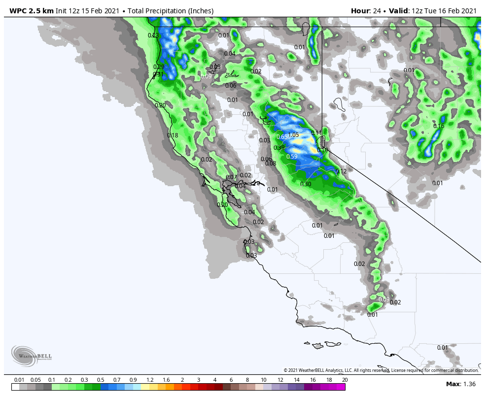
The snow showers Sunday night into early Monday morning dropped 1-2 inches of snow on the upper mountain, with snow turning to rain at the base.
Monday Storm:
Scattered rain & snow showers will continue into Monday evening before ending. Snow levels rising to around 7000-7500 ft. Monday morning and possibly sitting in that range through most of the day Monday and not falling until the system ends Monday evening.
This storm will also bring gusty winds for Monday with ridgetop gusts of 80-90+ mph from the southwest in the morning & up to 60+ mph through the afternoon, likely affecting some of the upper mountain lift operations. Highs in the 30s.
We could see an additional 2-5 inches of new snow on the upper mountain by Monday evening.
Tuesday – Wednesday:
Expecting mostly sunny skies for Tuesday – Wednesday, but the winds up top could still be gusty with northwest winds possibly gusting 40-50+ mph Tuesday and then turning northerly for Wednesday and becoming lighter. Highs in the 30s both days.
Thursday – Saturday System:
We may see increasing clouds Thursday ahead of another storm that is expected to move in by later by Thursday evening. This is a two-part system that could start warmer with snow levels near to just above the base Thursday night into Friday, and then a colder part Friday night into Saturday. We could see light to moderate snow showers through the 2-day period.
Initial snowfall estimates are for 4-10 inches at the base and 9-14 inches on the mountain through Saturday afternoon before clearing out Saturday night. Highs in the 30s both days.
Long-Range:
High-pressure building in near the CA coast by Sunday may bump the storm track to our north into early next week. We may see drier weather with highs in the 30s & 40s Sunday, and then possibly warming into the 40s & 50s early next week.
The pattern may shift the last few days of the month into the first few days of March with an active storm track returning.
BA


