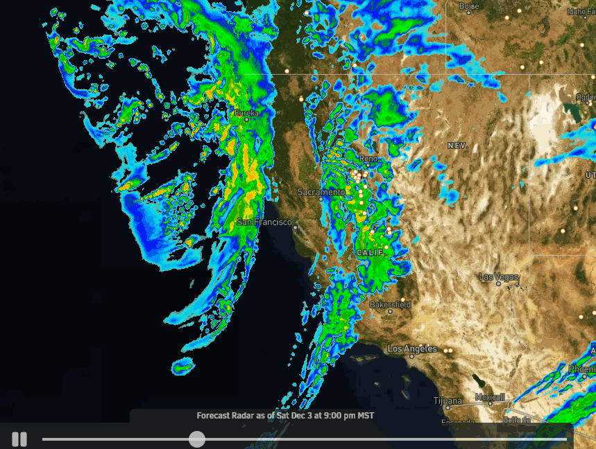
Skip to content
Palisades Tahoe Logo Palisades Tahoe Logo Palisades Tahoe Logo
Explore
Main Menu
  • Explore Palisades Tahoe
  • Base to Base Gondola
  • Our New Name
  • Explore Legendary Lifts
  • Palisades Tahoe Blog
  • About Lake Tahoe
  • About Us
Plan Your Visit
Main Menu
  • Tickets & Passes
  • Lodging
  • Lessons & Guides
  • Deals & Packages
  • Rentals & Demos
  • Travel Here
  • Getting Around
Mountain Information
Main Menu
  • Snow and Weather
  • Lift and Grooming Status
  • Webcams
  • Hours of Operation
  • Trail Maps
  • Parking & Road Conditions
  • Snowfall Tracker
Events & Activities
Main Menu
  • Events Calendar
  • Activities
  • Dining & Apres
  • Shopping
  • Things To Do In Lake Tahoe
  • Groups, Meetings & Weddings
  • Ski & Snowboard Teams
IKON PASS HOLDER LODGING DISCOUNT

Ikon Pass holders save up to 20% on slopeside lodging at The Village at Palisades Tahoe.

SLOPESIDE LODGING
Icon / FlashCreated with Sketch.
View All Offers
  • Weather

Rain & Snow Saturday, Turning to Snow Sunday

  • Dec 3, 2022
  • 8:00 am

Saturday:

Moisture is moving into the Sierra Saturday morning along with warmer air and gusty winds. We are seeing some light snow up top and some drizzle at the base. Ridgetop winds are gusting up to 60+ mph at times which is causing some wind holds.

Heavier precipitation will arrive Saturday afternoon into Saturday night. Ridgetop winds will continue to gust up to 60+ mph at times from the southwest. Highs in the 30s. Snow levels will fluctuate between 7000-8000 ft. through Saturday evening with rain at the base. A few inches of wet snow is possible up top Saturday.

Saturday Night:

The warmer system moves out after midnight and the colder system off the CA coast moves inland Sunday through Monday. That will bring in colder air early Sunday with snow levels dropping close to the base by Sunday morning. That means that 1-3″ of wet snow is possible to the Palisades Village by Sunday morning, with 4-12″ possible overnight on the mountain from bottom to top as snow levels fall.

Sunday-Monday:

Snow of varying intensity is possible for Sunday with snow levels falling below the base during the day. Ridgetop winds still gusting up to 70-80+ mph at times, which means another day of wind holds likely. Highs in the 30s at the base and 20s up top. Several more inches of snow could fall during the day with the snow becoming drier.

Sunday night into Monday the snow showers are expected to become more scattered and lighter. The winds come down Monday but could still gust up to 30-40+ mph from the west. In total Sunday through Monday, we could see an additional 6-10″ at the base and 9-20 inches on the mountain.

Storm totals could be around 7-13 inches at the base and 13-32 inches on the mountain from bottom to top by Tuesday morning. A large snowfall range than normally forecast for a storm but that’s what happens when we start with rain and then have falling snow levels throughout the storm. A lot more snow falls where it stays all snow vs where it turns to snow last.

Tuesday – Thursday:

We should see mostly sunny skies Tuesday through Thursday and cold with highs in the 30s at the base and 20s on the upper mountain. We should see lighter winds, at least through Wednesday.

Long-Range:

The next storm could move into northern CA around Friday the 9th into Saturday the 10th. We’ll continue to watch the trends with this storm as we get closer.

BA

lake tahoe weather palisades tahoe weather forecast snowfall forecast
Bryan Allegretto
Bryan Allegretto

Share this article:

Recent Posts

  • Weather ·
  • February 8, 2023·

Tracking Light Snow for Friday Night

Wednesday – Thursday: Mostly sunny skies through Thursday. Highs into the 30s for the upper mountain and 40s at the…
Read more
  • Weather ·
  • February 7, 2023·

Weak System Possible Fri Night – Saturday

Tuesday – Thursday: Mostly sunny skies with a few clouds possible through Thursday as high pressure builds in over CA.…
Read more
  • Weather ·
  • February 6, 2023·

1-2 Feet of Fresh Snow

Snowfall Report: We definitely saw more than the 8 inches being reported by mountain ops fall on the mountain on…
Read more

Social

Instagram Twitter Facebook Youtube

Contact

   Email Us
   1.800.403.0206

Our Partners

U.S. Forest Service Logo
1960 Olympic Valley Road
Olympic Valley, CA 96146

©2022 Palisades Tahoe

Alterra Mountain Company
  • Privacy Policy
  • Terms of Service
  • Photo Upload Terms of Use
  • Accessibility
  • Do Not Sell My Personal Information
  • Privacy Policy
  • Terms of Service
  • Photo Upload Terms of Use
  • Accessibility
  • Do Not Sell My Personal Information