

Tuesday – Wednesday:
We have a dry cold front moving through Tuesday. Highs cooling into the 40s at the base and 30s for the upper mountain. The cooler weather continues into Wednesday with sunny skies. We will see gusty west winds Tuesday morning slowing turning north then east into Wednesday.
The good news is that we will see a pair of cold nights where the mountain should be able to make snow at most elevations.
Thanksgiving – Month End:
By Thanksgiving, a large high-pressure ridge is building over the West and will stay there through the end of the month. We will see high temperatures warm into the 50s with sunny skies expected through the period.
Overnight we are expecting inversions most nights making for temperatures that may be too warm to make snow at most elevations. This pattern could continue through at least the first few days of December.
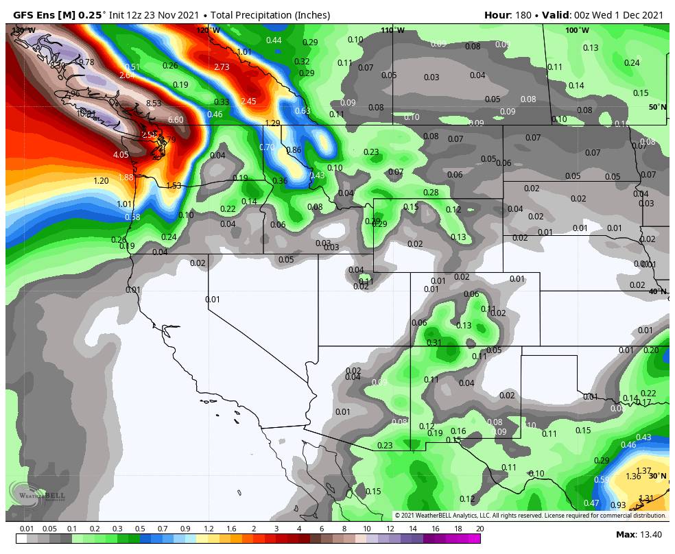
Long-Range:
The ridge is still showing a breakdown on the ensemble mean models by the weekend of the 4th. The storm track is forecast to shift farther south into at least northern CA during the latter half of the 1st week of December. The models show an increase in precipitation chances from December 4th – 9th.
Fingers crossed this shift in the pattern happens during this period to get both good snowmaking and natural snow going again.
BA
