

Thursday:
We will have mostly sunny skies Thursday morning and then increasing clouds and winds through the afternoon. Highs into the 20s on the mountain and 30s at the base. Ridgetop winds from the southwest up to 40+ mph during the morning and up to 60+ mph by the end of the day.
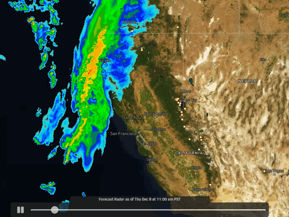
Weak Storm:
Snow showers are expected to move in between 4-7 PM Thursday. This is a weak system that will be weakening more as it moves through the Sierra. Snow showers may continue into Friday morning but then we should see them end with a break through Friday afternoon. Maybe a few scattered snow showers during the day.
Winds dip a bit Friday morning but still gusting up to 40+ mph up top and increasing back up to 50+ mph by evening. Snow levels dip below 4000 ft. Thursday night into Friday morning, so plenty cold enough for all snow with this storm and powdery snow on the mountain. Expected snowfall of 2-4 inches at the base and 3-6 inches on the mountain through by Friday morning.
Strong Storm:
The next storm is coming together with all of the ingredients for a classic Sierra storm. The snow showers are expected to move back in Friday evening and increase after midnight Friday night into Saturday morning. Then heavy snow moves in Saturday into Sunday morning. Snow showers continue Sunday and become more scattered Sunday night before ending Monday morning.
Strong winds with ridgetop winds gusting up to 100+ mph from the southwest Saturday. That should close down quite a few ski lifts Saturday and will blow the snow around causing low visibility. The jet stream will also tap into subtropical moisture. The snow levels look to peak near the base Saturday but it still looks to remain all snow to the base, and then they fall below 4000 ft. Saturday night into Sunday.
The winds come down through the day on Sunday for a better storm skiing day. The snow becomes more powdery Sunday. Highs in the 20s on the mountain and 30s at the base Saturday and then 20s top to bottom Sunday. We could see an additional 2-3 feet of snow at the base Friday night through Sunday night and 3-4 feet on the mountain!
Long-Range:
Monday we will see clearing with mostly sunny skies by the afternoon. It will be cold with highs continuing to be in the 20s. The winds will drop off behind the storm will beautiful skiing conditions expected. The cold and dry pattern is expected through Friday the 16th.
The pattern looks to remain cold through the 3rd week of December. Any storms may drop down from the north as we saw most of November. That means they are cold but could be weak and dry unless they track just off the coast and tap some Pacific moisture.
The next chance for snow right now looks to possibly be the weekend of the 17th-18th. We’ll continue to watch the trends and will let you know if that changes.
BA
