

The Weekend:
High pressure is over CA through the weekend. That will bring mostly sunny skies and milder temperatures. Highs into the 40s on the mountain Saturday and 50s for Sunday.
Colder & Windy:
Monday into Tuesday a pair of low-pressure systems drop south to the east of the Tahoe Basin. That will bring in colder air with highs in the 30s on the upper mountain and 40s at the base Monday, and colder Tuesday with highs only in the 30s to the base
The pressure gradient, with the colder air pushing in and systems dropping south to our east, will cause strong northeast winds both days. We could see ridgetop gusts to 100+ mph which will shut down upper mountain lifts. The strong winds could mix to the base with gusts to 50+ mph. This will also make it feel even colder than the air temperatures.
Wednesday – Thursday:
Mostly sunny skies continue through Thursday. The winds relax Wednesday into Thursday and turn southwest. Highs warming into the 40s on the lower mountain.
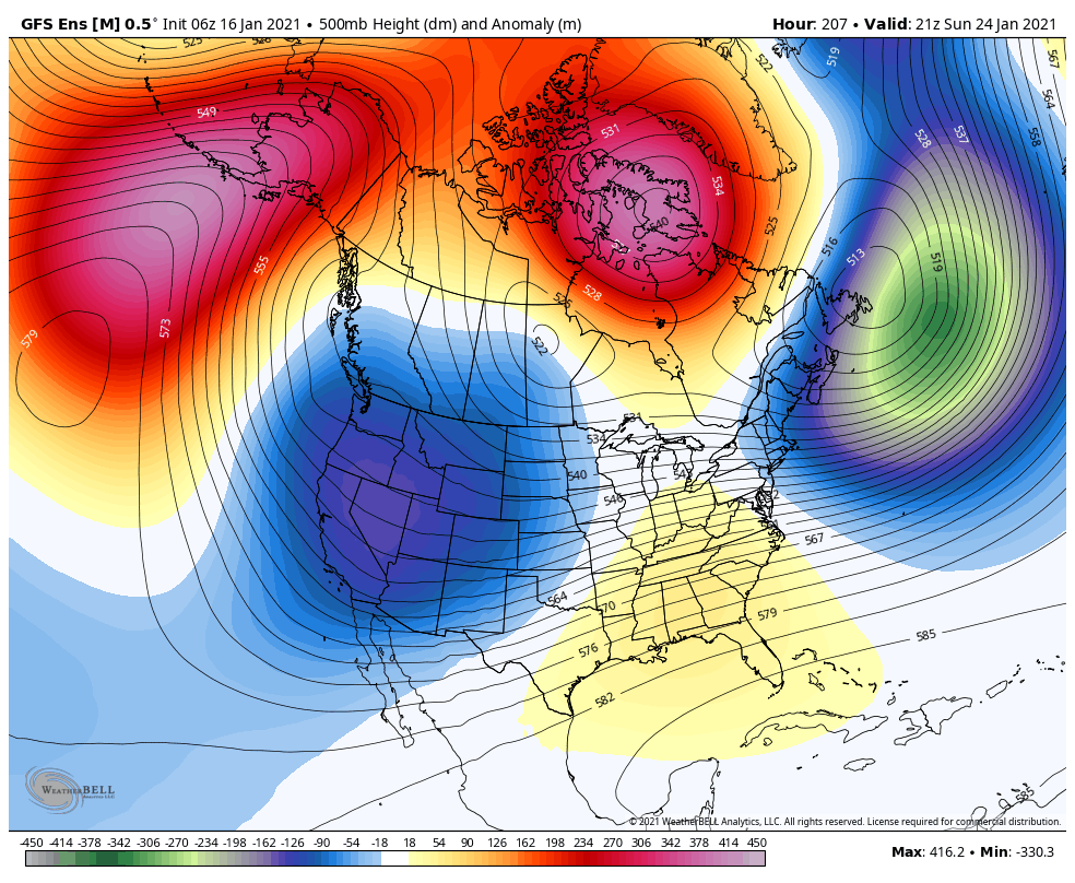
Long-Range:
By the end of the week, as the ridge continues to shift farther off the West Coast, we could start to see cold/weak systems drop-down from the north into CA. The first system could move through Friday into next Saturday with some light snow.
It looks like the last week of the month the storm door could open up a bit more to some wetter systems. We could see several systems the week of the 25th. We will continue to track that with more details as we get closer.
BA
