

Tuesday – Thursday:
Mostly sunny skies continue through Thursday morning. Highs warming into the 30s Tuesday, and 40s for Wed – Thu for the lower mountain and base. The winds become lighter Tuesday into Wednesday.
The winds increase from the southwest Thursday with ridgetop gusts up to 40-50+ mph by afternoon, along with increasing high clouds.
Friday System:
A weak system moves through Friday with some light snow possible. Ridgetop winds could be gusting up to 60+ mph Friday morning, which could affect some upper mountain lifts. Then falling through the afternoon. Highs in the 20s up top and 30s at the base.
We’ll have to see how much moisture this system has left by the time it reaches the Tahoe basin. Some models show little if any snow, while others show an inch or two possible by Friday afternoon.
Saturday:
We will have a break between storms Saturday as high pressure builds in briefly. Partly-mostly sunny skies and slightly milder temperatures. Highs in the 30s on the mountain and near 40 degrees at the base. Ridgetop winds start light but increase later in the day ahead of the next storm, with gusts up to 30-40+ mph from the southwest by the end of the day.
Saturday Night – Sunday Storm:
There is a split among the models with how much a 2nd storm holds together as it moves into the northern Sierra Saturday night into Sunday. It’s a stronger system with more of a moisture feed from off of the Pacific, so it should have a better chance of bringing us some snow.
We could see snow move in around 10 PM – Midnight Saturday night and continue into Sunday evening. Then winding down Sunday night and clearing out by Monday morning. It’s not a cold storm with snow levels starting near to just below the base, and hovering there through Sunday. Then falling below 5000 ft. by the end Sunday night.
The snowfall forecast is tricky as some forecast models only show 1-2 inches of snow while others show up to 2+ feet of snow. All we can do for now is to use the model average. Here is my initial snowfall forecast for Saturday night through Sunday night, for totals by early Monday morning.
- 5-9 inches at the base.
- 6-10 inches at mid-mountain elevations.
- 7-11 inches up top.
We’ll continue to fine-tune the forecast as the models come into better agreement as we get closer.
Long-Range:
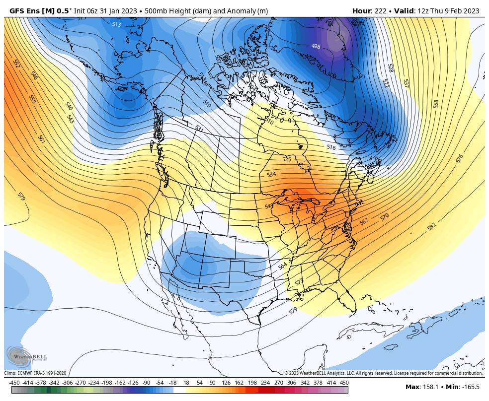
Starting Monday through at least Thursday the 9th, high pressure builds in near the West Coast. that should bring us a drier pattern but it should stay on the cooler side with the highest pressure centers to our west. Mostly sunny skies with highs into the 30s and 40s. There is an outside chance that a system diving down to our east next Wed-Thu could brush us with some clouds and a few snow showers.
By the 10th-11th the long-range models continue to show the ridge building in the northeast Pacific a bit farther northwest away from the West Coast and staying in that pattern through mid-month. Slightly colder air could be driven into the region. We could also see an uptick in weak systems dropping down into CA from the north, with shots of light snow possible every couple of days or so.
We’ll continue to watch each system closely as we go into this pattern through mid-month. If a storm or two tracks farther west just off the coast, they could tap into additional moisture from off of the Pacific Ocean, which could bring us a bit more snow. Until then we’ll just expect weak systems with light snow to continue for now.
BA
