Quiet Weather:
We saw a cold front move through Tuesday night dropping temperatures for Wednesday. Highs are only in the 30s on the mountain to nearly 40 degrees near the base.
The quiet weather pattern will continue into the weekend with highs warming back into the 50s for the lower elevations and 40s for the upper mountains. We could see a few clouds and maybe a stray shower Saturday night into Sunday morning from a weak system, but overall expecting mostly sunny skies each day.
The Next Storm:
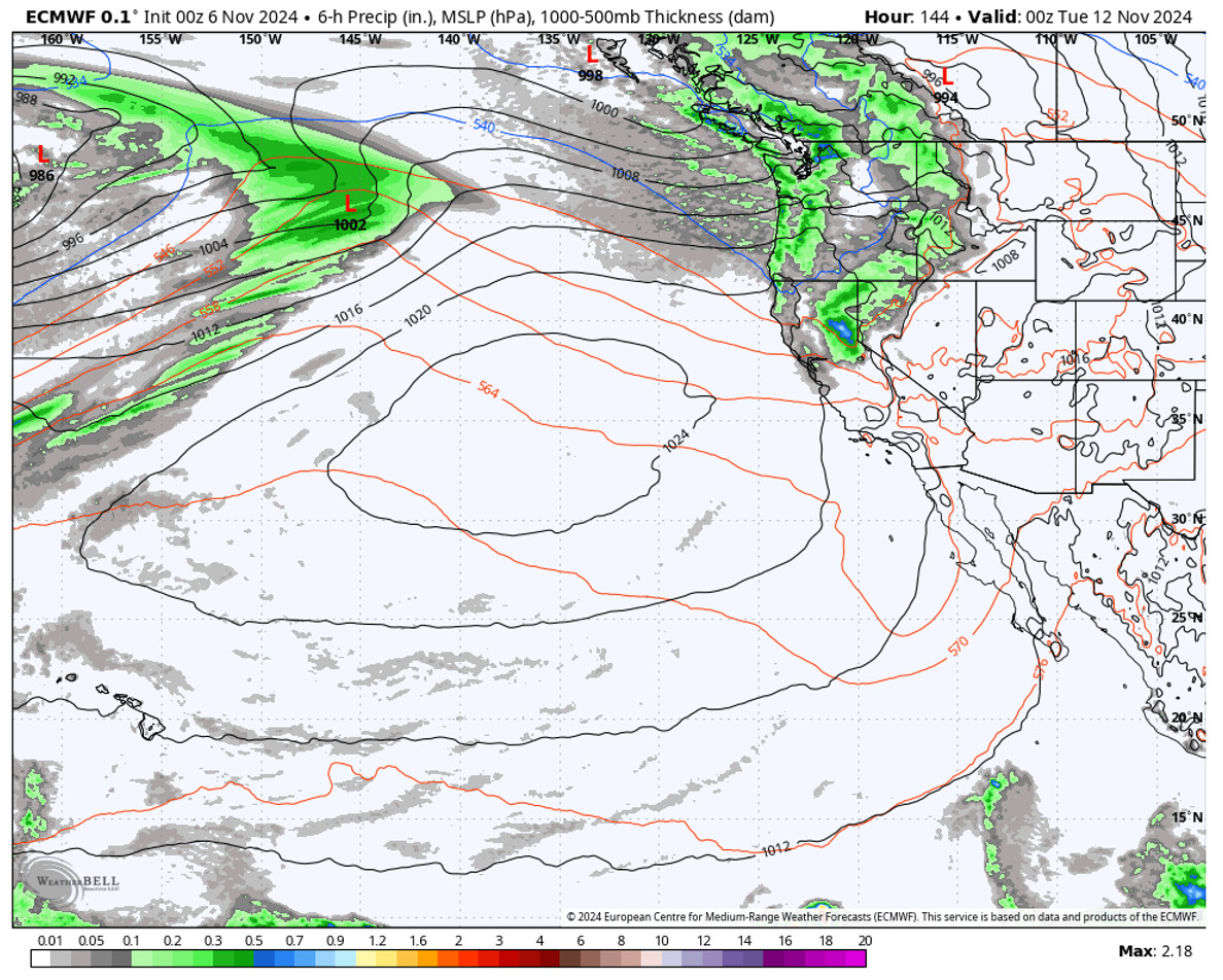
By Monday we expect a cold trough to dig into the West bringing back colder temperatures and a chance for some snow with the front. The latest forecast model runs disagree on how far south the heavier precipitation will reach as the front weakens as it pushes south.
We have some models that show up to an inch of precipitation reaching the mountain while others show much less or barely any precipitation reaching the mountain. I don’t like to start making a snowfall forecast when the models are that far apart, and we still have 5 more days to look at the trends.
Long-Range Forecast:
The long-range models show another trough digging into the West by the end of next week. We could see a break in the storms midweek before a shot of colder air and the storm door opening again.
Some models show a cut-off low off the coast by Friday the 15th while others push more storms inland by the end of the week. Overall the pattern next week looks wet for the Pacific NW with the northern Sierra on the southern edge.
We’ll continue to watch the trends to see if we could see another storm or two bring more snow to the mountains next week.
BA


