

Spring Weather through Wednesday:
High pressure is over the region and will continue into Wednesday. We will have clear skies and sunny days with mild temperatures. Highs into the 50s for the lower elevations on Sunday and then 60s for Monday – Wednesday.
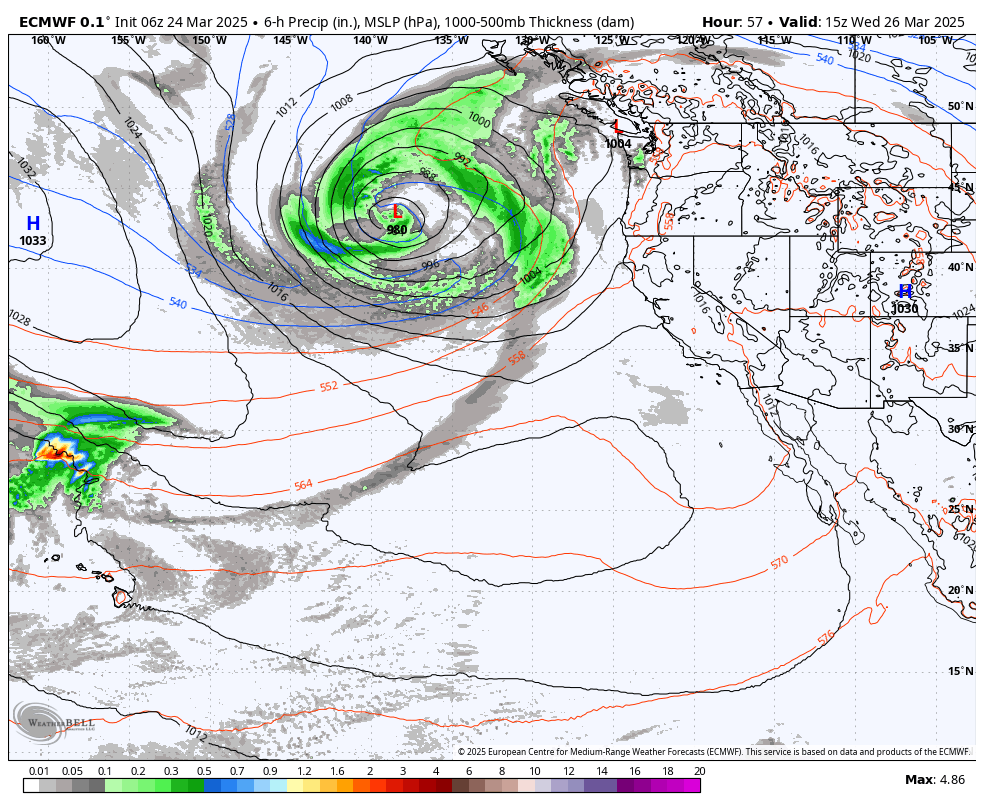
Increasing clouds with Gusty winds Wednesday afternoon as the next storm approaches. We could see a few scattered rain showers reach the mountain by the end of the day with ridgetop winds gusting up to 30-50+ mph.
Wednesday Night – Friday Showers:
A large low-pressure system slowly approaches the West Coast and directs moisture into the Pacific NW by midweek through the end of the week. We will be on the southern edge with showers possible Wednesday night through Friday as a secondary wave moves through.
Highs drop into the 40s for the lower elevations on Thursday and 30s for the higher elevations, with ridgetop winds gusting up to 80-100+ mph from the SW. That will likely close some upper mountain lifts. Then lighter winds for Friday.
The snow levels start very high up around 9500 – 10,500 ft. Wednesday evening, and only fall to around 7500-8500 ft. by Thursday morning, 5500-6500 ft. by evening, and bottoming out around 5000 ft. Thursday night and Friday night.
By Saturday morning we could see storm totals of around 1-3 inches above 8000 ft. with only a dusting up to an inch at the base after some rain on Thursday.
Saturday Weather:
A break between storms for Saturday with mostly sunny skies and highs into the 40s for the lower elevations with 30s for the higher elevations above 8000 ft.
Long-Range Forecast:
By Sunday into the first week of April, we could see more storms move through, and farther south into northern CA as the trough stays near the West Coast through the 6th of April.
Most of these storms look to be weak-moderate strength/wet. But each could bring measurable rain and snow. We’ll be watching the Sunday storm closely all week as that will be the next storm lined up to move through the region. Some models show a fairly wet storm tapping into Pacific moisture.
Others show a weak/moderate storm. Either way, this storm has a chance to bring several inches of new snow to the mountains on Sunday. We’ll move this storm into the short-range forecast starting Tuesday, with more details by Wednesday.
The storms could continue through at least the 3rd with another decent storm possible around the 1st of April. The long-range models disagree on when the active period ends, but range between the 3rd – 8th. Overall the ensemble mean models show above average precipitation for this time of year through the 6th.
BA
