Snowfall Reports:
We saw more snow on the upper mountain from the weak storm that moved through the region on Tuesday. The OpenSnow estimates show that 1-2 inches of new snow fell on the upper mountain.
Drier Pattern:
We are heading into a drier pattern for the end of the week, the weekend, and into early next week, through at least the 10th- 11th, it appears. High pressure is forecast to be over CA this weekend, with highs warming into the 50s for the lower elevations and 40s for the highest elevations.
That will bring an end to the snow and start to melt some of what has fallen. We are also expecting milder overnight temperatures and difficult or impossible snowmaking as we go through the period. The long-range forecast may have what we need to fix that…
Long-Range Outlook:
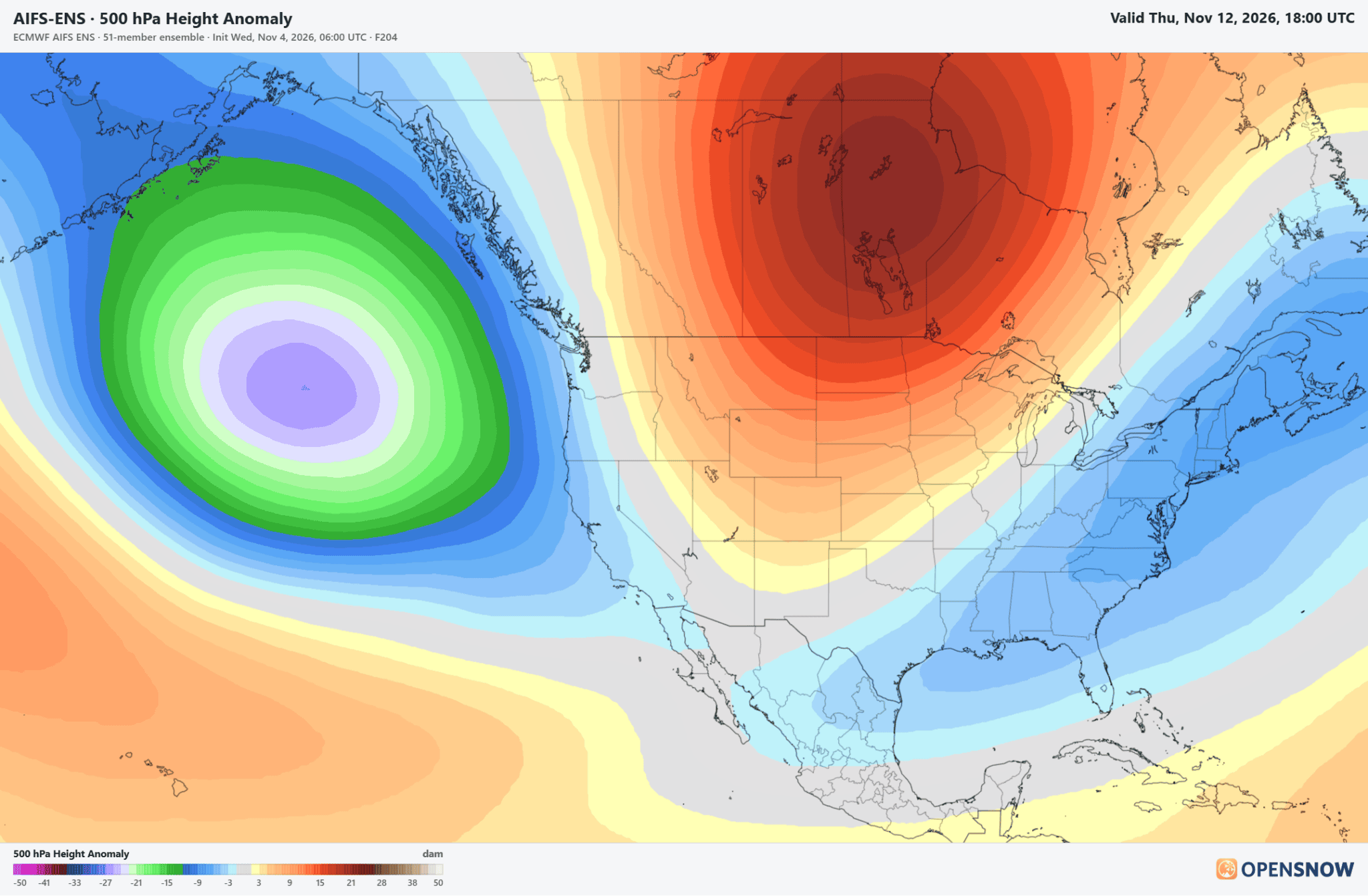
By the 11th, the long-range models continue to show a shift in the pattern, with a large low-pressure trough over the eastern Pacific and along the West Coast. If this well-advertised pattern sets up by the 12th and beyond, it could open the door to a parade of early-season storms.
The jet stream looks ready to help spin up and push storms into CA on most model runs. That could bring a very wet pattern. Looking at some of the long-range forecast models on the OpenSnow snowfall forecast charts, we see the snowfall forecasts picking up between the 12th and 19th. That’s nice to see, and we hope it holds.
We’ll continue to watch the trends. We are still at least 8 days out from the shift in the pattern per the latest long-range model runs. We could use a parade of storms to get lots of snow to pile up on the mountains right before Thanksgiving and the planned opening day. Let’s hope it works out to plan…
BA