Palisades Tahoe Logo Palisades Tahoe Logo Palisades Tahoe Logo
Explore
  • Explore Palisades Tahoe
  • Our New Name
  • Explore Legendary Lifts
  • Palisades Tahoe Blog
  • About Lake Tahoe
  • About Us
Plan Your Visit
  • Tickets & Passes
  • Lodging
  • Lessons & Guides
  • Deals & Packages
  • Rentals & Demos
  • Travel Here
  • Getting Around
Mountain Information
  • Snow and Weather
  • Lift and Grooming Status
  • Webcams
  • Hours of Operation
  • Trail Maps
  • Parking & Road Conditions
  • Snowfall Tracker
Events & Activities
  • Events Calendar
  • Activities
  • Dining & Apres
  • Shopping
  • Things To Do In Lake Tahoe
  • Groups, Meetings & Weddings
  • Ski & Snowboard Teams
IKON PASS HOLDER LODGING DISCOUNT

Ikon Pass holders save up to 25% on slopeside lodging at The Village at Palisades Tahoe.

SLOPESIDE LODGING
Icon / FlashCreated with Sketch.
View All Offers
  • Weather

Increasing Clouds Monday, Light Showers Possible Tuesday

  • Feb 8, 2021
  • 8:08 am

Monday – Tuesday:

We will see some clouds Monday from a system off the coast. We will also see ridgetop wind gusts increase to 50+ mph during the afternoon. That weather continues into Tuesday with slightly cooler temps in the 30s for highs on the upper mountain. Ridgetop gusts could peak around 60+ mph in the morning and then coming down some through the afternoon.

A small amount of moisture will try to stream into the Sierra by Tuesday into Tuesday night. Amounts look pretty meager. We could see scattered showers with snow levels around 7000 ft. or just above. That means rain showers for the base, and maybe a coating to an inch of snow up top by Wednesday morning.

Wednesday:

For Wednesday, high pressure builds back in briefly with mostly sunny skies expected. Highs in the 30s & 40s.

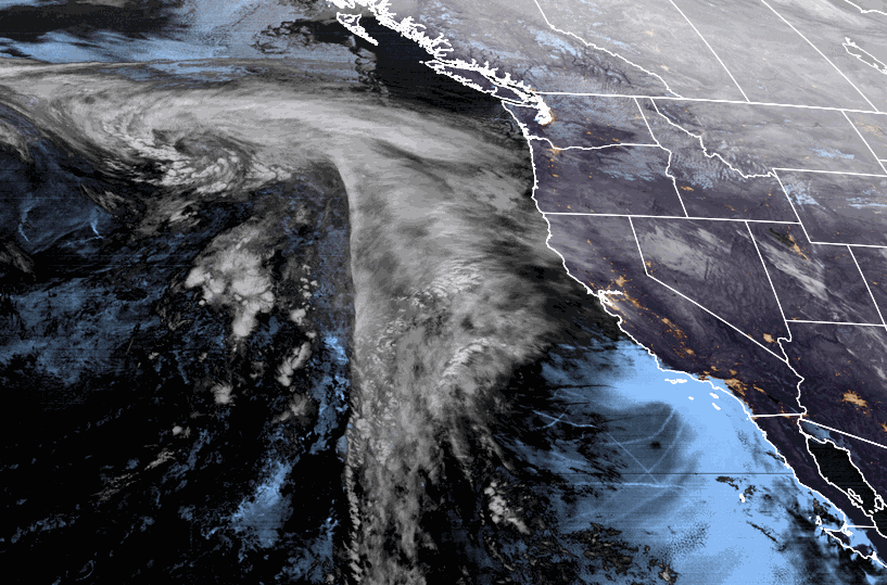
Thursday – Friday System:

The next storm will try to push into northern/central CA by Thursday afternoon into Thursday night, and then clearing out Friday. We have a lot of discrepancies still with the details of this system as it is trying to push over high pressure off the coast and under high pressure farther north.

We could see rain/snow showers by Thursday afternoon with snow levels around 6000-6500 ft. (just above the base) to start. Then steadier snow possible Thursday night with snow levels falling below the base. Showers could linger into Friday morning before clearing.

Initial estimates for snowfall are for 1-4 inches at the base, and 3-7 inches on the mountain.

The Weekend:

Another system will try to push into northern/central CA Saturday afternoon into Sunday morning. This system will have the same issues as the first, but it could be slightly colder. We will continue to watch the trend on both systems over the next few days and will fine-tune the details as we get closer.

BA

lake tahoe weather snowfall forecast Squaw Weather Forecast
Bryan Allegretto
Bryan Allegretto

Share this article:

Recent Posts

  • Weather ·
  • May 26, 2022·

Colder with Unsettled Weather for Memorial Day Weekend

It’s the last weekend of the season and we could see a few flakes fall on the mountain! Thursday –…
Read more
  • Weather ·
  • May 17, 2022·

Quick Cooldown Thu-Fri, Then Milder Weather

A cool trough moves through Thursday – Friday. Highs dip down into the 60s at the base Thursday and 50s…
Read more
  • Weather ·
  • May 11, 2022·

After 15″ of Snow, A Return to Spring

Snowfall Report: We have had a cold and wintry first half of the week with several systems that rotated through…
Read more

Social

Instagram Twitter Facebook Youtube

Contact

   Email Us
   1.800.403.0206

Our Partners

U.S. Forest Service Logo
1960 Squaw Valley Road
Olympic Valley, CA 96146

©2022 Palisades Tahoe

Alterra Mountain Company
  • Privacy Policy
  • Terms of Service
  • Photo Upload Terms of Use
  • Accessibility
Menu
  • Privacy Policy
  • Terms of Service
  • Photo Upload Terms of Use
  • Accessibility