Wednesday:
Dry for Wednesday with some high clouds. Highs warming into the 40s at the base and 30s up top.
Thursday – Friday Storm:
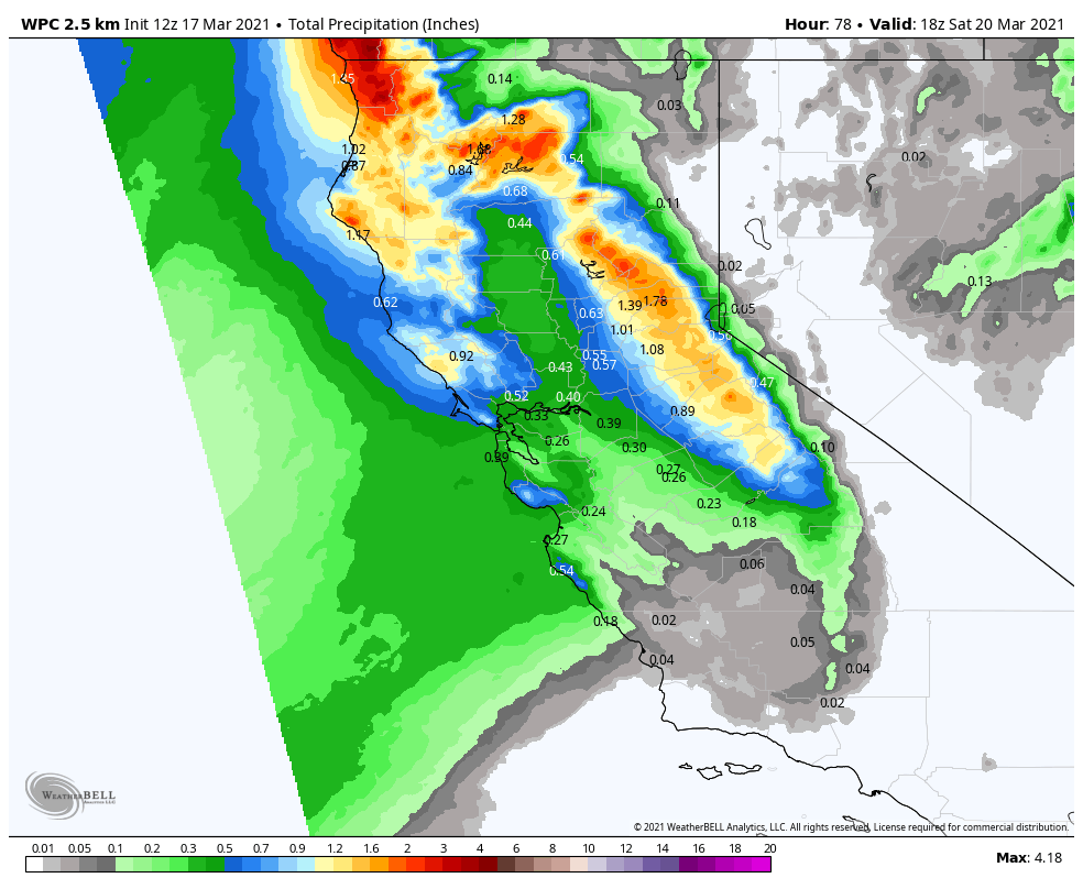
The next storm could push precipitation back into the region as early as Thursday morning or by afternoon. Initially, we may start with lighter showers Thursday and gusty winds. Ridgetop gusts increasing to 50-60+ mph from the southwest by afternoon. Snow levels may initially be above the base on Thursday around 7000-7500 ft with some rain on the lower mountain, possibly up to 8k briefly at times.
We should see a period of heavier precipitation Thursday evening into Friday morning with falling snow levels lowering to near to just above the base around 6000-6500 ft. Then lighter snow showers possible into Friday night before ending by Saturday morning with snow levels falling below 5000 ft. Ridgetop winds could continue to be gusty through Friday gusting to 50-60+ mph up top.
Rain at the base turning to snow or a mix Thursday night into Friday and ending as snow Friday night. Mostly snow expected above 7000 ft through the storm. Totals by Saturday morning could be between 2-6 inches at the base and 7-13 inches on the mountain from bottom to top.
The Weekend:
We should see partly-mostly sunny skies and lighter winds for the weekend. Highs in the 40s at the base and 30s on the upper mountain.
Long-Range:
The next storm moves through to our northeast on Monday with some colder air moving in and possibly some light snow showers brushing us. Highs dropping into the 30s with some gusty winds. We will continue to watch the trends and will fine-tune the forecast as we get closer.
Starting next Tuesday we may go into a drier pattern through the 30th. Some long-range models suggest we possibly transition back to a more active pattern around the end of the month into the first week of April.
BA


