Snowfall Report:
We picked up 8 inches of new snow up top, 4 inches near mid-mountain, and a dusting at the base. That is 1 inch less than forecast up top and 2 inches less than forecast for mid-mountain and the base due to the warmer air hanging on longer on Sunday before moving in Sunday night after most of the precipitation had fallen.
Monday – Tuesday Weather:
Mostly sunny skies are expected for Monday and Tuesday along with lighter winds and highs in the 30s.
Wednesday Thursday Weather:
The active storm pattern is expected to continue for the Pacific NW through Friday. Storms on Wednesday and Thursday could bring in some clouds with partly sunny skies. Several models are now trending toward some scattered showers on both days as well. Highs in the 30s for the upper mountain and 40s for the lower elevations.
Snow levels likely start out above 7000 ft. Wednesday and rising to above 9000 ft. going into Thursday. So not expecting any snowfall accumulations, especially with only light scattered showers possible.
Friday Storm:
This morning we still have a couple of models missing us to the north with this storm, but most are now reaching us with at least some light precipitation, and some models show some steadier precipitation moving through between Friday and Friday night. Friday will likely be a windy day with highs in the 30s. Ridgetop winds gusting up to 60-80+ mph by afternoon, likely closing some upper mountain lifts.
We will need to fine-tune the forecast for the next few days as my snowfall forecast is based on a model average including the completely dry models. The snow levels likely start high, above 8000 ft., and fall close to lake level by evening and below 5000 ft. Friday night. But that could cause the same issues with rain & wet snow for the lower elevations as we saw on Sunday.
The initial forecast is for around 1-4 inches at the base, 2-6 inches near mid-mountain, and 4-8 inches of snow up top by Saturday morning.
The Weekend:
The storm clears Saturday and high pressure starts to build in over the region into Sunday. That should bring some nice weekend weather finally. Mostly sunny skies with highs in the 30s on the mountains, and near 40 degrees down at the base.
Long-Range Forecast:
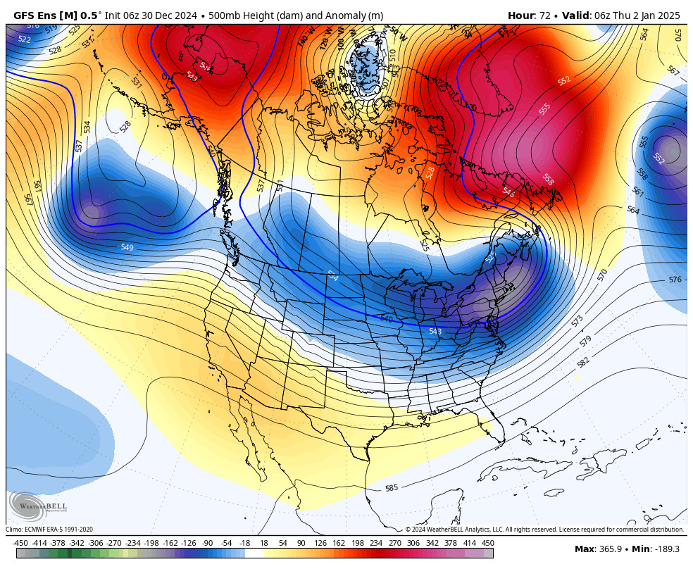
The dry pattern coming for next week into the 2nd week of January is likely fairly inescapable as the high-pressure ridge over the West Coast is forecast to amplify pretty far north. We will likely see a lot of sunny days and temperatures warming a bit.
The long-range models show us stuck in this -NAO/+PNA pattern through the 2nd week of January up until mid-month possibly. The 10-day precipitation anomaly forecasts look very dry starting Sunday. The cold is stuck over the eastern U.S. so we may stay on the milder side as well as dry. We will keep an eye out for any systems that try to sneak in, but the pattern looks very dry right now.
Looking way out, there are some signs that the weather pattern could start to shift toward a more active pattern beyond mid-month, but that’s pretty far out right now. We’ll continue to watch the trends…
BA


