Skip to content
Palisades Tahoe Logo Palisades Tahoe Logo Palisades Tahoe Logo
Explore
Main Menu
  • Explore Palisades Tahoe
  • Base to Base Gondola
  • Our New Name
  • Explore Legendary Lifts
  • Palisades Tahoe Blog
  • About Lake Tahoe
  • About Us
Plan Your Visit
Main Menu
  • Tickets & Passes
  • Lodging
  • Lessons & Guides
  • Deals & Packages
  • Rentals & Demos
  • Travel Here
  • Getting Around
Mountain Information
Main Menu
  • Snow and Weather
  • Lift and Grooming Status
  • Webcams
  • Hours of Operation
  • Trail Maps
  • Parking & Road Conditions
  • Snowfall Tracker
Events & Activities
Main Menu
  • Events Calendar
  • Activities
  • Dining & Apres
  • Shopping
  • Things To Do In Lake Tahoe
  • Groups, Meetings & Weddings
  • Ski & Snowboard Teams
IKON PASS HOLDER LODGING DISCOUNT

Ikon Pass holders save up to 20% on slopeside lodging at The Village at Palisades Tahoe.

SLOPESIDE LODGING
Icon / FlashCreated with Sketch.
View All Offers
  • Weather

Colder & Windy

  • Jan 18, 2021
  • 5:38 am

Colder & Windy:

Monday into Tuesday we will have colder air and gusty winds. Highs in the 30s on the upper mountain and 40s at the base Monday, and colder Tuesday with highs only in the 30s to the base. Expecting partly sunny skies both days.

The jet stream diving in from the northeast Monday night into Tuesday will bring strong northeast winds. We could see ridgetop gusts to 70+ mph Monday, increasing to 100+ mph Monday night into Tuesday. That will shut down some upper mountain lifts and will make it feel much colder than the air temperatures.

Wednesday – Thursday:

Mostly sunny skies for Wednesday into Thursday. The winds relax Wednesday into Thursday and turn southwest with ridgetop gusts to 30+ mph Thursday afternoon. Highs warming into the 40s on the lower mountain both days.

Friday – Saturday Storm:

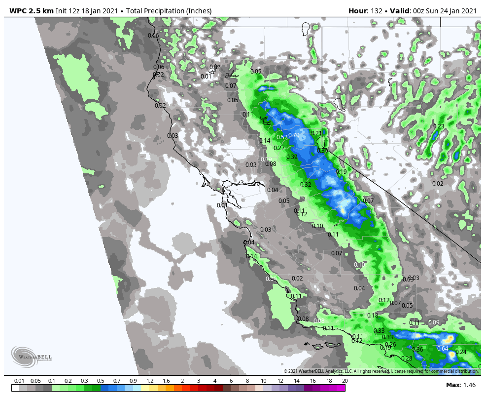
A cold but weak system moves down from the north Friday into Saturday. Highs drop into the 30s, with 20s up top. We could see snow showers by midday Friday that could linger into Saturday as the low moves through CA. Then clearing Saturday night. 

Early estimates are for 1-3 inches of new snow at the base and 2-4 inches for the upper mountain. Low snow levels below the base and a lighter density snow for the upper mountain. Ridgetop winds could gust from the southwest up to 40+ mph Friday.

Long-Range:

It looks like the last week of the month the storm door could open up a bit more to some wetter systems starting as early as Sunday night, and then through most of next week.  We could see several cold storms bring decent amounts of snow through the end of the month.

We will be tracking each system and fine-tuning the snowfall and details as we get closer.

BA

lake tahoe weather snowfall forecast Squaw Weather Forecast
Bryan Allegretto
Bryan Allegretto

Share this article:

Recent Posts

  • Weather ·
  • March 24, 2023·

Drier w/ Spotty Snow Showers thru Sunday

Snowfall Report: 3-5 inches of new snow fell on the mountain, from the base to the upper mountain, in the…
Read more
  • Weather ·
  • March 23, 2023·

Snow Thursday, Drier for the Weekend

Snowfall Report: An additional 2 inches of snow fell on the mountain in the past 24 hours as of 5…
Read more
  • Weather ·
  • March 22, 2023·

Scattered Snow Showers Continue

Snowfall Report: We were expecting 1-4 inches to fall Tuesday-Tuesday night. We picked up the lower end of the forecast…
Read more

Social

Instagram Twitter Facebook Youtube

Contact

   Email Us
   1.800.403.0206

Our Partners

U.S. Forest Service Logo
1960 Olympic Valley Road
Olympic Valley, CA 96146

©2022 Palisades Tahoe

Alterra Mountain Company
  • Privacy Policy
  • Terms of Service
  • Photo Upload Terms of Use
  • Accessibility
  • Do Not Sell My Personal Information
  • Privacy Policy
  • Terms of Service
  • Photo Upload Terms of Use
  • Accessibility
  • Do Not Sell My Personal Information