Sunday – Monday:
Mostly sunny skies with highs into the 40s up top and 50s at the base Sunday with lighter winds.
A bit cooler with highs in the 40s Monday with gusty winds. Ridgetop winds from the southwest increase throughout the day and could be up to 100+ mph up top by evening. That should close some upper mountain lifts Monday.
Monday Night – Tuesday System:
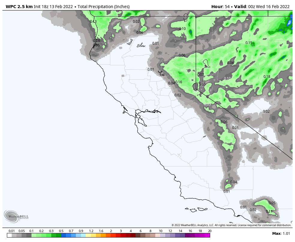
A weak system associated with a cold front moves through Monday night into early Tuesday morning. Snow levels could start as low as the base and fall quickly overnight. Snow showers could clear out by Tuesday mid-morning at the latest. Highs only into the 20s up top and 30s at the base Tuesday.
The most recent model runs suggest 0-2″ at the base and 1-3″ of snow possible for the mountain by Tuesday morning. Gusty north/northeast winds of up to 60+ mph up top Tuesday will make it feel even colder and could affect some upper mountain lifts.
Wednesday – Saturday:
High pressure is forecast to build back over the region again by Wednesday bringing back a drier pattern through the 19th. Highs in the 40s at the base and 30s up top by Wednesday and then warming some through the end of next week. Wednesday could still have gusty north winds up top.
Long-Range:
The pattern is forecast to shift again next weekend. That could allow a storm to move in by next Sunday into Monday the 21st. We will be watching that system all week to see if it could bring more snow and how much.
The more active pattern could continue through the last week of February. No BIG storms don’t the horizon yet, but we’ll take weak/moderate systems after 6 weeks of dry weather. Anything to add to and freshen up the base. Stay tuned for updates as we get closer.
BA


