Friday Weather:
We saw a few snow showers move through to our northeast early Friday morning and now we are clearing out into the daytime hours, with temperatures starting out in the 20s. We will see mostly sunny skies with highs in the 30s. There will be breezy north winds keeping it feeling cold on the mountain tops.
Saturday Storm:
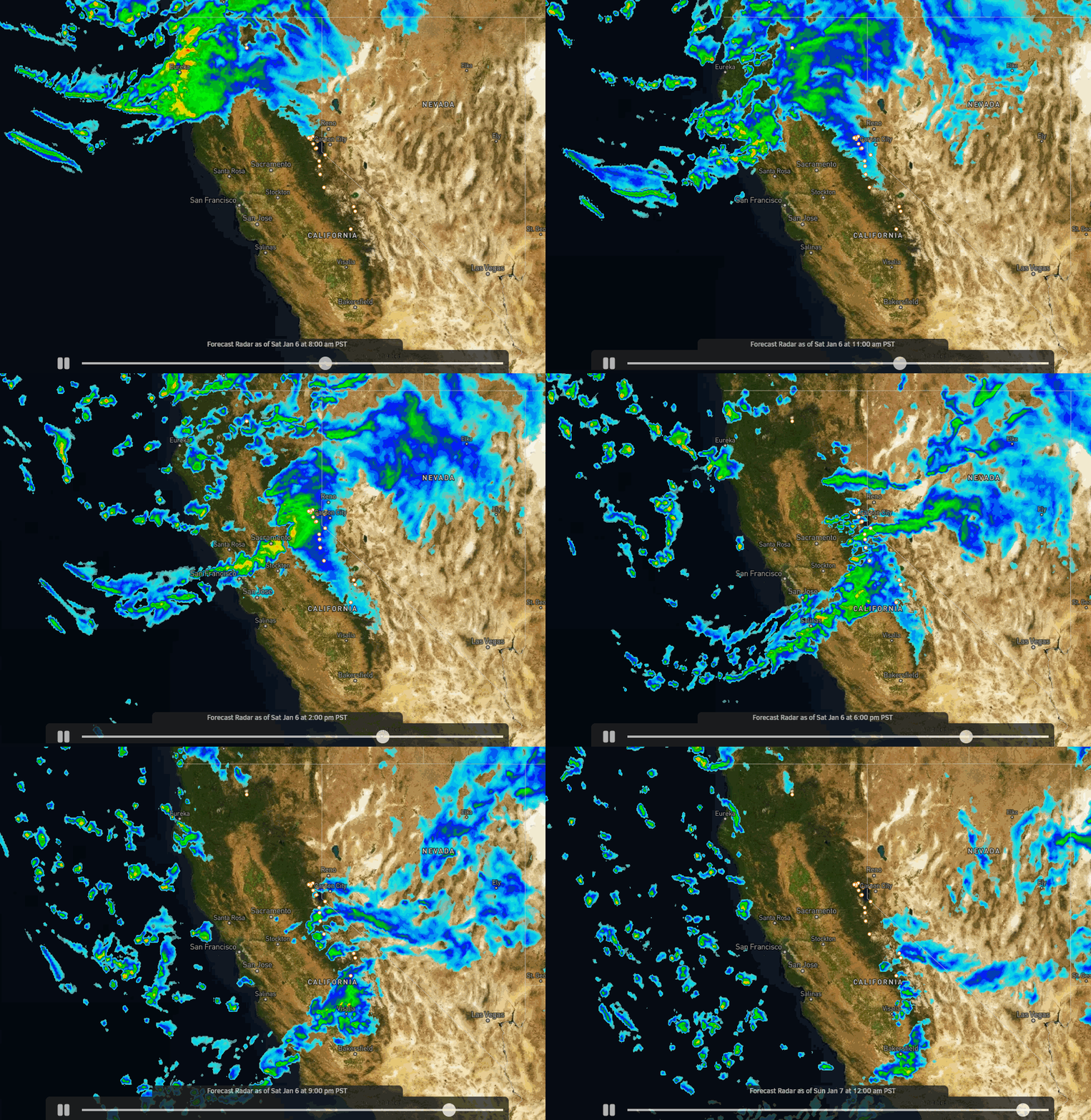
Saturday is going to be a Sierra storm day with strong winds, cold temperatures, and snow. The snow is expected to move in around 8-9 AM and then clearing out by midnight Saturday night. Winds will increase from the west with gusts up to 90-100+ mph over the exposed ridges through the day, so expect some lifts to be closed for the day. Highs in the 30s near the base and 20s for the upper mountain.
The forecast models have finally started to converge and agree on the precipitation totals with this storm, and they are showing a bullseye over the heaviest precipitation totals of around an inch falling right near Palisades Tahoe. Low snow levels well below the base and high snow ratios with powdery snow falling on the mountain.
By Sunday morning we could have 24-hour snowfall totals of 8-13 inches near the base and 10-17 inches on the mountain.
Sunday – Monday:
We will clear out by Sunday morning with mostly sunny skies expected for both Sunday and Monday. It will be cold for Sunday with highs only in the 20s and a cold breeze from the north. Monday we will rebound into the 30s near the base with breezy north winds continuing.
Tuesday – Wednesday:
The coldest air of the season so far will spill south into the West next week as a cold trough digs south. Cold storms will start to drop down from the north down the west side of the trough into northern CA starting Tuesday. Depending on the track of each wave, over land or closer to the coast over water, we will see lighter snow or heavier snow with each, and low snow levels with powdery snow continuing to pile up.
The first wave dropping into CA Tuesday looks drier with snow showers, and then the 2nd wave is trending toward an overwater trajectory with heavier snow for Wednesday. We will start a little warmer Tuesday with highs in the 30s near the base, and then 20s for Wednesday. Strong winds will gust from the west up to 70-80+ mph Tuesday & 90-100+ mph Wednesday, likely closing some upper mountain lifts.
Very low snow levels and high snow ratios are expected again helping to fluff the snowfall totals with powdery snow falling on the mountain. By Wednesday morning we could see additional snowfall totals of around 12-17 inches near the base and 14-21 inches on the mountain. We’ll continue to watch the trends.
Long-Range Forecast:
We look to possibly see a break between systems on Thursday with some scattered snow showers and cold temperatures, and the winds may drop some with ridgetop gusts from the northwest up to 30-40+ mph. Probably the best skiing day of the 4-day period, but dress warm.
Friday another wave drops south into CA and could have more of an overwater trajectory again, and this time some models show a moisture tap farther west into the Pacific under the ridge shifting north in the eastern Pacific. That would send even more moisture into the cold air over the Sierra.
We’ll continue to watch the trends all week. The latest model runs show a 4-day period of cold storms and feet of powdery snow falling on the mountain. Hopefully, that forecast holds through next Friday!
MLK Weekend:
The long-range models continue to show the trough shifting east with a weak ridge trying to build over the West from the 13th-16th.
That would shift the coldest air to the east and bump the storm track north, with drier and slightly warmer weather expected for the northern Sierra through the 3-day weekend. Still cold but starting to warm a little each day. Air that cold over the West will be hard to move quickly and will moderate slowly.
Looking way out there, the long-range models suggest that a wetter but warmer storm pattern could develop around the 17th.
BA


