Skip to content
Palisades Tahoe Logo Palisades Tahoe Logo Palisades Tahoe Logo
Explore
Main Menu
  • Explore Palisades Tahoe
  • Base to Base Gondola
  • Our New Name
  • Explore Legendary Lifts
  • Palisades Tahoe Blog
  • About Lake Tahoe
Plan Your Visit
Main Menu
  • Tickets & Passes
  • Lodging
  • Lessons & Guides
  • Deals & Packages
  • Rentals & Demos
  • Travel Here
  • Getting Around
Mountain Information
Main Menu
  • Snow and Weather
  • Lift and Grooming Status
  • Webcams
  • Hours of Operation
  • Trail Maps
  • Parking & Road Conditions
  • Snowfall Tracker
Events & Activities
Main Menu
  • Events Calendar
  • Aerial Tram
  • Activities
  • Dining & Apres
  • Shopping
  • Groups, Meetings & Weddings
  • Ski & Snowboard Teams
Winter Lodging Exteriors of the Village at Palisades Tahoe
Book Winter Early

Ikon Pass holders save up to 25% when you book with The Village at Palisades Tahoe this winter.

SAVE ON LODGING
Icon / FlashCreated with Sketch.
View All Offers
  • Weather

Blizzard Closes the Mountain

  • Feb 28, 2023
  • 8:28 am

Snowfall Report:

The upper mountain picked up an additional 38 inches of snow in the past 24 hours as of 5 AM Tuesday! That brings the 7-day totals to over 100 inches and counting, and pushed the season total to over 500 inches so far!

The high avalanche danger and blizzard conditions continuing Tuesday will keep the mountain closed for the day.
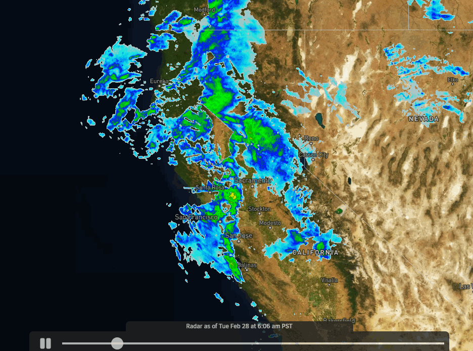
Tuesday Blizzard:

The winds are gusting up to 90+ mph up top from the southwest Tuesday morning with colder temperatures and heavy snow continuing to pile up dry powdery snow on the mountain. Highs in the teens up top and 20s at the base. The winds are whipping around the snow causing low visibility and big drifts.

The snow starts to wind down Tuesday night with scattered snow showers possible into Wednesday morning as we start to clear out. It remains cold Wednesday with partly sunny skies and high into the 20s. Gusty east winds up to 40-50+ mph up top.

We expect to double down on the 24-hour snowfall Tuesday through Tuesday night, with an additional 2-3+ feet of snow expected by Wednesday morning! That means we could see up to 140 inches of snow in total by Wednesday morning for the 8-day totals!

Thursday – Friday:

We will see a break in the active pattern from Thursday into Friday, with mostly sunny skies and highs into the 30s along with lighter winds. It should be beautiful!

Weekend Snow:

Another cold trough digs into the West Coast Saturday into next week. That will reopen the door to more cold storms Saturday into possibly next Wednesday the 8th. 

We may see light snow showers move in Saturday morning with heavier snow possible by afternoon and into Sunday. We also expect ridgetop winds to increase to 80-90+ mph Saturday which will likely close some lifts. Highs drop back down into the 20s for the weekend.

Here is a look at the initial snowfall forecast for the weekend, for possible new snowfall totals by early Monday morning.

  • 20-27 inches at the base.
  • 24-31 inches at mid-mountain elevations.
  • 28-35 inches up top.

Long-Range:

We could transition from a cold/wet pattern through the 8th to a not-as-cold wet pattern starting around the 9th through mid-March. We’re watching for the possibility of a strengthening Pacific jet stream streaming across the Pacific into CA during this period, sending storms into CA with fluctuating snow levels.

We’ll continue to watch the trends as we get closer.

BA

lake tahoe weather palisades tahoe weather forecast snowfall forecast
Bryan Allegretto
Bryan Allegretto

Share this article:

Recent Posts

  • Weather ·
  • September 19, 2023·
The predicted El Nino pattern for this winter

2023-24 Palisades Tahoe Winter Forecast Preview…

As we look ahead to the 2023-2024 winter season, it's important to remember that any winter outlook will contain an inherent degree of uncertainty. However, there are a few clues that we can keep an eye on.
Read more
  • Weather ·
  • May 8, 2023·

Final Forecast of the 2022-23 Season

First Week of May Snowfall Report: The first week of May was a cold and snowy one. The upper mountain…
Read more
  • Weather ·
  • May 1, 2023·

Snowy First Week of May

Monday – Friday Snow Shower Chances: A low-pressure system will be making its way south down the coast on Monday…
Read more

Social

Instagram Twitter Facebook Youtube

Contact

   Email Us
   1.800.403.0206

Our Partners

U.S. Forest Service Logo
1960 Olympic Valley Road
Olympic Valley, CA 96146

©2022 Palisades Tahoe

Alterra Mountain Company
  • Privacy Policy
  • Terms of Service
  • Photo Upload Terms of Use
  • Accessibility
  • Do Not Sell My Personal Information
  • Privacy Policy
  • Terms of Service
  • Photo Upload Terms of Use
  • Accessibility
  • Do Not Sell My Personal Information