Friday Storm:
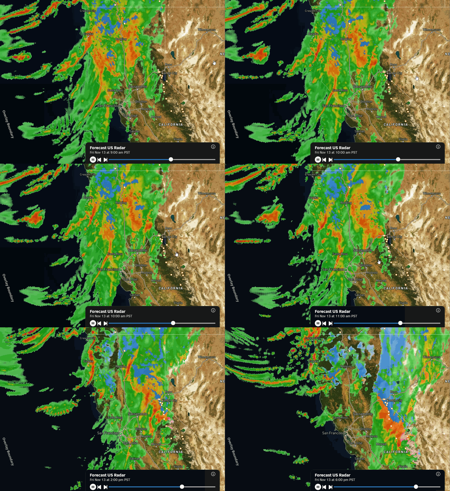
The latest model runs show precipitation reaching the mountain by late morning, with the precipitation continuing into Friday night, and it should taper off Saturday morning. Highs drop into the 40s near the base and 30s on the mountain Friday and Saturday. Ridgetop winds on Friday gusting up to 70-80+ mph.
The snow levels start up around 7000 ft. Friday morning, and then fall below the base by evening. That means mostly all snow on the mountain, and snow accumulations are expected at the base and village. We could see around 5-10 inches at the base by Saturday morning, 11-16 inches near mid-mountain, and 14-19 inches up top.
Later Saturday into Sunday:
We are expecting a break between storms over the weekend, with some sun and clouds. Highs in the 40s for the lower elevations and 30s for the higher elevations. The winds drop on Saturday and increase again on Sunday from the SW, with gusts up to 50-60+ mph over the ridges by afternoon.
Sunday Night – Monday Storm:
The latest model runs show the arrival of precipitation with the next storm as early as late Sunday afternoon or not until Sunday night. The front weakens and slows as it moves through the Sierra, with low pressure forming over NV, which could have showers lingering all the way into Tuesday morning before finally clearing.
This front will bring in some colder air, with highs dropping into the 30s. The winds drop some Monday and into Tuesday. The snow levels rise again on Sunday and could start as high as 7000 ft. again, but then fall to the base Sunday night into Monday night.
That means we should see mainly snow on the mountains again as the totals continue to pile up. We could see an additional 3-7 inches of snow near the base, 5-9 inches at mid-mountain, and 6-11 inches up top. That would bring total 4-5 day snowfall amounts of up to 1 – 2+ feet of snow by Tuesday.
Wednesday Storm:
The latest model runs continue to show another storm moving in next Wednesday and possibly into Thursday. We’ll continue to watch the trends on this storm. It’s still a bit early to look at snowfall details, but it could be another decent little storm with more snow for the mountains ahead of opening day.
Long-Range Outlook:
Some of the long-range models try to move in another storm around the end of next week, but the overall pattern is still forecast to start shifting beyond the 19th. They show a large trough setting up in the eastern Pacific into the last week of November, but staying just off the coast.
It’s starting to look like more of a classic strong El Niño pattern as we get later in the month. But if the trough and jet stay too far west, any storms they try to push into CA could weaken as they encounter high pressure over the West, and may not have much success in bringing us more snow.
Looking at the precipitation anomaly forecasts for the 20th – 27th, they show a wet pattern near the West Coast, as storms will be spinning up in that trough, but the Sierra is right on the eastern edge. We could see some wet storms get close enough, we could just see some weak storms, or we could stay fairly dry for a little while later in the month. We’ll continue to watch the trends.
BA