

Monday Weather:
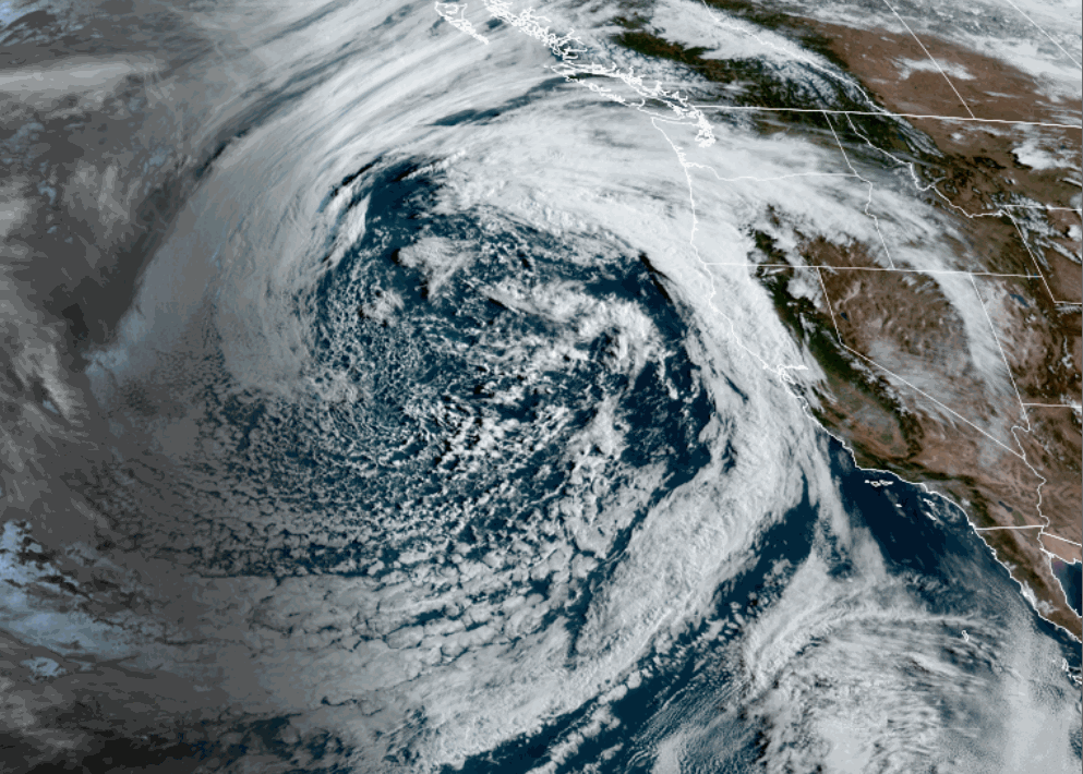
The next storm looks impressive for April as it is spinning near the CA coast Monday morning. It is not progressing east very fast, and there is southerly flow on the east side. That means the clouds will be slow to push into the northern Sierra, with the day starting off mostly sunny, with some clouds possible later in the day.
Highs into the 50s for the lower elevations, and 40s for the higher elevations. Ridgetop winds from the south, gusting up to 40-50+ mph.
Monday Night – Wednesday Storm:
The latest model runs show the precipitation slowly approaching and finally pushing in near the crest after midnight, and spilling into the Tahoe Basin Tuesday morning. We are expecting steady precipitation and falling snow levels during the day on Tuesday. Ridgetop winds continuing to gust up to 40-50+ mph.
The precipitation will become more showery Tuesday night, with scattered showers lingering into Wednesday as the weakening center of the low moves through. Lighter winds turning westerly for Wednesday. Highs only in the 30s both days.
The snow levels will start up around 8000 ft. Monday night, and then fall to around 7000-7500 ft. as the precipitation starts to push in early Tuesday morning. Then falling to around 6000-6500 ft. during the day on Tuesday, and below 5000 ft. Tuesday night.
That means a mix of rain and snow near the base, which should turn to snow at times during the day on Tuesday under heavier precipitation, and then snow showers for Tuesday night into Wednesday. Mostly all snow for the upper mountain.
We could see storm totals of around 3-6 inches at the base (a bit more if snow levels fall faster), 7-12 inches near mid-mountain, and 10-15 inches up top by Wednesday afternoon. Most of that falls by Wednesday morning. We could see slightly more up top if the precipitation has better luck pushing over the mountains.
Thursday – Sunday:
The sun returns starting Thursday, with high temperatures warming into the 50s for the lower elevations and 40s for the higher elevations into the weekend.
Moisture from a system moving through the region could bring afternoon showers to the mountains Saturday and Sunday afternoon.
Long-Range Outlook:
The long-range models continue to show troughing over the West and CA, leaving the door open to weak systems moving through from the west and northeast.
We could see afternoon showers over several more days into early May. The precipitation forecasts show near-average precipitation amounts through the period, which isn’t a lot this time of year, but shows that we aren’t expecting a bone-dry pattern.
The temperatures are also expected to stay seasonal, with highs in the 50s for the lower elevations and 40s for the higher elevations most days.
BA
