Snowfall Report:
The small storm that moved through Friday night into Saturday morning dropped 5 inches up top and 1 inch at the base of the mountain. That brings the season total to 14 inches so far up top.
Drier Pattern:
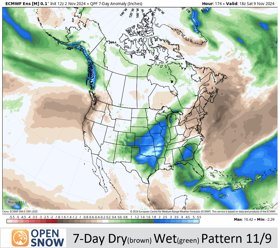
Sunday through the end of the week we expect a drier pattern as a high-pressure ridge builds near the West Coast.
We could see a backdoor trough with some colder air dig south and west into the Western U.S. by Wednesday, bringing us slightly colder temperatures. Highs into the 40s for the lower elevations and 30s for the higher elevations through Tuesday. Temperatures could be around 10 degrees colder on Wednesday.
Then high pressure shifts inland a bit which could warm lower elevation temperatures into the 50s by the end of the week into next weekend. Overall for the next 7 days, we will be on the edge of below-average temperatures to our east and we will see below-average precipitation with the drier pattern.
Long-Range Forecast:
By the 10th into the week of the 11th, the long-range models are trying to shift the pattern with a large trough digging into the West. Some of the long-range models show a ridge farther off the coast with the trough into CA opening the door to storms.
Others are a bit different with the forecast and show the Pacific ridge closer to the coast and the trough that week just to our east. That could result in the pattern being drier right along the West Coast down into northern CA.
We’ll continue to watch the trends to see if storms could return beyond a week, or whenever they decide to return bringing more snow. In the meantime, we have a little snow on the mountain and cold enough air at night for some snowmaking.
BA


